Map Collection
Our map collection enables you to see how Philadelphia's neighborhoods and streets have grown and changed. Use our interactive mapping tool to overlay atlases dating back as far as 1843 over today's street layout.
Showing 1 to 20 of 5,151

Insurance Maps of the City of Philadelphia, 1893-1895, Back cover
1893-1895: Hexamer, Insurance Maps of the City of Philadelphia, Volume 21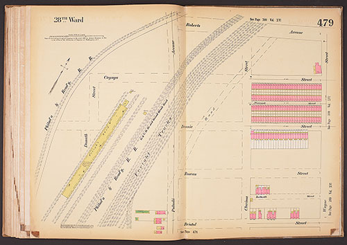
Insurance Maps of the City of Philadelphia, 1893-1895, Plate 479
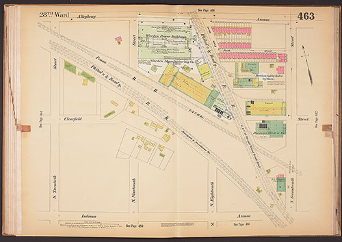
1893-1895: Hexamer, Insurance Maps of the City of Philadelphia, Volume 21
Insurance Maps of the City of Philadelphia, 1893-1895, Plate 478
1893-1895: Hexamer, Insurance Maps of the City of Philadelphia, Volume 21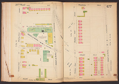
Insurance Maps of the City of Philadelphia, 1893-1895, Plate 477
1893-1895: Hexamer, Insurance Maps of the City of Philadelphia, Volume 21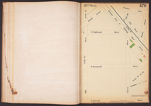
Insurance Maps of the City of Philadelphia, 1893-1895, Plate 476
1893-1895: Hexamer, Insurance Maps of the City of Philadelphia, Volume 21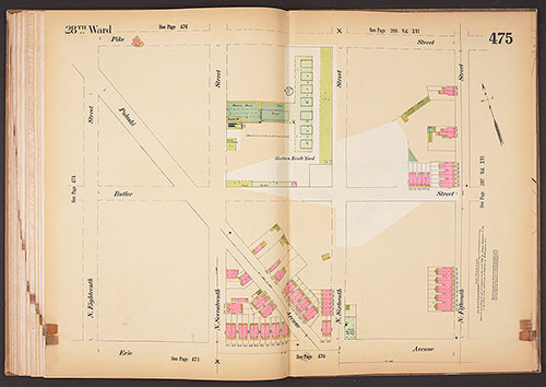
Insurance Maps of the City of Philadelphia, 1893-1895, Plate 475
1893-1895: Hexamer, Insurance Maps of the City of Philadelphia, Volume 21
Insurance Maps of the City of Philadelphia, 1893-1895, Plate 474
1893-1895: Hexamer, Insurance Maps of the City of Philadelphia, Volume 21
Insurance Maps of the City of Philadelphia, 1893-1895, Plate 473
1893-1895: Hexamer, Insurance Maps of the City of Philadelphia, Volume 21
Insurance Maps of the City of Philadelphia, 1893-1895, Plate 472
1893-1895: Hexamer, Insurance Maps of the City of Philadelphia, Volume 21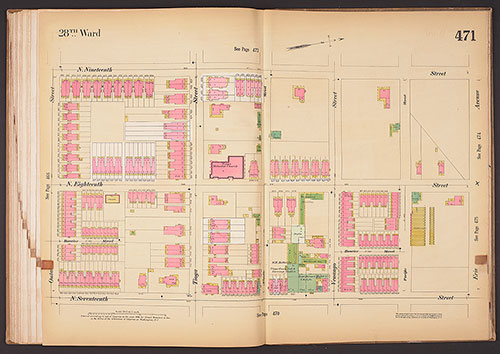
Insurance Maps of the City of Philadelphia, 1893-1895, Plate 471
1893-1895: Hexamer, Insurance Maps of the City of Philadelphia, Volume 21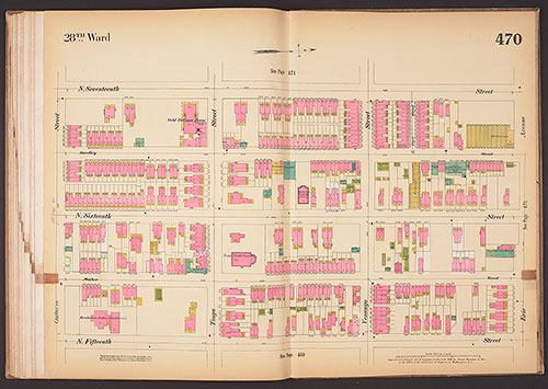
Insurance Maps of the City of Philadelphia, 1893-1895, Plate 470
1893-1895: Hexamer, Insurance Maps of the City of Philadelphia, Volume 21
Insurance Maps of the City of Philadelphia, 1893-1895, Plate 469
1893-1895: Hexamer, Insurance Maps of the City of Philadelphia, Volume 21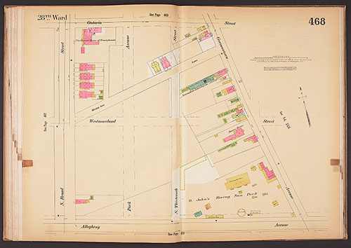
Insurance Maps of the City of Philadelphia, 1893-1895, Plate 468
1893-1895: Hexamer, Insurance Maps of the City of Philadelphia, Volume 21
Insurance Maps of the City of Philadelphia, 1893-1895, Plate 467
1893-1895: Hexamer, Insurance Maps of the City of Philadelphia, Volume 21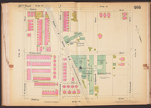
Insurance Maps of the City of Philadelphia, 1893-1895, Plate 466
1893-1895: Hexamer, Insurance Maps of the City of Philadelphia, Volume 21
Insurance Maps of the City of Philadelphia, 1893-1895, Plate 465
1893-1895: Hexamer, Insurance Maps of the City of Philadelphia, Volume 21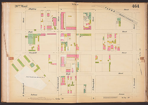
Insurance Maps of the City of Philadelphia, 1893-1895, Plate 464
1893-1895: Hexamer, Insurance Maps of the City of Philadelphia, Volume 21