The Better Philadelphia Exhibit: A Vision of the Future From 70 Years Ago
By Francis B.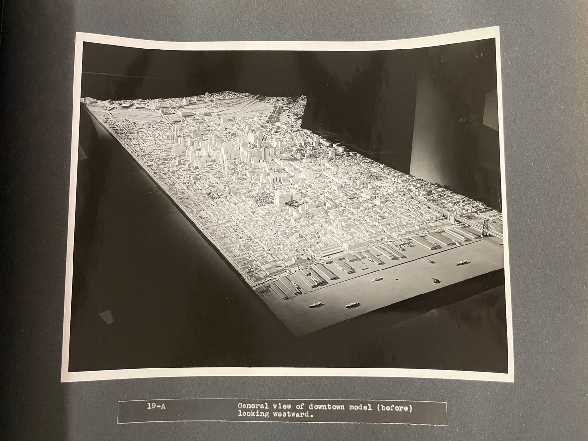
A scrapbook from 1947 documents the Better Philadelphia Exhibition, a showcase of urban renewal projects planned for Center City.
How do you represent a city? How do you take a superstructure of buildings, roads, water, land, plazas, vehicles, trees, and people, and turn it into something which can be observed all at once? Even more difficult, how do you do that with a city that hasn’t been built yet?
This was the challenge facing the designers of the Better Philadelphia Exhibition of 1947. The project was a collaborative effort between members of the Philadelphia City Planning Commission and local architects such as Edmund Bacon, Louis I. Kahn, and Oskar Stonorov. Its purpose was to sell the citizens of Philadelphia on the ambitious urban renewal scheme it proposed, laying out the costs of various improvements and the benefits of following a coherent plan. Free of charge, the exhibit admitted 350,000 visitors in the time it was open between September 8 – October 15, 1947.
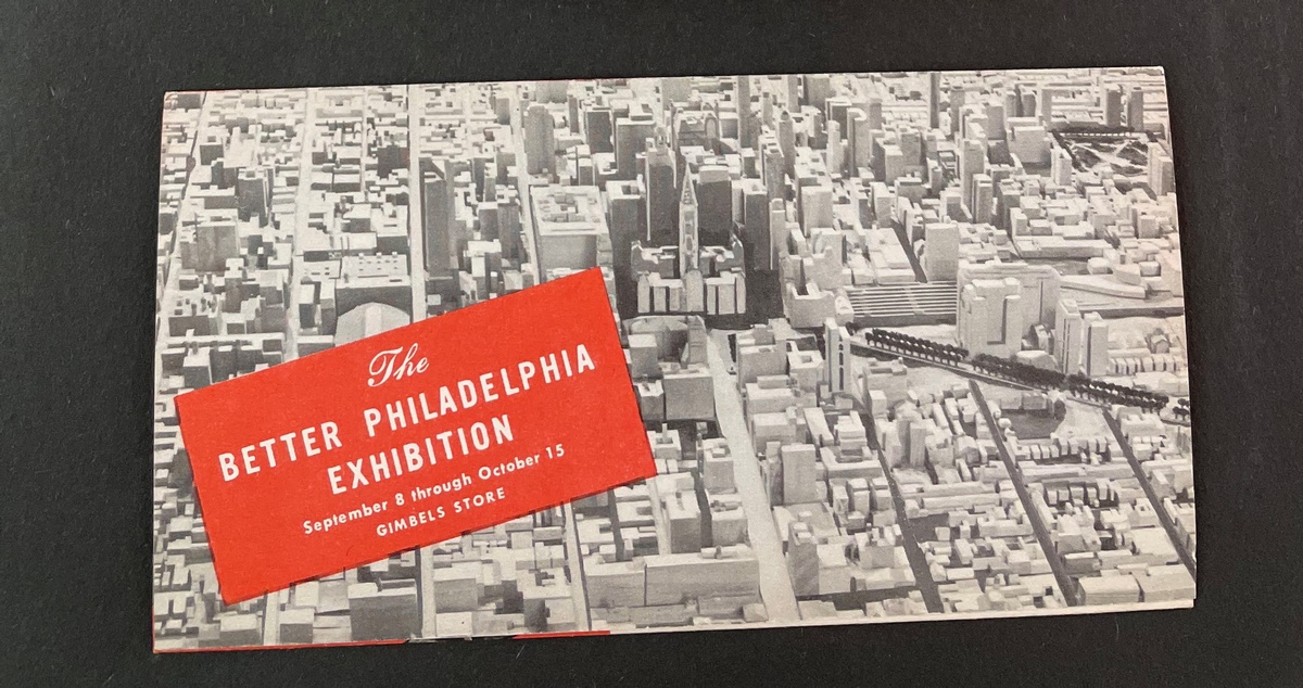
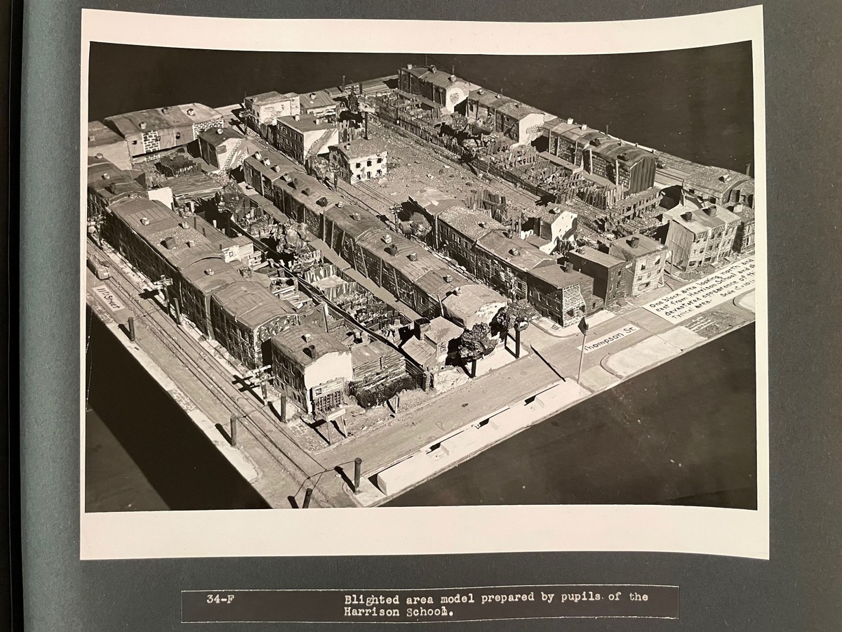
Before even attending the showcase, a citizen may have come across a flyer like the one pictured below, preserved now in a two-volume scrapbook held by the Free Library Art Department. “Most of the things that are wrong with Philadelphia came about through inadequate planning,” the flyer explains. “By and large, the city ‘just grew’—so we have traffic problems and overcrowding and blighted areas. Planning can correct these faults, and it can guide the city into an efficient and attractive future.” Younger Philadelphians may have encountered the exhibit through their school, as teachers were encouraged to bring students there on field trips. Some schools even made maps and models as class projects, designing future versions of their own neighborhoods.
The exhibition was housed on two floors of the Gimbels department store at 9th and Market. Before arriving at the main model of Center City, visitors would encounter a variety of maps and dioramas to give them a general understanding of the situation. A set of glass overlays, which could be lit individually, displayed maps of Philadelphia throughout history. Another map showed the growth of “old homes” as ominous black patches. Visitors would also see a pair of photos demonstrating a neighborhood “Before and After Blight.” Blight was the term used for vacant, deteriorated, or otherwise undesirable and unprofitable areas of the city. Removing blight and replacing it with green spaces, high-volume expressways, and new commercial and residential buildings acted as the designers’ primary method for creating a “better” Philadelphia. After passing by these smaller models and infographics, after reading about the costs to taxpayers and the expected benefits, and after passing by large satellite maps of Philadelphia, visitors would arrive at the exhibit’s spectacular centerpiece: a 14" x 30" model of Center City.
Models of futuristic cities weren’t entirely new in 1947. Eight years earlier, General Motors built “Futurama” for the 1939 New York World’s Fair, enthralling visitors with a vision of broad, high-speed roads cutting directly through a dense metropolis. And years later, in 1964, again for the World’s Fair, Robert Moses would present an enormous model of all of New York City.
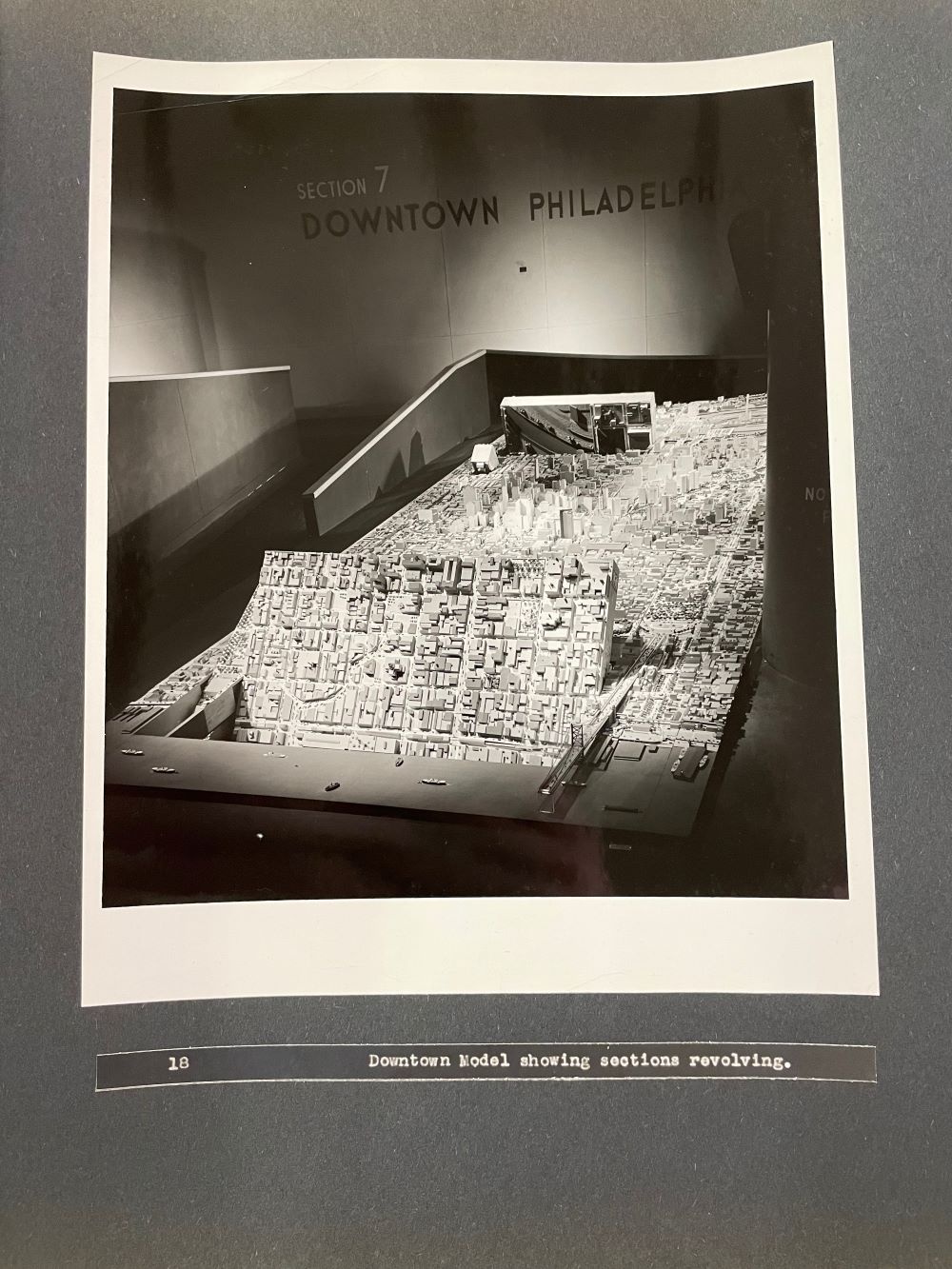
The Better Philadelphia model differed from both of these in that it could show both the present and the proposed future. Panels in the model could rotate, dramatically overturning the old city, the “blight,” and revealing new skyscrapers, parks, and expressways. Footage of the panels moving can be seen in this video on the Philadelphia Department of Records YouTube channel.
Although the new buildings were not yet designed, and so were represented by simple rectangles, many of the proposed developments in this future city are, today, recognizable as real features of the cityscape. Independence Hall Mall, the Delaware River Waterfront Promenade, the Vine Street Expressway, and the Society Hill Towers all figured as hypothetical developments in the exhibit.
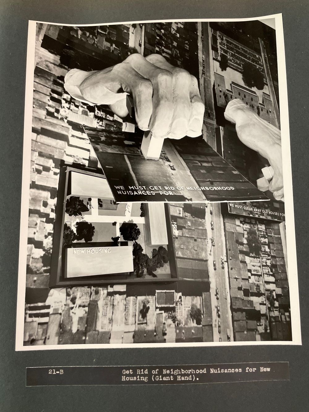
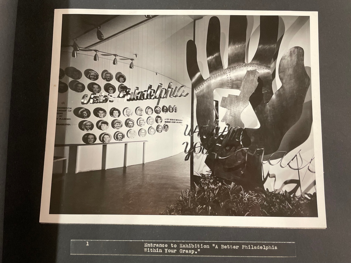
Aside from the Center City model, there were many more dioramas and graphics for visitors to see. One notable display was a map of a blighted area with enormous hands attached to certain blocks. Like the other model, these hands could move, and would tear away the old houses to reveal “New Housing” or “New Playgrounds.”
The Better Philadelphia Exhibit was a fantastic success for the architects and city planners who designed it. Attendants were asked for their opinions following their visit, and 65% responded that they’d be willing to pay higher taxes in exchange for the developments proposed. And in the next two decades, much of the hypothetical city became a reality.
By the 1970s though, one major feature was receiving pushback: the Crosstown Expressway. This would’ve been a high-speed arterial road similar to the Vine Street Expressway, but built along South Street. Residents were concerned that the expressway would discourage redevelopment, and sever South Philadelphia from Center City. Community members formed a committee to oppose the expresway, and encourage re-investment in the areas that would’ve been demolished. They were successful, and the Crosstown Expressway was removed from city plans in 1974. And today, the Vine Street Expressway itself is being re-evaluated by the city, with plans to cap the highway and “stitch” together the portion of Chinatown it divides.
Whether the designers succeeded in creating a “better” Philadelphia is dubious. What they did create, and what has been preserved in these scrapbooks, is a remarkably clear and coherent vision of a future city, and one which strongly compelled the citizens who beheld it. More images of the exhibit can be seen in the gallery below, and many more photos, fliers, and booklets are contained in the scrapbooks themselves, available for in-library viewing in the Art Department at Parkway Central.
Have a question for Free Library staff? Please submit it to our Ask a Librarian page and receive a response within two business days.