Map Collection
Our map collection enables you to see how Philadelphia's neighborhoods and streets have grown and changed. Use our interactive mapping tool to overlay atlases dating back as far as 1843 over today's street layout.
Showing 381 to 400 of 5,151
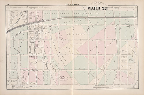
City Atlas of Philadelphia, 25th Ward, 1875, Plate L
1875: G. M. Hopkins, City Atlas of Philadelphia, 25th Ward, Volume 4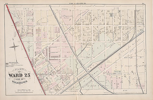
City Atlas of Philadelphia, 25th Ward, 1875, Plate K
1875: G. M. Hopkins, City Atlas of Philadelphia, 25th Ward, Volume 4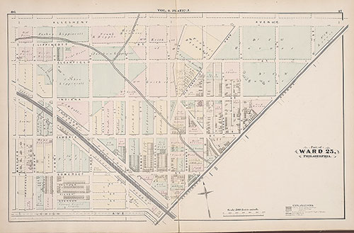
City Atlas of Philadelphia, 25th Ward, 1875, Plate J
1875: G. M. Hopkins, City Atlas of Philadelphia, 25th Ward, Volume 4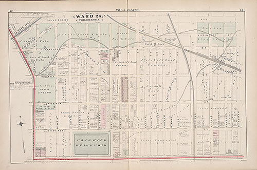
City Atlas of Philadelphia, 25th Ward, 1875, Plate I
1875: G. M. Hopkins, City Atlas of Philadelphia, 25th Ward, Volume 4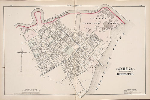
City Atlas of Philadelphia, 25th Ward, 1875, Plate H
1875: G. M. Hopkins, City Atlas of Philadelphia, 25th Ward, Volume 4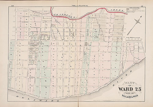
City Atlas of Philadelphia, 25th Ward, 1875, Plate G
1875: G. M. Hopkins, City Atlas of Philadelphia, 25th Ward, Volume 4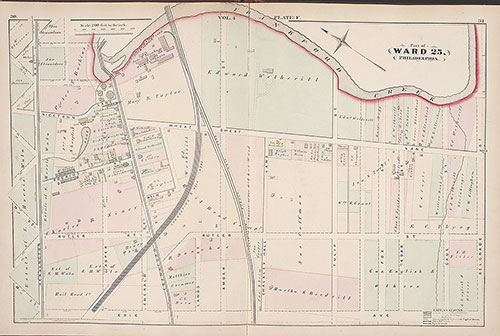
City Atlas of Philadelphia, 25th Ward, 1875, Plate F
1875: G. M. Hopkins, City Atlas of Philadelphia, 25th Ward, Volume 4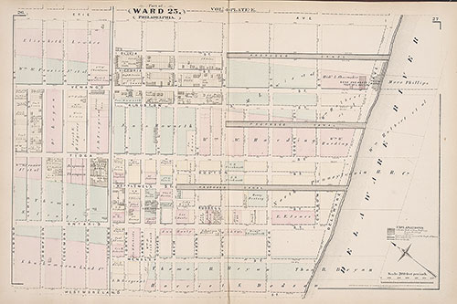
City Atlas of Philadelphia, 25th Ward, 1875, Plate E
1875: G. M. Hopkins, City Atlas of Philadelphia, 25th Ward, Volume 4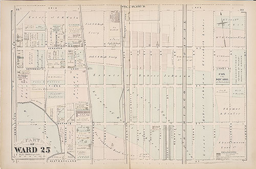
City Atlas of Philadelphia, 25th Ward, 1875, Plate D
1875: G. M. Hopkins, City Atlas of Philadelphia, 25th Ward, Volume 4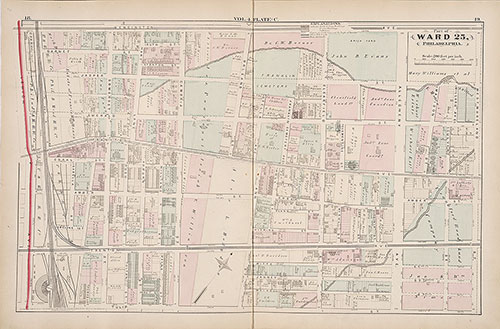
City Atlas of Philadelphia, 25th Ward, 1875, Plate C
1875: G. M. Hopkins, City Atlas of Philadelphia, 25th Ward, Volume 4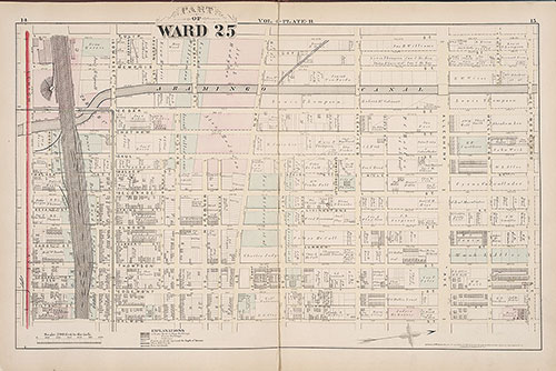
City Atlas of Philadelphia, 25th Ward, 1875, Plate B
1875: G. M. Hopkins, City Atlas of Philadelphia, 25th Ward, Volume 4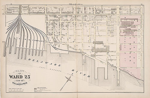
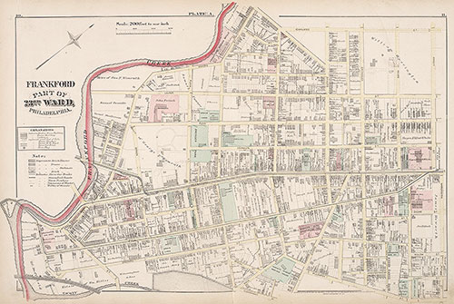
City Atlas of Philadelphia, 25th Ward, 1875, Plate A
1875: G. M. Hopkins, City Atlas of Philadelphia, 25th Ward, Volume 4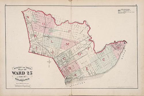
City Atlas of Philadelphia, 25th Ward, 1875, Map Index
1875: G. M. Hopkins, City Atlas of Philadelphia, 25th Ward, Volume 4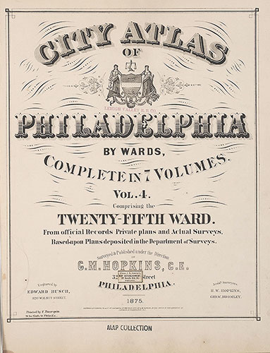
City Atlas of Philadelphia, 25th Ward, 1875, Title Page
1875: G. M. Hopkins, City Atlas of Philadelphia, 25th Ward, Volume 4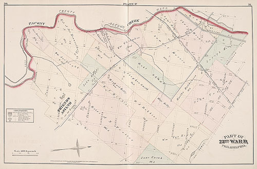
City Atlas of Philadelphia, 23rd Ward, 1876, Plate F
1876: G. M. Hopkins, City Atlas of Philadelphia, 23rd Ward, Volume 3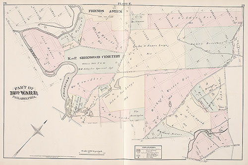
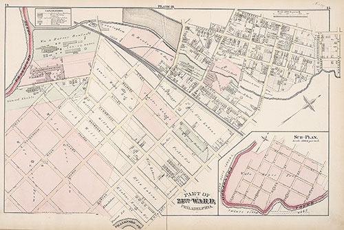
City Atlas of Philadelphia, 23rd Ward, 1876, Plate E
1876: G. M. Hopkins, City Atlas of Philadelphia, 23rd Ward, Volume 3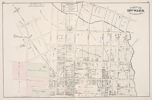
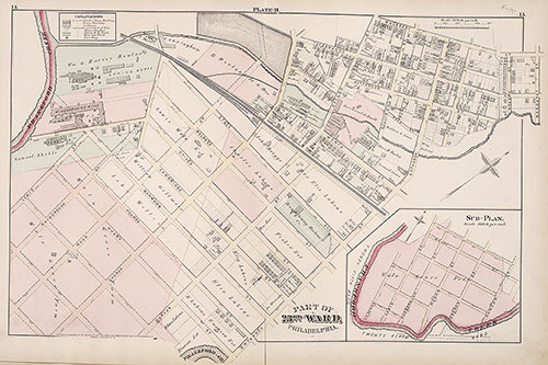
City Atlas of Philadelphia, 23rd Ward, 1876, Plate D
1876: G. M. Hopkins, City Atlas of Philadelphia, 23rd Ward, Volume 3