Map Collection
Our map collection enables you to see how Philadelphia's neighborhoods and streets have grown and changed. Use our interactive mapping tool to overlay atlases dating back as far as 1843 over today's street layout.
Showing 4881 to 4900 of 5,151
Atlas of Philadelphia and Environs, Pages 14-15
1877: G. M. Hopkins, Atlas of Philadelphia and Environs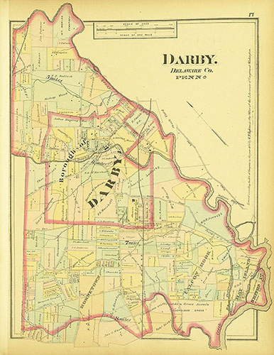
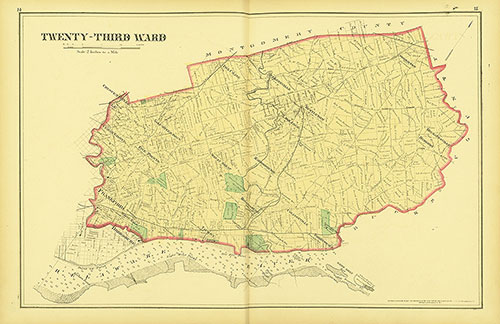
Atlas of Philadelphia and Environs, Pages 18-19
1877: G. M. Hopkins, Atlas of Philadelphia and Environs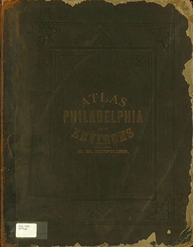
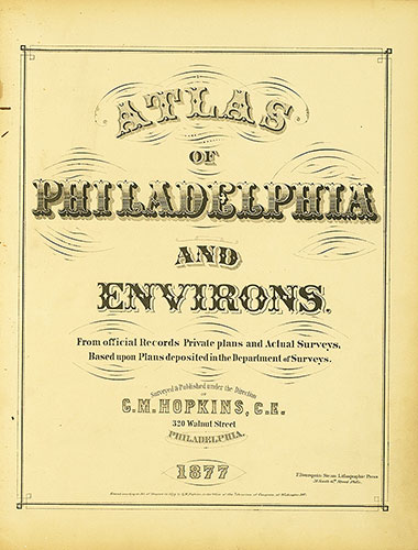
Atlas of Philadelphia and Environs, Title Page
1877: G. M. Hopkins, Atlas of Philadelphia and Environs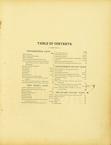
Atlas of Philadelphia and Environs, Contents
1877: G. M. Hopkins, Atlas of Philadelphia and Environs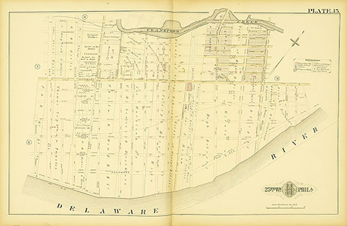
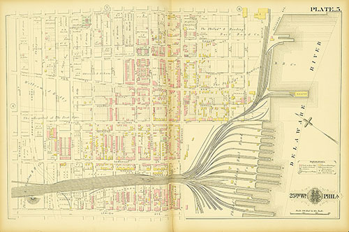
Atlas of the City of Philadelphia, 25th Ward, Plate 15
1886: G. M. Hopkins, Atlas of the City of Philadelphia, 25th Ward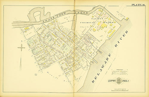
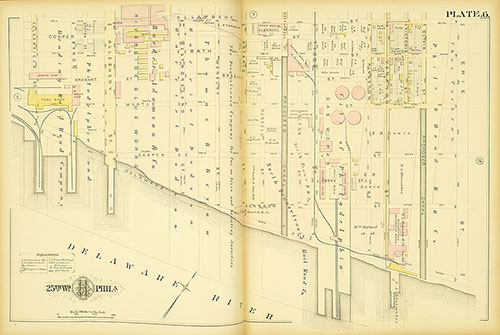
Atlas of the City of Philadelphia, 25th Ward, Plate 16
1886: G. M. Hopkins, Atlas of the City of Philadelphia, 25th Ward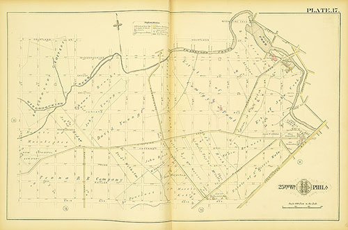
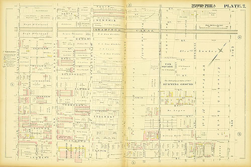
Atlas of the City of Philadelphia, 25th Ward, Plate 17
1886: G. M. Hopkins, Atlas of the City of Philadelphia, 25th Ward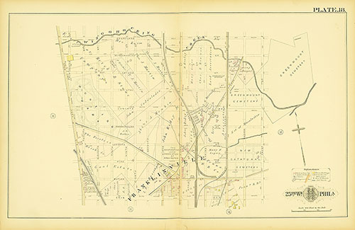
Atlas of the City of Philadelphia, 25th Ward, Plate 18
1886: G. M. Hopkins, Atlas of the City of Philadelphia, 25th Ward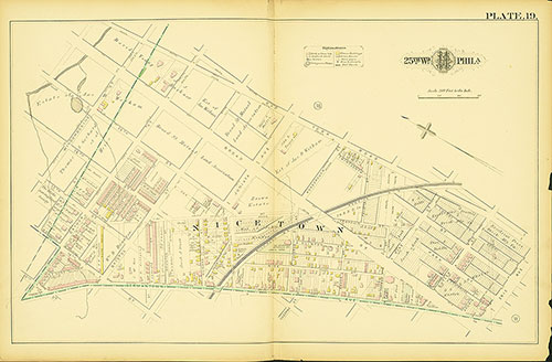
Atlas of the City of Philadelphia, 25th Ward, Plate 19
1886: G. M. Hopkins, Atlas of the City of Philadelphia, 25th Ward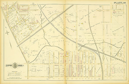
Atlas of the City of Philadelphia, 25th Ward, Plate 10
1886: G. M. Hopkins, Atlas of the City of Philadelphia, 25th Ward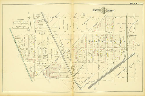
Atlas of the City of Philadelphia, 25th Ward, Plate 11
1886: G. M. Hopkins, Atlas of the City of Philadelphia, 25th Ward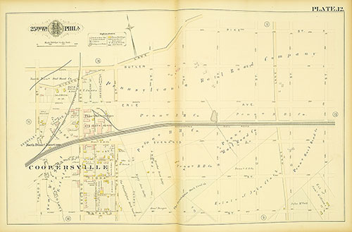
Atlas of the City of Philadelphia, 25th Ward, Plate 12
1886: G. M. Hopkins, Atlas of the City of Philadelphia, 25th Ward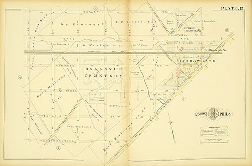
Atlas of the City of Philadelphia, 25th Ward, Plate 13
1886: G. M. Hopkins, Atlas of the City of Philadelphia, 25th Ward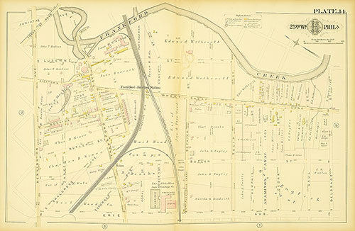
Atlas of the City of Philadelphia, 25th Ward, Plate 14
1886: G. M. Hopkins, Atlas of the City of Philadelphia, 25th Ward