Maps of the City of Philadelphia, 1858-1860, Plate 65
Maps 1859: Hexamer & Locher, Maps of the City of Philadelphia: Volume 5
Item Info
Item No: MHXLAF00012
Title: Maps of the City of Philadelphia, 1858-1860, Plate 65
Additional Title: Maps of the City of Philadelphia, 1858-1860: Volume 5
Publication Year:
1859
Page: 12
Work Type: Property Atlases/Maps
Source: Map Collection
Notes:
Central High School: Broad Street between Green and Brandywine Streets
Spring Garden Hall: northwest corner Spring Garden and 13th Street
Spring Garden Institute: northeast corner Spring Garden and Broad Streets
Northside Orientation of Image: Right
Alternate Page Number: Plate 65
City/Town/Township: Geographic Coverage State/Province:Pennsylvania
Geographic Coverage City/Town/Township:Philadelphia
Creator Name: Hexamer & Locher
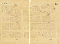 Plate 56
 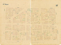 Plate 57
 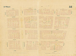 Plate 58
 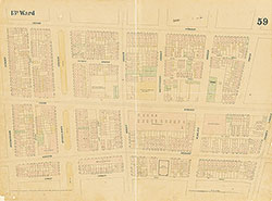 Plate 59
 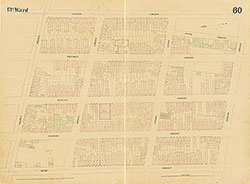 Plate 60
 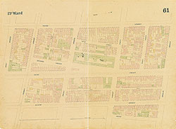 Plate 61
 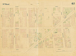 Plate 62
 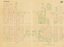 Plate 63
 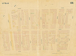 Plate 64
 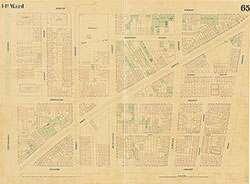 Plate 65
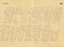 Plate 66
 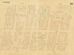 Plate 67
 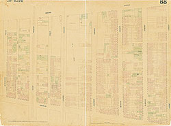 Plate 68
 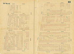 Plate 69
 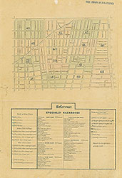 Index (v. 5)
 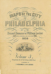 Title
Title