Maps of the City of Philadelphia, 1858-1860, Plate 82
Maps 1859: Hexamer & Locher, Maps of the City of Philadelphia: Volume 6
Item Info
Item No: MHXLAG00016
Title: Maps of the City of Philadelphia, 1858-1860, Plate 82
Additional Title: Maps of the City of Philadelphia, 1858-1860: Volume 6
Publication Year:
1859
Page: 16
Work Type: Property Atlases/Maps
Source: Map Collection
Notes:
Green & Coates Street Railroad stable: north side Wallace Street between 24th & 25th Streets
Green & Coates Street Railroad Station: north side Wallace Street between 24th & 25th Streets
Northside Orientation of Image: Right
Alternate Page Number: Plate 82
City/Town/Township: Geographic Coverage State/Province:Pennsylvania
Geographic Coverage City/Town/Township:Philadelphia
Creator Name: Hexamer & Locher
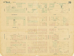 Plate 70
 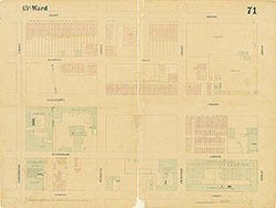 Plate 71
 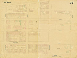 Plate 72
 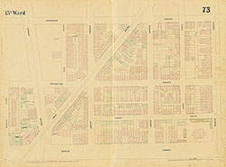 Plate 73
 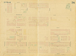 Plate 74
 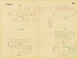 Plate 75
 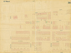 Plate 76
 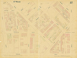 Plate 77
 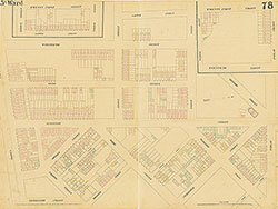 Plate 78
 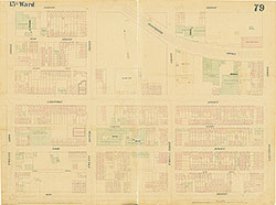 Plate 79
 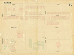 Plate 80
 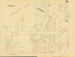 Plate 81
 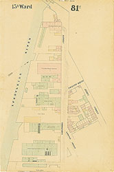 Plate 81A
 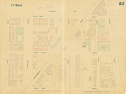 Plate 82
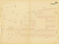 Plate 83
 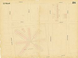 Plate 84
 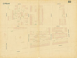 Plate 85
 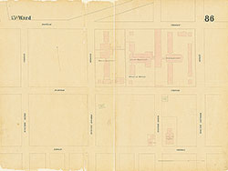 Plate 86
 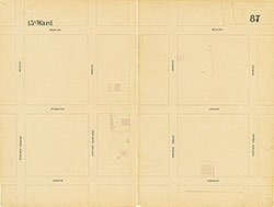 Plate 87
 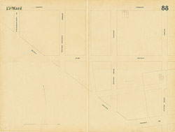 Plate 88
 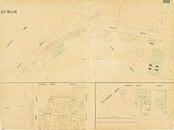 Plate 89
 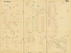 Plate 90
 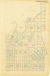 Index (v. 6)
 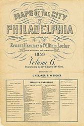 Title
Title