Hexamer General Surveys, Volume 17, Plate 1650
Maps 1881-1882: Hexamer General Surveys: Volume 17, Plates 1556-1655
Item Info
Item No: MHGSAR00081
Title: Hexamer General Surveys, Volume 17, Plate 1650
Additional Title: Hexamer General Surveys, Volume 17
Page:
1650
Work Type: Industrial Site Surveys
Source: Map Collection
Notes:
Corner: N
Notes:
Facility Name: Mill A
Owner: Lea, William & Sons
Products:
- Flour
Northside Orientation of Image: North
Alternate Page Number: Plate 1650
City/Town/Township: Geographic Coverage State/Province:Delaware
Geographic Coverage City/Town/Township:Wilmington
Geographic Coverage Note:Brandywine Creek
Geographic Coverage Region/County:New Castle
Creation Year (Single Year or Range Begin): 1882
Creator Name: Ernest Hexamer
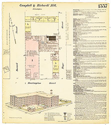 Plate 1557
 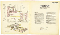 Plates 1558-1559
 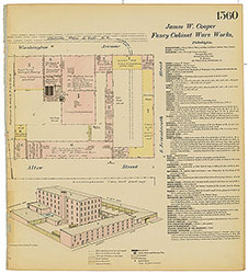 Plate 1560
 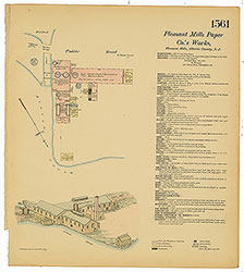 Plate 1561
 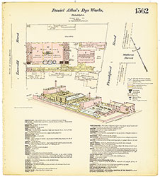 Plate 1562
 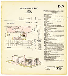 Plate 1563
 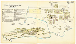 Plates 1564-1565
 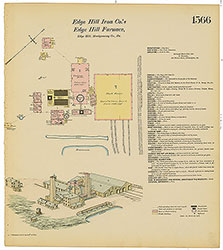 Plate 1566
 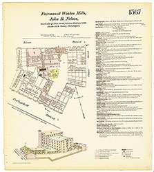 Plate 1567
 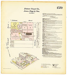 Plate 1570
 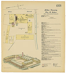 Plate 1571
 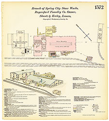 Plate 1572
 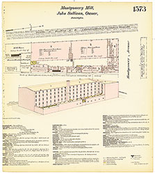 Plate 1573
 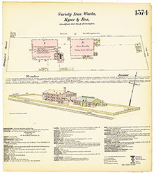 Plate 1574
  Plates 1575-1576
  Plates 1577-1578
 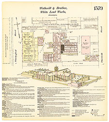 Plate 1579
 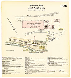 Plate 1580
 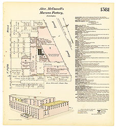 Plate 1581
 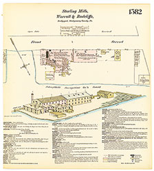 Plate 1582
 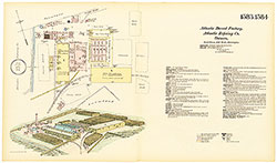 Plates 1583-1584
 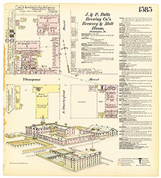 Plate 1585
 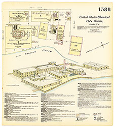 Plate 1586
 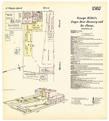 Plate 1587
 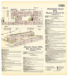 Plate 1588
 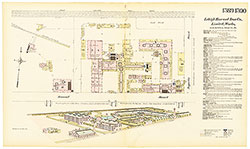 Plates 1589-1590
 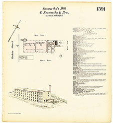 Plate 1591
 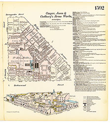 Plate 1592
 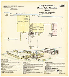 Plate 1593
 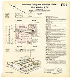 Plate 1594
 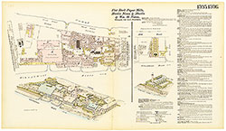 Plates 1595-1596
 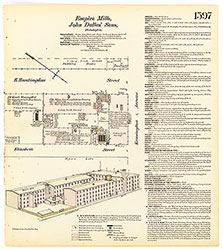 Plate 1597
 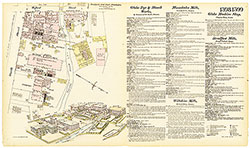 Plates 1598-1599
 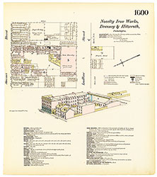 Plate 1600
 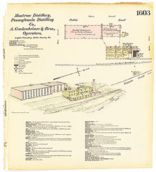 Plate 1603
 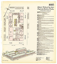 Plate 1605
 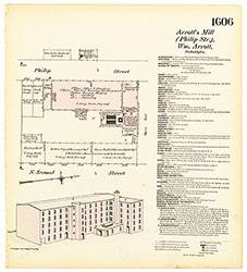 Plate 1606
 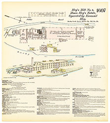 Plate 1607
 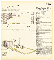 Plate 1608
 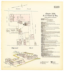 Plate 1609
 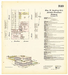 Plate 1610
 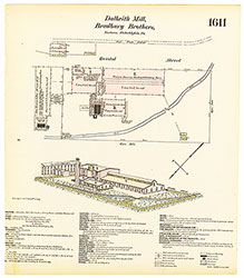 Plate 1611
 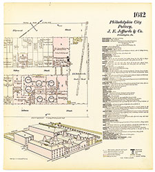 Plate 1612
 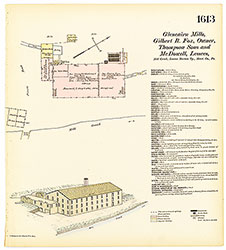 Plate 1613
 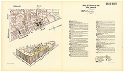 Plates 1614-1615
 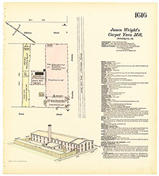 Plate 1616
 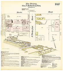 Plate 1617
 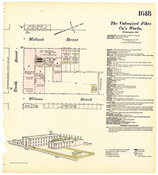 Plate 1618
 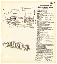 Plate 1619
 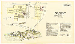 Plates 1620-1621
 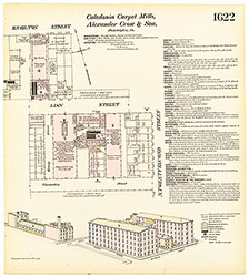 Plate 1622
 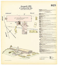 Plate 1623
 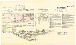 Plates 1624-1625
 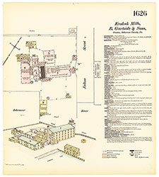 Plate 1626
 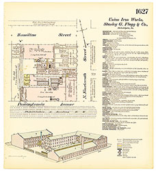 Plate 1627
 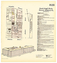 Plate 1628
 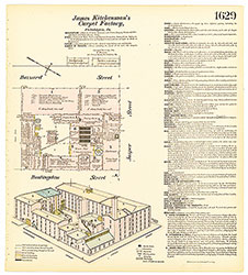 Plate 1629
 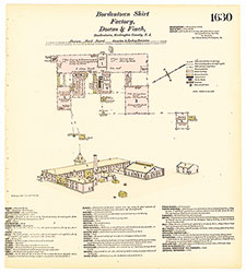 Plate 1630
 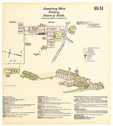 Plate 1631
 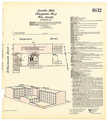 Plate 1632
 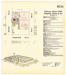 Plate 1633
 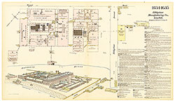 Plates 1634-1635
 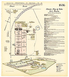 Plate 1636
 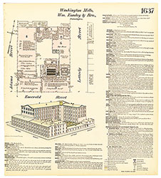 Plate 1637
 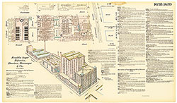 Plates 1638-1639
 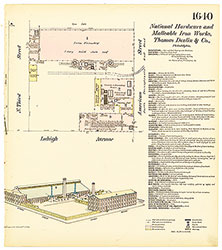 Plate 1640
 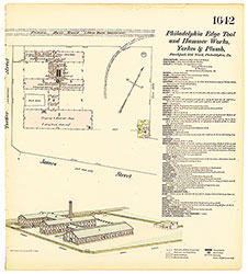 Plate 1642
 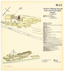 Plate 1643
 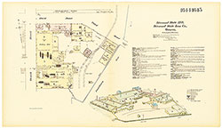 Plates 1644-1645
  Plate 1646
  Plates 1647-1648
  Plate 1649
 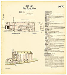 Plate 1650
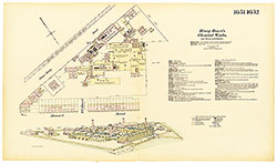 Plates 1651-1652
 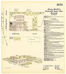 Plate 1653
 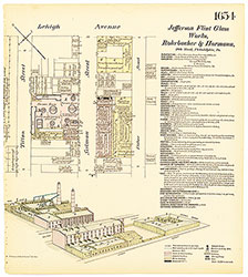 Plate 1654
 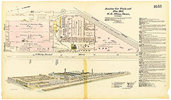 Plate 1655
  Plate 1556
 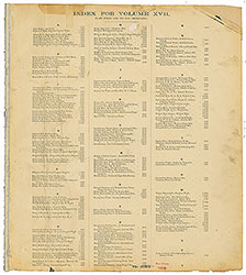 Index (Vol. 17)