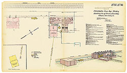
Hexamer General Surveys, Volume 29, Plate 2811
Maps 1894-1895: Hexamer General Surveys: Volume 29, Plates 2756-2854/5
Item Info
Item No: MHGSBD00042
Title: Hexamer General Surveys, Volume 29, Plate 2811
Additional Title: Hexamer General Surveys, Volume 29
Page:
2811
Work Type: Industrial Site Surveys
Source: Map Collection
Notes:
Facility Name: Loyal Hanna Shaft No. 2, Loyal Hanna Coal & coke Co.
Owner: Corporation
Products:
- Coal Tar Products
Northside Orientation of Image: North
Alternate Page Number: Plate 2811
City/Town/Township: Geographic Coverage State/Province:Pennsylvania
Geographic Coverage City/Town/Township:Derry Township
Geographic Coverage Note:7 miles SW of Loyalhanne Station, P. R. R.
Geographic Coverage Region/County:Westmoreland
Creation Year (Single Year or Range Begin): 1894
Creator Name: Ernest Hexamer
 Plates 2757-2758
 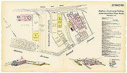 Plates 2759-2760
 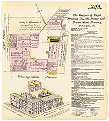 Plate 2761
 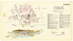 Plates 2762-2763
 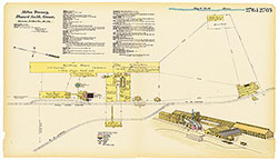 Plates 2764-2765
 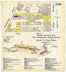 Plate 2766
 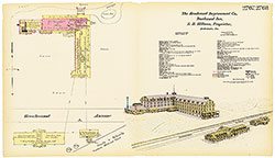 Plates 2767-2768
 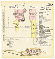 Plate 2769
 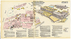 Plates 2770-2771
 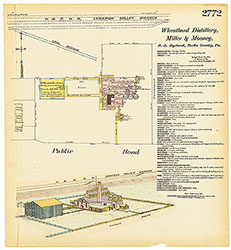 Plate 2772
 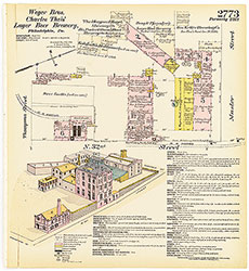 Plate 2773
 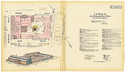 Plates 2774-2775
 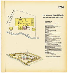 Plate 2776
  Plates 2777-2778
  Plates 2779-2780
 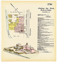 Plate 2781
 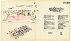 Plates 2782-2783
 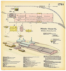 Plate 2784
 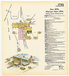 Plate 2785
 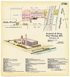 Plate 2786
 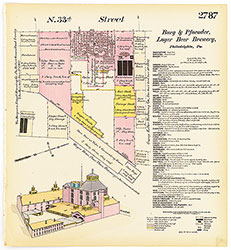 Plate 2787
 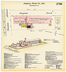 Plate 2788
 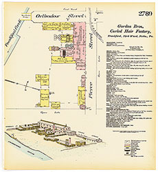 Plate 2789
 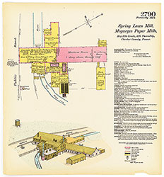 Plate 2790
 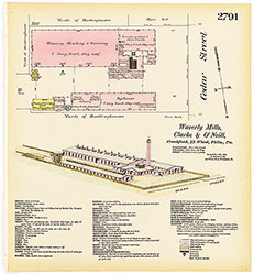 Plate 2791
 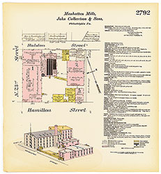 Plate 2792
 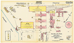 Plates 2793-2794
 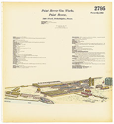 Plate 2795
  Plates 2796-2797
  Plates 2798-2799
  Plates 2800-2801
  Plates 2802-2803
 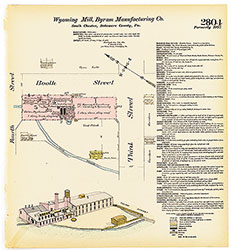 Plate 2804
 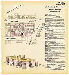 Plate 2805
 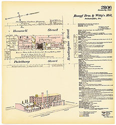 Plate 2806
 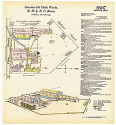 Plate 2807
  Plate 2808
  Plate 2809
  Plate 2810
 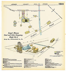 Plate 2811
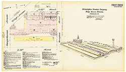 Plates 2812-2813
 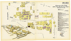 Plates 2814-2815
 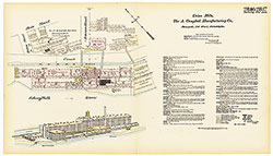 Plates 2816-2817
 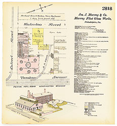 Plate 2818
 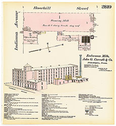 Plate 2819
 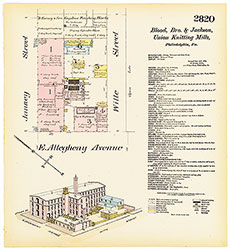 Plate 2820
 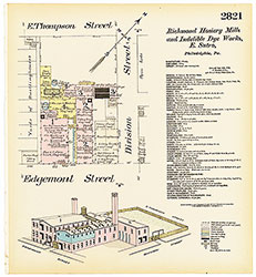 Plate 2821
 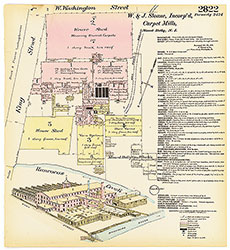 Plate 2822
 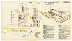 Plates 2823-2824
 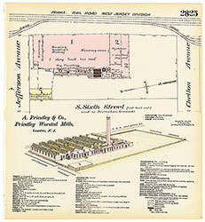 Plate 2825
 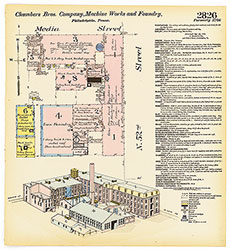 Plate 2826
 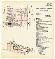 Plate 2827
 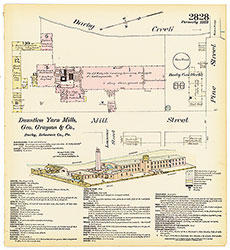 Plate 2828
 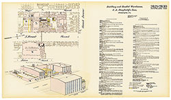 Plates 2829-2830
  Plates 2831-2832
 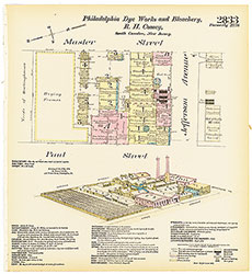 Plate 2833
 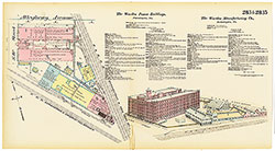 Plates 2834-2835
 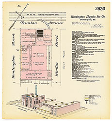 Plate 2836
  Plates 2837-2838
  Plates 2839-2840
 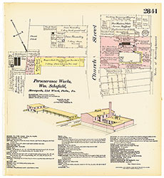 Plate 2841
 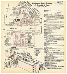 Plate 2842
 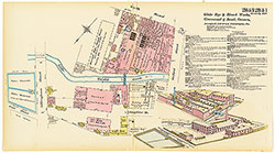 Plates 2843-2844
 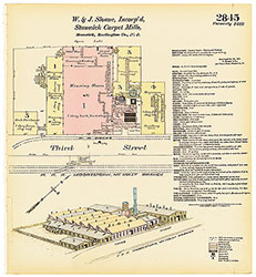 Plate 2845
 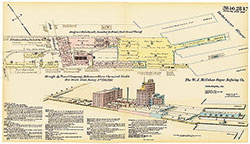 Plates 2846-2847
 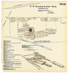 Plate 2848
 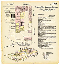 Plate 2849
 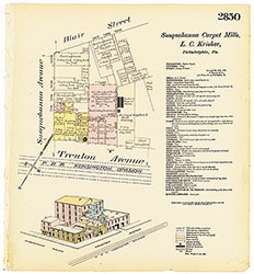 Plate 2850
 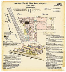 Plate 2851
  Plates 2852-2853
  Plates 2854-2855
  Plate 2756
  Index (Vol. 29)