Insurance Maps of the City of Philadelphia, 1887, Plate 15
Maps 1887: Hexamer, Insurance Maps of the City of Philadelphia, Volume 2
Item Info
Item No: MHIMAC00005
Title: Insurance Maps of the City of Philadelphia, 1887, Plate 15
Additional Title: Insurance Maps of the City of Philadelphia, 1887: Volume 2
Publication Year:
1887
Page: 5
Work Type: Property Atlases/Maps
Source: Map Collection
Northside Orientation of Image: Right
Alternate Page Number: Plate 15
City/Town/Township: Geographic Coverage Ward:10th Ward
Geographic Coverage State/Province:Pennsylvania
Geographic Coverage City/Town/Township:Philadelphia
Geographic Coverage Neighborhood:Center City
Geographic Coverage Region/County:Philadelphia
Creation Year (Single Year or Range Begin): 1887
Creator Name: Ernest Hexamer & Son - Publisher
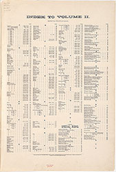 Street Index
 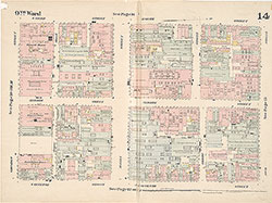 Plate 14
 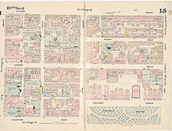 Plate 15
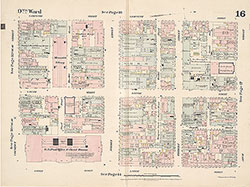 Plate 16
 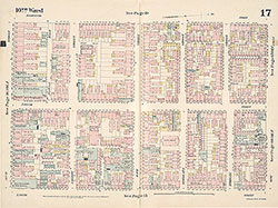 Plate 17
 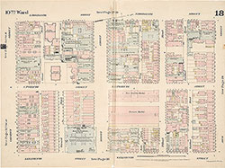 Plate 18
 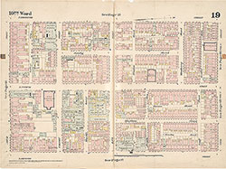 Plate 19
 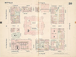 Plate 20
 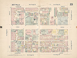 Plate 21
 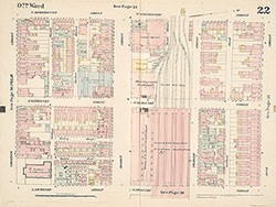 Plate 22
 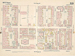 Plate 23
 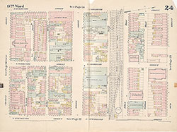 Plate 24
 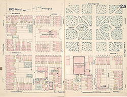 Plate 25
 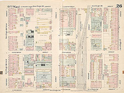 Plate 26
 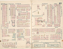 Plate 27
 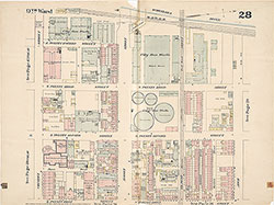 Plate 28
 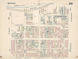 Plate 29
 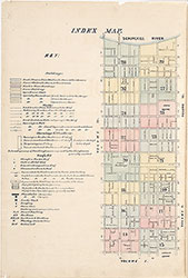 Index Map and key
 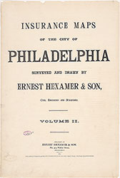 Title Page