City Atlas of Philadelphia, 21st & 28th Wards, 1875, 28th Ward Map Index
Maps 1875: G.M. Hopkins Atlas of Philadelphia, Wards 21, 28, Volume 2
Item Info
Item No: MGMHAF00005
Title: City Atlas of Philadelphia, 21st & 28th Wards, 1875, 28th Ward Map Index
Additional Title: City Atlas of Philadelphia, 21st & 28th Wards, 1875: Volume 2
Publication Year:
1875
Page: 3
Work Type: Property Atlases/Maps
Source: Map Collection
Notes:
Volume 2 of 7
Northside Orientation of Image: Top Right
Alternate Page Number: 28th Ward Map Index
City/Town/Township: Geographic Coverage State/Province:Pennsylvania
Geographic Coverage City/Town/Township:Philadelphia
Creator Name: G.M. Hopkins, C.E. - Publisher
Subjects
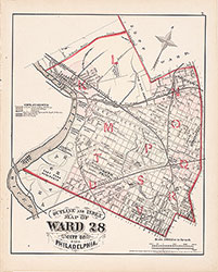 28th Ward Map Index
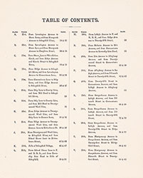 Table of Contents
 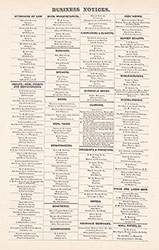 Business Notices
 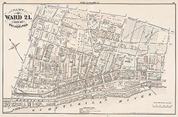 Plate A
 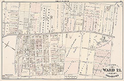 Plate B
 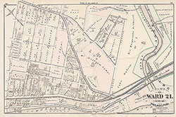 Plate C
 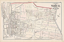 Plate D
 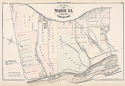 Plate E
 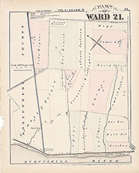 Plate F
 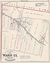 Plate G
 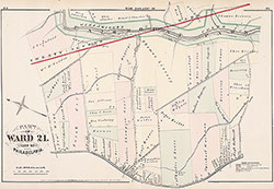 Plate H
 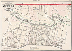 Plate I
 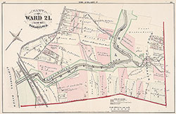 Plate J
 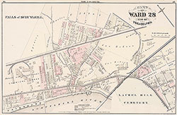 Plate K
 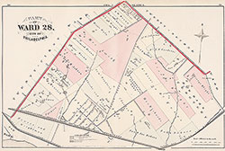 Plate L
 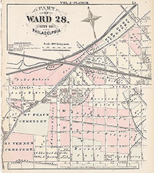 Plate M
 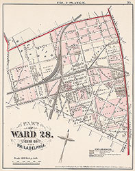 Plate N
 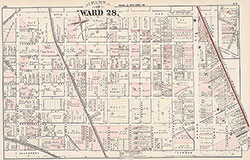 Plate O
 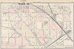 Plate P
 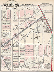 Plate Q
 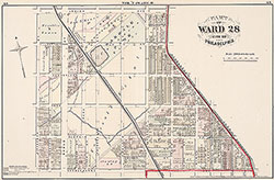 Plate R
 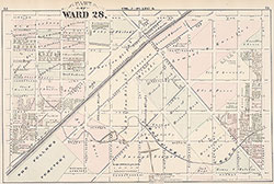 Plate S
 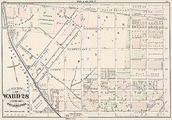 Plate T
 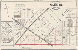 Plate U
 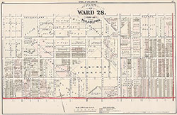 Plate V
 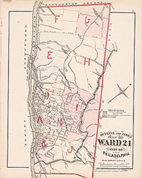 21st Ward Index Map
 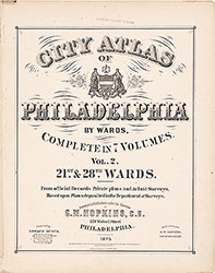 Title Page