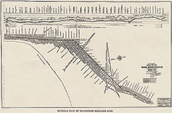
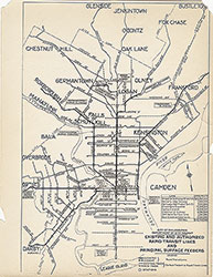
Plan of Subways and Elevated Railways, 1916, map
Maps 1914: Estimated Time Saving From Market St-Broad to 8th St. by Recommended Rapid Transit Lines
Item Info
Item No: MDCTAA00014
Title: Plan of Subways and Elevated Railways, 1916, map
Additional Title: Plan of Subways and Elevated Railways, 1916
Publication Year:
1916
Page: 1
Work Type: Transportation Maps
Source: Map Collection
Notes:
From: Annual Report of the Department of City Transit. Covers Broad, Arch, Eighth, Locust, The Parkway, twenty-Ninth Streets
Northside Orientation of Image: Right
Alternate Page Number: map
City/Town/Township: Geographic Coverage State/Province:Pennsylvania
Geographic Coverage City/Town/Township:Philadelphia
Creator Name: Philadelphia (Pa.). Department of City Transit - Publisher
 map
map 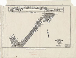 map
map  map
map  map
map 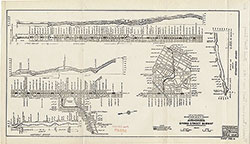 map
map 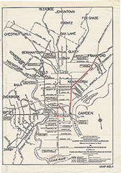 map
map 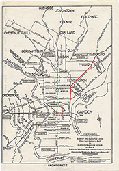 map
map  map
map 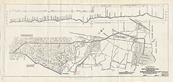 map
map 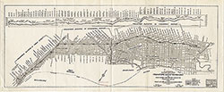 map
map 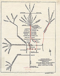 map
map 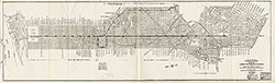 map
map
 map
map 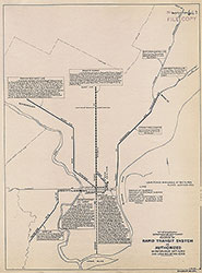 map
map  map
map  map
map 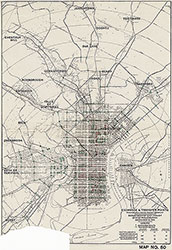 map
map 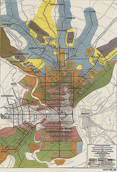 map
map