Atlas of Philadelphia, 5th, 7th & 8th Wards, 1874, Plate 11
Maps 1874: G. H. Jones, Atlas of Philadelphia, 5th, 7th & 8th Wards
Item Info
Item No: MGHJAA00014
Title: Atlas of Philadelphia, 5th, 7th & 8th Wards, 1874, Plate 11
Additional Title: Atlas of Philadelphia, 5th, 7th & 8th Wards, 1874
Publication Year:
1874
Page: 14
Work Type: Property Atlases/Maps
Source: Map Collection
Notes:
American Sunday School Union: 1122 Chestnut Street
China Hall: 1218 Chestnut Street
Classical Institute: 238-240 Dean Street
Collegiate School & Dancing Academy: 1400 Walnut Street
Episcopal Academy: sw corner Juniper & Locust Streets
Horticultural Hall: nw corner Broad & Lardner Streets
La Pierre House: west side of Broad Street below Chestnut Street
Presbyterian Board of Publications: 1334-1336 Chestnut Street
White Building: 1130 Chestnut Street
Notes:
Index to street railways
Notes:
Volume 1 of 4 (only volumes published)
Northside Orientation of Image: Top
Alternate Page Number: Plate 11
City/Town/Township: Geographic Coverage City/Town/Township:Philadelphia
Creator Name: G.H. Jones - Publisher
Walter S. MacCormac, C.E. - Surveyor
Subjects
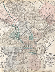 City Map
 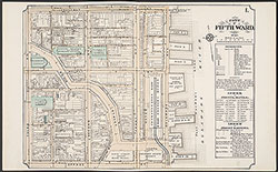 Plate 1
 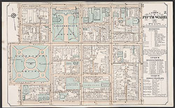 Plate 2
 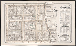 Plate 3
 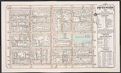 Plate 4
 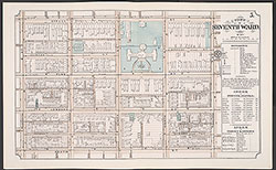 Plate 5
 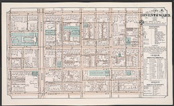 Plate 6
 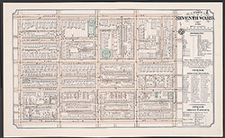 Plate 7
 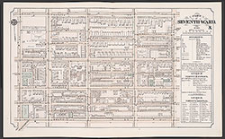 Plate 8
 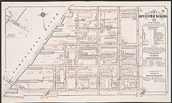 Plate 9
 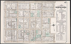 Plate 10
 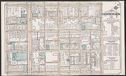 Plate 11
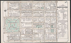 Plate 12
 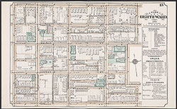 Plate 13
  Plate 14
  Plate 15
 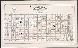 Plate 16
 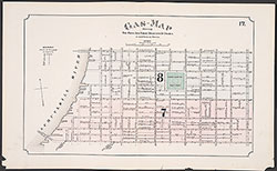 Plate 17
 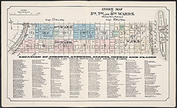 Index Map & Street Listing
 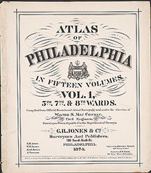 Title Page