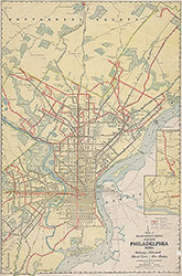
Map of Transportation System, Philadelphia, Penna., 1934-1935, Map
Maps
Item Info
Item No: MAP00000021
Title: Map of Transportation System, Philadelphia, Penna., 1934-1935, Map
Publication Year:
1934
Page: 21
Work Type: Transportation Maps
Source: Map Collection
Notes:
Subway, Elevated, Street Cars, Bus Routes
Northside Orientation of Image: Top
Alternate Page Number: Map
City/Town/Township: Geographic Coverage State/Province:Pennsylvania
Geographic Coverage City/Town/Township:Philadelphia
Creator Name: Interstate Map Co. - Publisher
 Map
Map