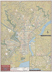
Street and Transit Map of Philadelphia Showing Street Car, Bus and Subway-Elevated Lines, 1956, Map
Maps
Item Info
Item No: MAP00000053
Title: Street and Transit Map of Philadelphia Showing Street Car, Bus and Subway-Elevated Lines, 1956, Map
Publication Year:
1956
Page: 53
Work Type: Transportation Maps
Source: Map Collection
Notes:
15th revised edition
Northside Orientation of Image: Top
Alternate Page Number: Map
City/Town/Township: Geographic Coverage State/Province:Pennsylvania
Geographic Coverage City/Town/Township:Philadelphia
Creator Name: Philadelphia Transportation Company - Publisher
 Map
Map
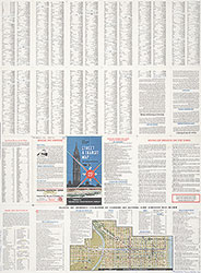 Directory