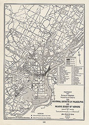
Industrial Districts of Philadelphia and Relative Density of Workers, 1946, Map
Maps
Item Info
Item No: MAP00000129
Title: Industrial Districts of Philadelphia and Relative Density of Workers, 1946, Map
Additional Title: Industrial Districts of Philadelphia and Relative Density of Workers, 1946
Publication Year:
1946
Page: 1
Work Type: General Maps
Source: Map Collection
Notes:
Report on survey of hospitals. Includes general hospitals and workers per acre within city neighborhoods
Northside Orientation of Image: Top
Alternate Page Number: Map
City/Town/Township: Geographic Coverage State/Province:Pennsylvania
Geographic Coverage City/Town/Township:Philadelphia
Creator Name: Ford, Bacon, and Davis - Engineer
Philadelphia City Planning Commission - Publisher
 Map
Map