Map Collection
Our map collection enables you to see how Philadelphia's neighborhoods and streets have grown and changed. Use our interactive mapping tool to overlay atlases dating back as far as 1843 over today's street layout.
Showing 4541 to 4560 of 5,151
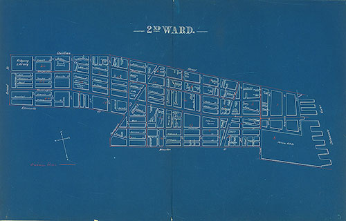
Atlas of the City of Philadelphia by Wards, Ward 2
1892: J. E. Shiedt, Atlas of the City of Philadelphia by Wards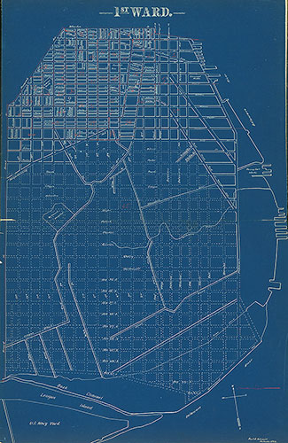
Atlas of the City of Philadelphia by Wards, Ward 1
1892: J. E. Shiedt, Atlas of the City of Philadelphia by Wards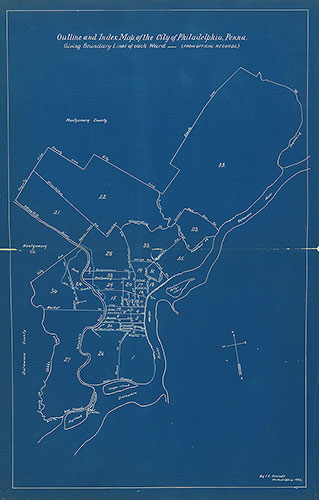
Atlas of the City of Philadelphia by Wards, Index
1892: J. E. Shiedt, Atlas of the City of Philadelphia by Wards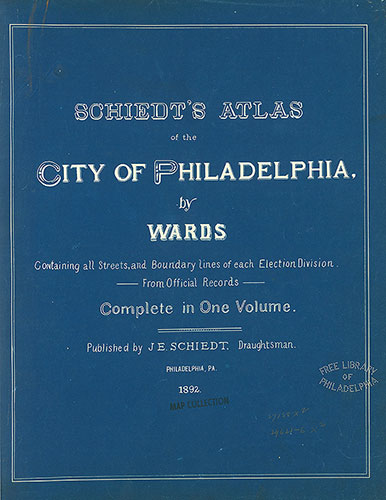
Atlas of the City of Philadelphia by Wards, Titlepage
1892: J. E. Shiedt, Atlas of the City of Philadelphia by Wards
Atlas of the City of Philadelphia by Wards, Cover
1892: J. E. Shiedt, Atlas of the City of Philadelphia by Wards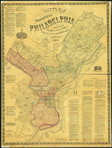
Scott's Map of the Consolidated City of Philadelphia, 1856, Map
1856: Scott & Moore, Map of the Consolidated City of Philadelphia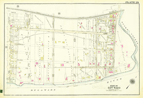
Atlas of the City of Philadelphia, 23rd and 41st Wards, Plate 29
1929: Bromley, Atlas of the City of Philadelphia, 23rd and 41st Wards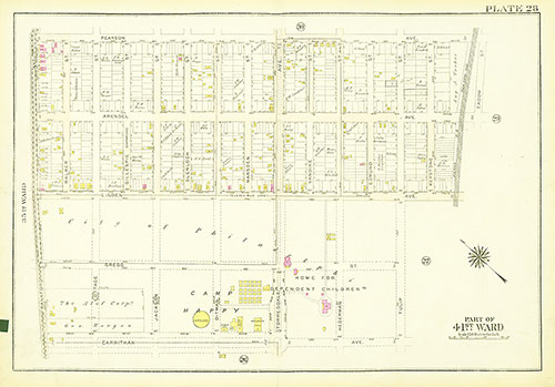
Atlas of the City of Philadelphia, 23rd and 41st Wards, Plate 28
1929: Bromley, Atlas of the City of Philadelphia, 23rd and 41st Wards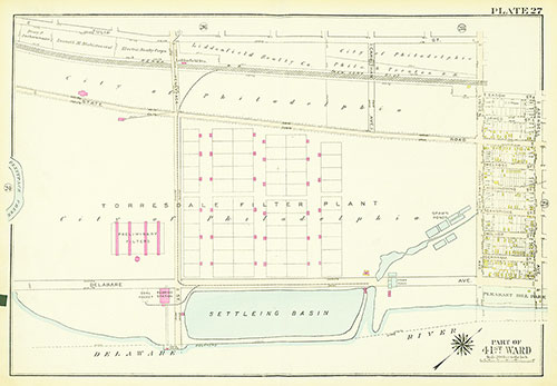
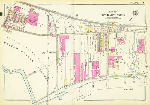
Atlas of the City of Philadelphia, 23rd and 41st Wards, Plate 27
1929: Bromley, Atlas of the City of Philadelphia, 23rd and 41st Wards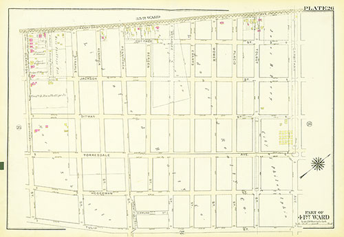
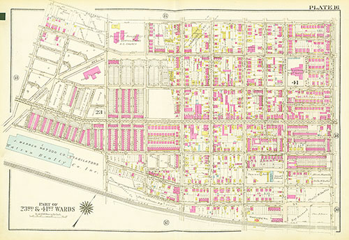
Atlas of the City of Philadelphia, 23rd and 41st Wards, Plate 26
1929: Bromley, Atlas of the City of Philadelphia, 23rd and 41st Wards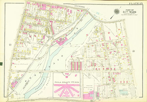
Atlas of the City of Philadelphia, 23rd and 41st Wards, Plate 25
1929: Bromley, Atlas of the City of Philadelphia, 23rd and 41st Wards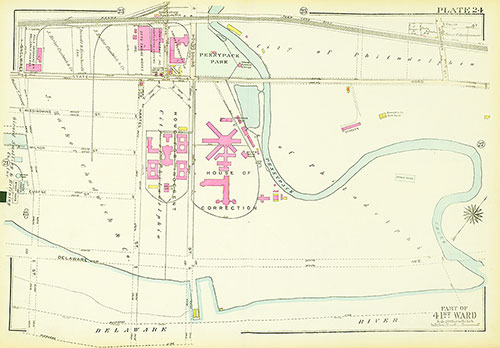
Atlas of the City of Philadelphia, 23rd and 41st Wards, Plate 24
1929: Bromley, Atlas of the City of Philadelphia, 23rd and 41st Wards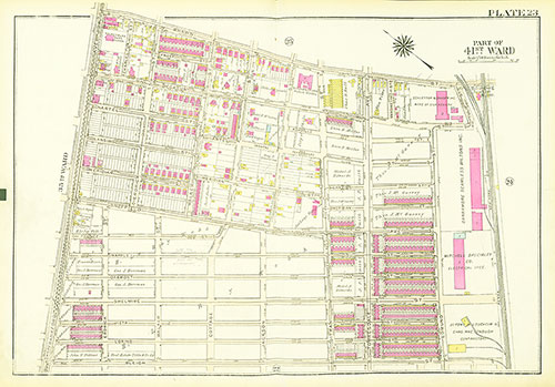
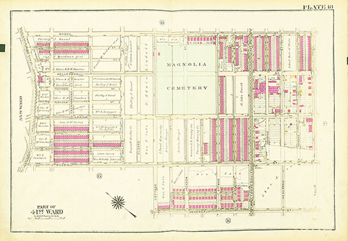
Atlas of the City of Philadelphia, 23rd and 41st Wards, Plate 23
1929: Bromley, Atlas of the City of Philadelphia, 23rd and 41st Wards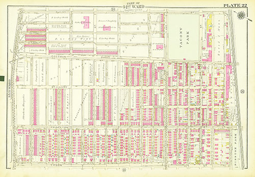
Atlas of the City of Philadelphia, 23rd and 41st Wards, Plate 22
1929: Bromley, Atlas of the City of Philadelphia, 23rd and 41st Wards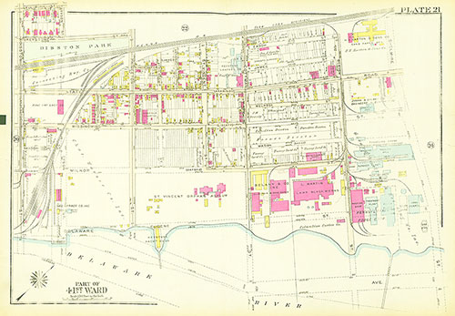
Atlas of the City of Philadelphia, 23rd and 41st Wards, Plate 21
1929: Bromley, Atlas of the City of Philadelphia, 23rd and 41st Wards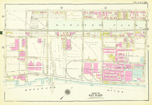
Atlas of the City of Philadelphia, 23rd and 41st Wards, Plate 20
1929: Bromley, Atlas of the City of Philadelphia, 23rd and 41st Wards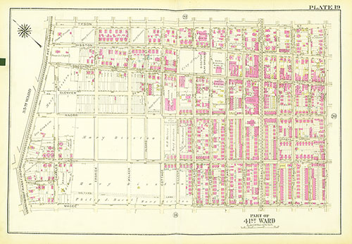
Atlas of the City of Philadelphia, 23rd and 41st Wards, Plate 19
1929: Bromley, Atlas of the City of Philadelphia, 23rd and 41st Wards