Map Collection
Our map collection enables you to see how Philadelphia's neighborhoods and streets have grown and changed. Use our interactive mapping tool to overlay atlases dating back as far as 1843 over today's street layout.
Showing 1681 to 1700 of 5,151

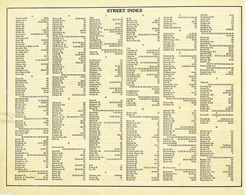
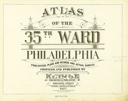
Atlas of the 35th Ward, Philadelphia, Street Index
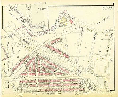
1927: Klinge, Atlas of the 35th Ward, Philadelphia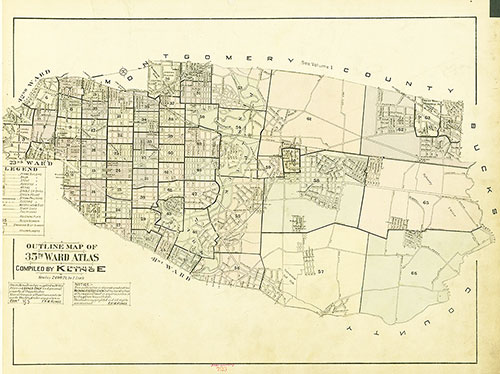
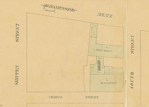
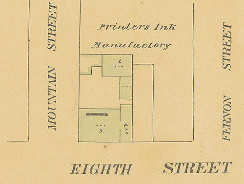
Maps of the City of Philadelphia, 1858-1860, Plate 96, Section A6
1860: Hexamer & Locher, Maps of the City of Philadelphia: Volume 7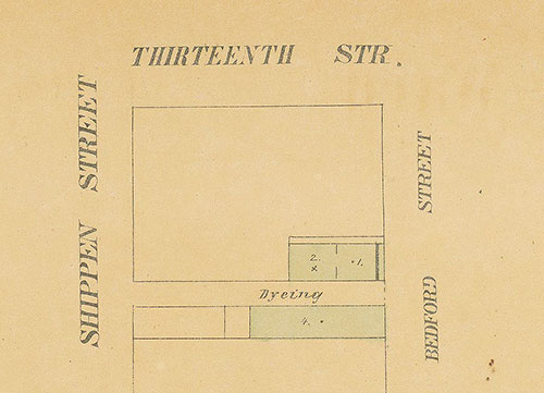
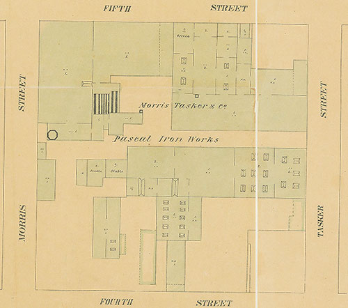
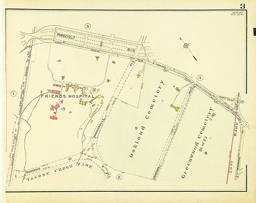
Maps of the City of Philadelphia, 1858-1860, Plate 96, Section A4
1860: Hexamer & Locher, Maps of the City of Philadelphia: Volume 7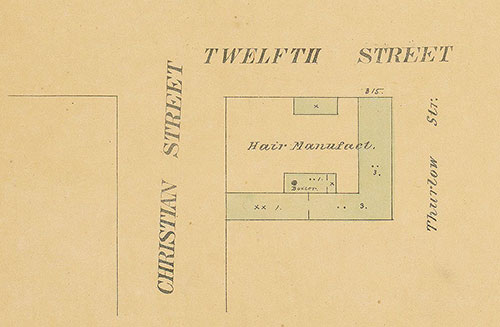
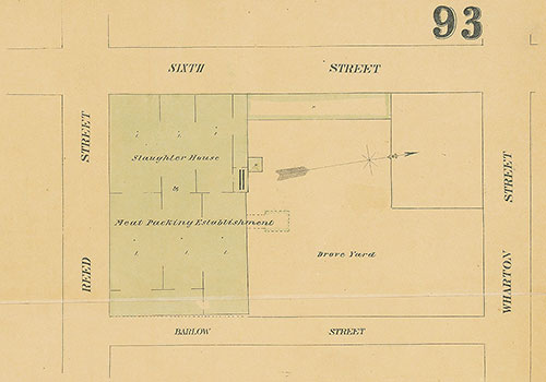
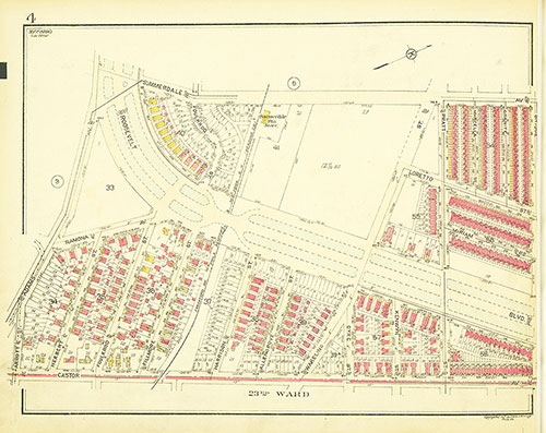
Maps of the City of Philadelphia, 1858-1860, Plate 96, Section A2
1860: Hexamer & Locher, Maps of the City of Philadelphia: Volume 7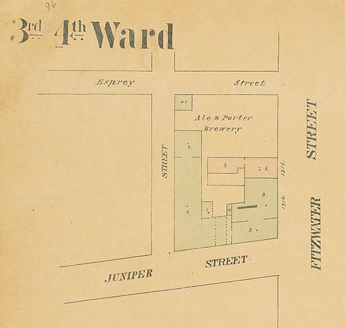
Maps of the City of Philadelphia, 1858-1860, Plate 96, Section A1
1860: Hexamer & Locher, Maps of the City of Philadelphia: Volume 7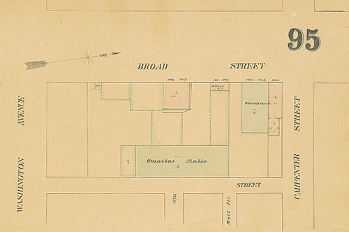
Maps of the City of Philadelphia, 1858-1860, Plate 95, Section B1
1860: Hexamer & Locher, Maps of the City of Philadelphia: Volume 7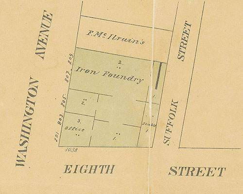
Maps of the City of Philadelphia, 1858-1860, Plate 95, Section A3
1860: Hexamer & Locher, Maps of the City of Philadelphia: Volume 7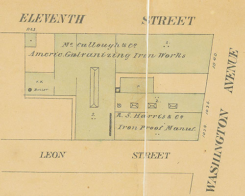
Maps of the City of Philadelphia, 1858-1860, Plate 95, Section A2
1860: Hexamer & Locher, Maps of the City of Philadelphia: Volume 7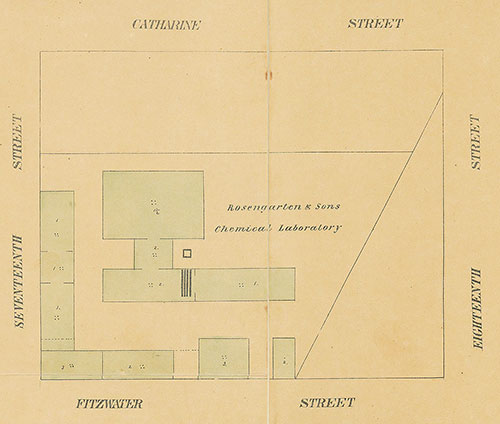
Maps of the City of Philadelphia, 1858-1860, Plate 94, Section A3
1860: Hexamer & Locher, Maps of the City of Philadelphia: Volume 7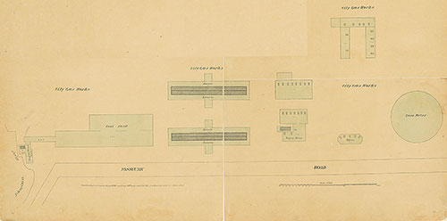
Maps of the City of Philadelphia, 1858-1860, Plate 94, Section A1
1860: Hexamer & Locher, Maps of the City of Philadelphia: Volume 7