Maps of the City of Philadelphia, 1858-1860, Plate 34
Maps 1858: Hexamer & Locher, Maps of the City of Philadelphia: Volume 3
Item Info
Item No: MHXLAD00007
Title: Maps of the City of Philadelphia, 1858-1860, Plate 34
Additional Title: Maps of the City of Philadelphia, 1858-1860: Volume 3
Publication Year:
1858
Page: 7
Work Type: Property Atlases/Maps
Source: Map Collection
Notes:
Adams Express Company: southeast corner Broad and Locust Streets
Classical Institute: west side Dean Street below Locust Street
Schuylkill Hose Company: 1227 Locust Street
Universalist Church of the Messiah: northeast corner Juniper and Locust Streets
Northside Orientation of Image: Right
Alternate Page Number: Plate 34
City/Town/Township: Geographic Coverage State/Province:Pennsylvania
Geographic Coverage City/Town/Township:Philadelphia
Creator Name: Hexamer & Locher
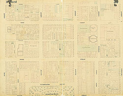 Plate 30
 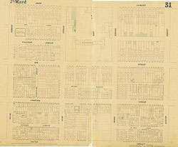 Plate 31
 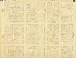 Plate 32
 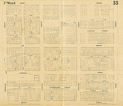 Plate 33
 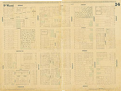 Plate 34
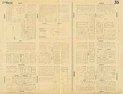 Plate 35
 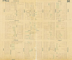 Plate 36
 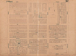 Plate 37
 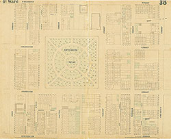 Plate 38
 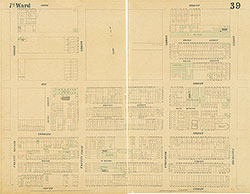 Plate 39
 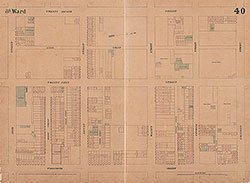 Plate 40
 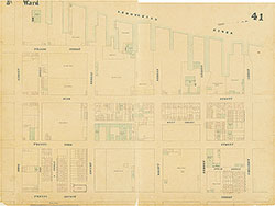 Plate 41
 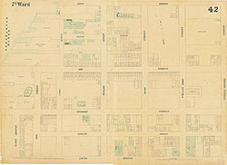 Plate 42
 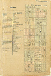 Index (v. 3)
 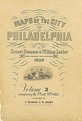 Title Page