Maps of the City of Philadelphia, 1858-1860, Plate 16
Maps 1860: Hexamer & Locher, Maps of the City of Philadelphia: Volume 2
Item Info
Item No: MHXLBC00005
Title: Maps of the City of Philadelphia, 1858-1860, Plate 16
Additional Title: Maps of the City of Philadelphia, 1858-1860: Volume 2
Publication Year:
1860
Page: 5
Work Type: Property Atlases/Maps
Source: Map Collection
Notes:
Bulls Head Hotel: 1025-1027 Market Street
Commission and Forwarding Warehous: 1015 Market Street
Diligent Engine Company: 26 N. 10th Street
Fame Hose Company: 903 Filbert Street
Franklin Market: south side of Marble Street at 10th Street
Mansion House: southeast corner of 11th and Market Streets
Markoe House: 919 Chestnut Street
Parkinson House: 1017-1019 Chestnut Street
Pennsylvania Academy of Fine Arts: rear 1025 Chestnut Street
Pennsylvania Railroad Station: northeast corner 11th and Marle Streets
Sanford's Opera House: southeast corner 11th and Marble Streets
University of Pennsylvania: west side 9th Street below Market Street
White Horse Hotel: 1014-1016 Market Street
Northside Orientation of Image: Right
Alternate Page Number: Plate 16
City/Town/Township: Geographic Coverage State/Province:Pennsylvania
Geographic Coverage City/Town/Township:Philadelphia
Creator Name: Hexamer & Locher
Subjects
- Philadelphia, Pennsylvania
- Railroad stations
- Hotels
- Warehouses
- Markets
- Theaters
- Universities & colleges
- Pennsylvania Academy of the Fine Arts
- Pennsylvania Railroad Station
- University Of Pennsylvania
- Fire stations
- Franklin Market
- Minstrel shows
- Art museums (buildings)
- Opera houses
- Commission and Forwarding Warehouse
- Bull's Head Hotel
- Mansion House
- White Horse Hotel
- Parkinson House
- Sanford's Opera House
- Markoe House
- Fame Hose Company
- Diligent Engine Company
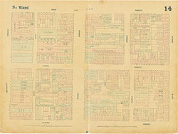 Plate 14
 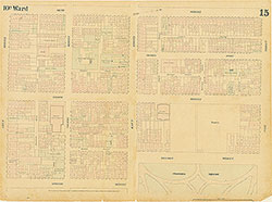 Plate 15
 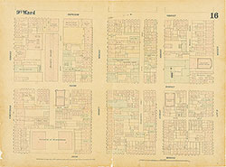 Plate 16
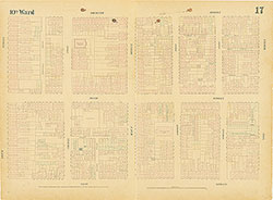 Plate 17
 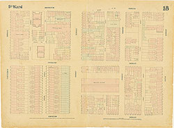 Plate 18
 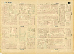 Plate 19
 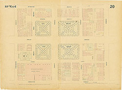 Plate 20
 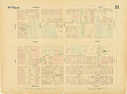 Plate 21
 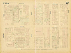 Plate 22
 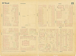 Plate 23
 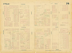 Plate 24
 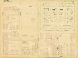 Plate 25
 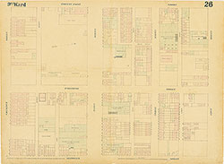 Plate 26
 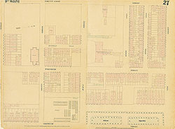 Plate 27
 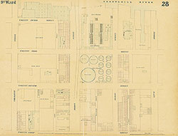 Plate 28
 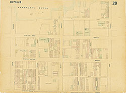 Plate 29
 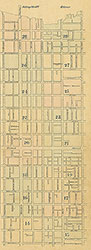 Index (v. 2)
 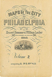 Title
Title