Hexamer General Surveys, Volume 1, Plate 40
Maps 1866-1867: Hexamer General Surveys: Volume 1, Plates 1-79
Item Info
Item No: MHGSAB00041
Title: Hexamer General Surveys, Volume 1, Plate 40
Additional Title: Hexamer General Surveys, Volume 1
Page:
40
Street Address: Manayunk Canal
Work Type: Industrial Site Surveys
Source: Map Collection
Notes:
Corner: B/W
Notes:
Facility Name: Manayunk Pulp Works
Products:
- Pulp
Notes:
Ward: 21
Northside Orientation of Image: North
Alternate Page Number: Plate 40
City/Town/Township: Geographic Coverage Ward:21st ward
Geographic Coverage State/Province:Pennsylvania
Geographic Coverage City/Town/Township:Philadelphia
Geographic Coverage Note:Schuylkill River
Geographic Coverage Neighborhood:Manayunk
Geographic Coverage Region/County:Philadelphia
Creation Year (Single Year or Range Begin): 1866
Creator Name: Ernest Hexamer
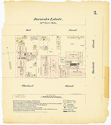 Plate 2
 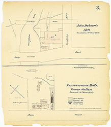 Plate 3
 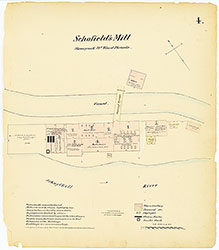 Plate 4
 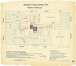 Plate 5
  Plate 6
  Plate 7
  Plate 8
  Plate 9
 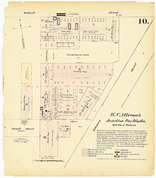 Plate 10
  Plate 11
  Plate 12
  Plate 13
 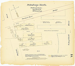 Plate 14
  Plate 15
  Plate 16
  Plate 17
 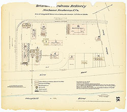 Plate 18
  Plate 19
  Plate 20
  Plate 21
  Plate 22
  Plate 23
  Plate 24
  Plate 25
  Plate 26
  Plate 27
  Plate 28
  Plate 29
 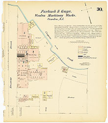 Plate 30
 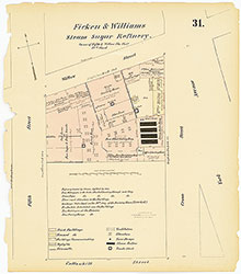 Plate 31
 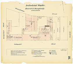 Plate 32
 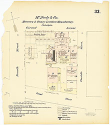 Plate 33
 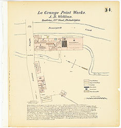 Plate 34
  Plate 35
  Plate 36
  Plate 37
  Plate 38
 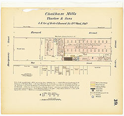 Plate 39
 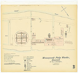 Plate 40
 Plate 41
  Plate 42
 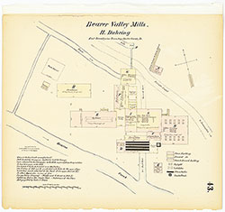 Plate 43
 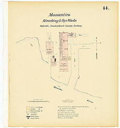 Plate 44
 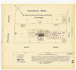 Plate 45
 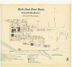 Plate 46
  Plate 47
  Plate 48
  Plate 49
  Plate 50
 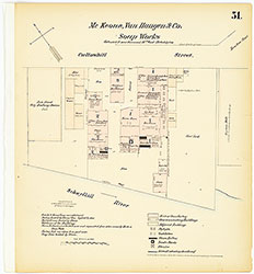 Plate 51
 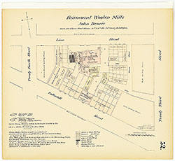 Plate 52
 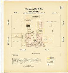 Plate 54
 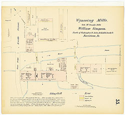 Plate 55
 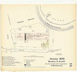 Plate 57
 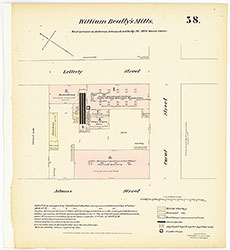 Plate 58
 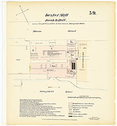 Plate 59
 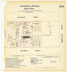 Plate 60
 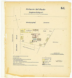 Plate 61
 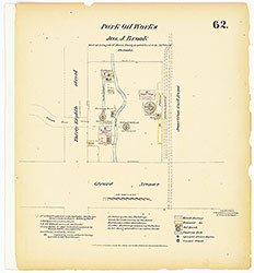 Plate 62
 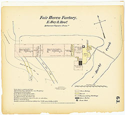 Plate 63
 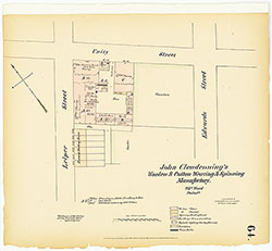 Plate 64
  Plate 65
 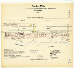 Plate 66
  Plate 67
  Plate 68
 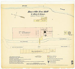 Plate 69
 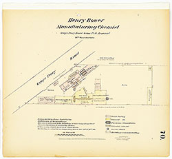 Plate 70
 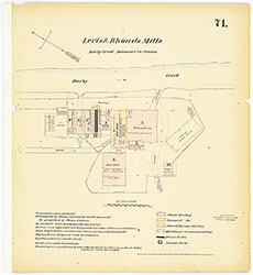 Plate 71
 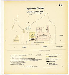 Plate 72
 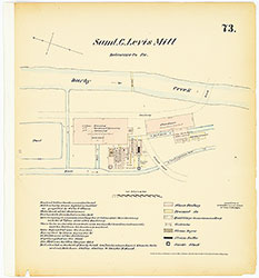 Plate 73
 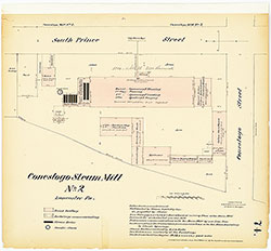 Plate 74
 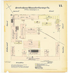 Plate 75
 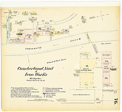 Plate 76
 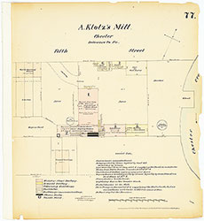 Plate 77
  Plate 79
  Plate 1
  Index (Vol. 1)