Hexamer General Surveys, Volume 18, Plate 1710
Maps 1882-1883: Hexamer General Surveys: Volume 18, Plates 1656-1755
Item Info
Item No: MHGSAS00043
Title: Hexamer General Surveys, Volume 18, Plate 1710
Additional Title: Hexamer General Surveys, Volume 18
Page:
1710
Work Type: Industrial Site Surveys
Source: Map Collection
Notes:
Facility Name: Providence Mill
Owner: Singerley, William M.
Products:
- Paper
Northside Orientation of Image: North
Alternate Page Number: Plate 1710
City/Town/Township: Geographic Coverage State/Province:Maryland
Geographic Coverage City/Town/Township:Fairhill District
Geographic Coverage Note:Little Elk Creek
Geographic Coverage Region/County:Cecil
Creation Year (Single Year or Range Begin): 1882
Creator Name: Ernest Hexamer
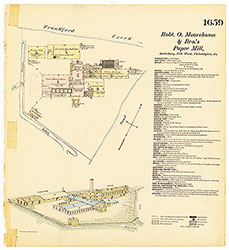 Plate 1659
 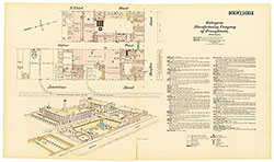 Plates 1660-1661
 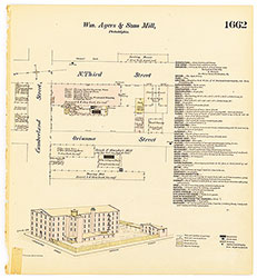 Plate 1662
 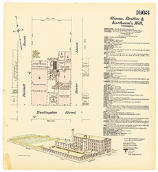 Plate 1663
 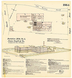 Plate 1664
 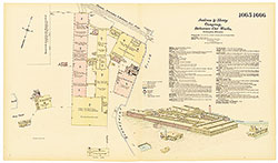 Plates 1665-1666
 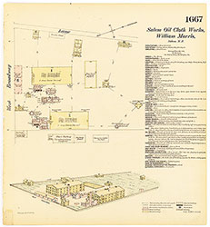 Plate 1667
 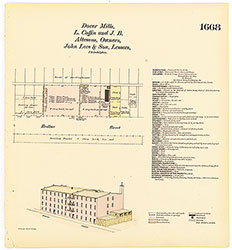 Plate 1668
 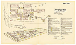 Plates 1669-1670
 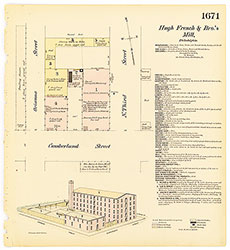 Plate 1671
 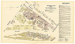 Plates 1672-1673
 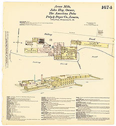 Plate 1674
 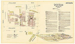 Plates 1675-1676
 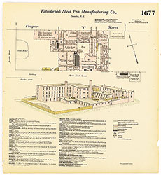 Plate 1677
 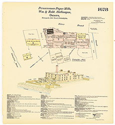 Plate 1678
 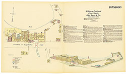 Plates 1679-1680
  Plate 1681
  Plate 1682
  Plate 1683
  Plate 1684
 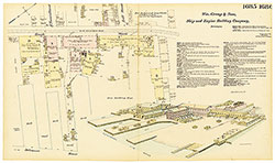 Plates 1685-1686
 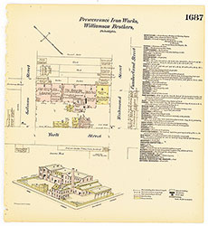 Plate 1687
 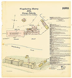 Plate 1688
 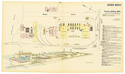 Plates 1689-1690
 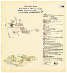 Plate 1691
 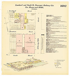 Plate 1692
 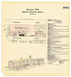 Plate 1693
 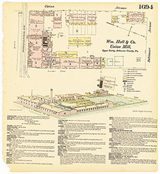 Plate 1694
  Plates 1695-1696
 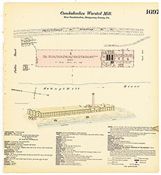 Plate 1697
  Plates 1698-1699
 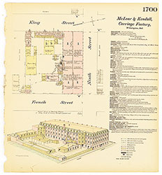 Plate 1700
 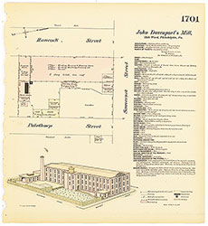 Plate 1701
 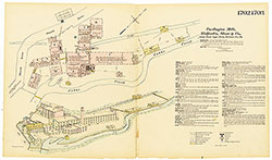 Plates 1702-1703
 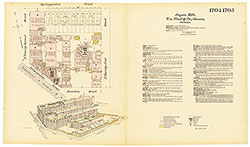 Plates 1704-1705
 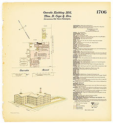 Plate 1706
 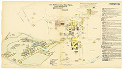 Plates 1707-1708
 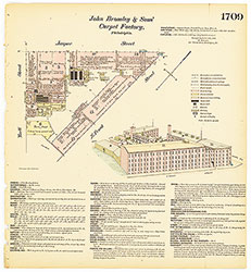 Plate 1709
 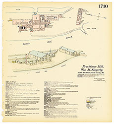 Plate 1710
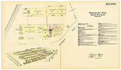 Plates 1711-1712
 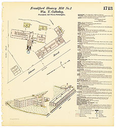 Plate 1713
 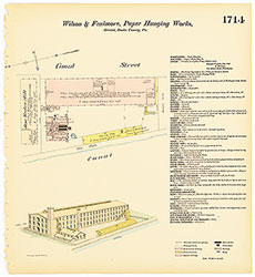 Plate 1714
 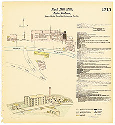 Plate 1715
 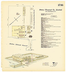 Plate 1716
 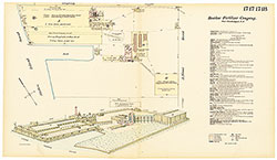 Plates 1717-1718
 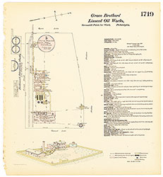 Plate 1719
 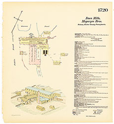 Plate 1720
 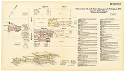 Plates 1721-1722
 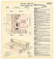 Plate 1723
 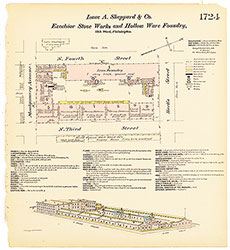 Plate 1724
 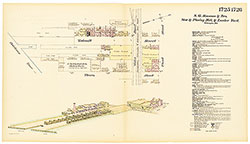 Plates 1725-1726
 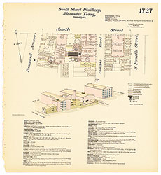 Plate 1727
 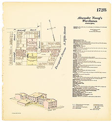 Plate 1728
 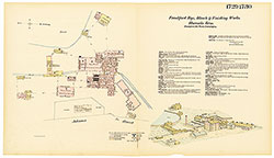 Plates 1729-1730
 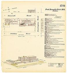 Plate 1731
 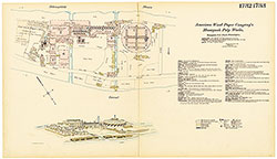 Plates 1732-1733
 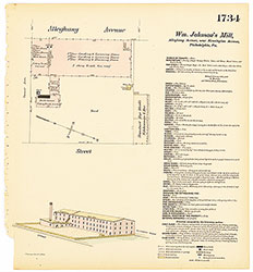 Plate 1734
 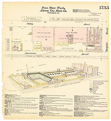 Plate 1735
 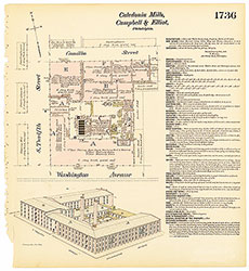 Plate 1736
 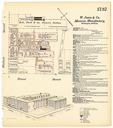 Plate 1737
 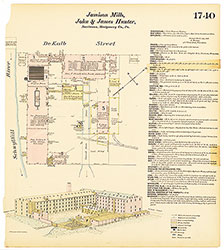 Plate 1740
 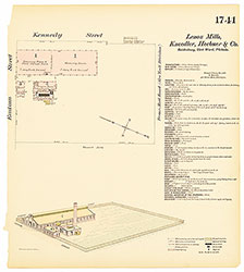 Plate 1741
 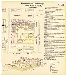 Plate 1742
 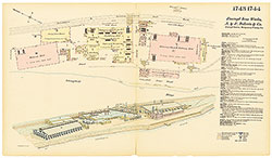 Plates 1743-1744
  Plate 1745
  Plate 1746
  Plate 1747
  Plates 1748-1749
 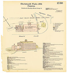 Plate 1750
 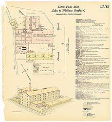 Plate 1751
 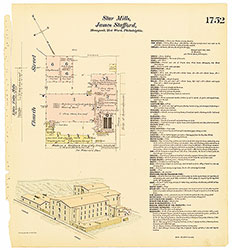 Plate 1752
 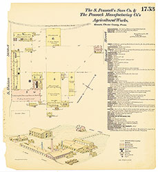 Plate 1753
 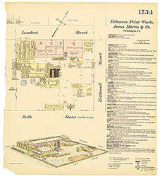 Plate 1754
 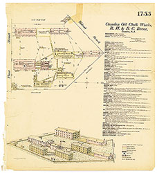 Plate 1755
 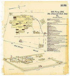 Plate 1656
 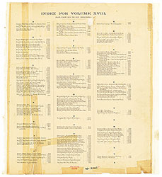 Index (Vol. 18)