Atlas of Germantown, 22nd Ward, 1871, Plate 6
Maps 1871: G. M. Hopkins, Atlas of Germantown, 22nd Ward
Item Info
Item No: MGMHAM00009
Title: Atlas of Germantown, 22nd Ward, 1871, Plate 6
Additional Title: Atlas of Germantown, 22nd Ward, 1871
Publication Year:
1871
Page: 9
Work Type: Property Atlases/Maps
Source: Map Collection
Notes:
Clement, E. School: south side Walnut Lane west of Green Street
Germantown Hose Co.: northwest corner Germantown Avenue & Tulpohocken Street
Germantown Hosiety Mill (Button & Conyers): northeast corner Germantown Ave. & Walnut Lane
Germantown Waterworks: south side West Washington Lane west of Pulaski Avenue
Grassie, William Nursery: south side Johnson Street east of Green Street
Northside Orientation of Image: Top Right
Alternate Page Number: Plate 6
City/Town/Township: Geographic Coverage City/Town/Township:Philadelphia
Geographic Coverage Neighborhood:Germantown
Creator Name: G.M. Hopkins, C.E. - Publisher
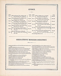 Table of Contents & Business Directory
 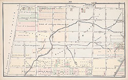 Plate 1
 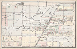 Plate 2
 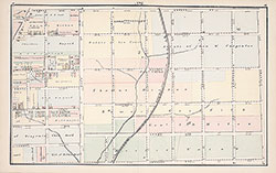 Plate 3
 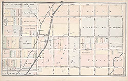 Plate 4
 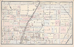 Plate 5
 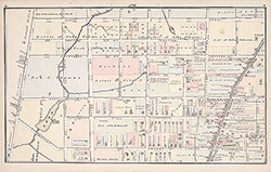 Plate 6
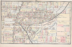 Plate 7
 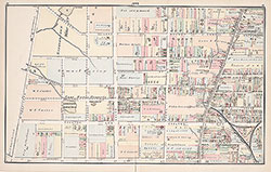 Plate 8
 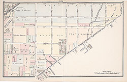 Plate 9
 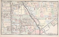 Plate 10
 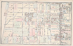 Plate 11
 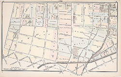 Plate 12
 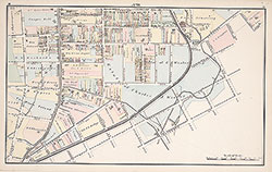 Plate 13
 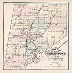 Map Index
 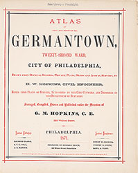 Title Page