Plan of Ground Appropriated For the Preservation of the Purity of Water and an Addition to Fairmount Park, 1864, Map
Maps
Item Info
Item No: MAP00000083
Title: Plan of Ground Appropriated For the Preservation of the Purity of Water and an Addition to Fairmount Park, 1864, Map
Publication Year:
1864
Page: 1
Work Type: Park Maps
Source: Map Collection
Notes:
At the bottom of the map it states: "Reduced from the original By Samuel L. Smedley, November 1868"
Notes:
Plan later appears on: Maps of Farms and Lots Embraced Within the Limits of Fairmount Park, 1868. Area covered is west from Pennsylvania Avenue to Coates Street, 26th Street to Landing Avenue
Northside Orientation of Image: Top
Alternate Page Number: Map
City/Town/Township: Geographic Coverage State/Province:Pennsylvania
Geographic Coverage City/Town/Township:Philadelphia
Geographic Coverage Note:Fairmount Park
Creator Name: Roberts, Edward D. - Surveyor
Subjects
 Map
Map  Map
Map  Map
Map  Map
Map  Map
Map  Map
Map  Map
Map  Map
Map 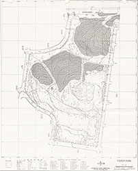 Map
Map  Map
Map  Map
Map  Map
Map 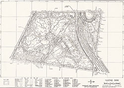 Map
Map  Map 1
Map 1  Map 2
Map 2  Map 3
Map 3 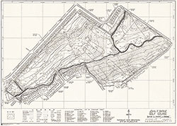 Map
Map 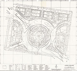 Map
Map  Map
Map  Map
Map  Map 1
Map 1  Map 2
Map 2  Map
Map  Map
Map 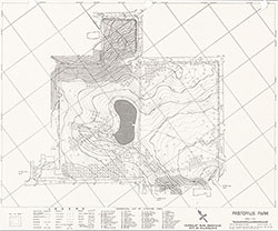 Map
Map  Map 1
Map 1  Map 2
Map 2  Map 3
Map 3 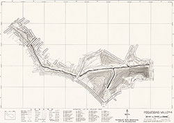 Map 4
Map 4  Map 5
Map 5  Map 6
Map 6  Map 7
Map 7  Map 8
Map 8  Map 9
Map 9  Map 10
  Map
Map  Map 1
Map 1  Map 2
Map 2  Map 3
Map 3  Map 4
Map 4  Map 5
Map 5  Map 6
Map 6  Map
Map  Map
Map 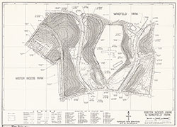 Map
Map  Map
Map  Map F-1
  Map F-2
 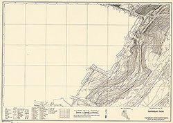 Map F-3
  Map F-4
  Map F-5
  Map F-6
 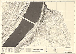 Map F-7
  Map F-8
  Map F-9
  Map F-10
 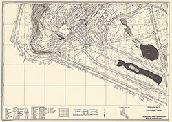 Map F-11
  Map F-13
  Map F-14
  Map F-15
 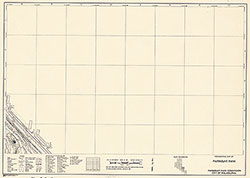 Map F-16
  Map F-17
  Map F-18
  Map F-19
 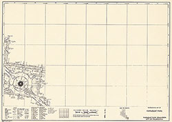 Map F-20
  Map F-21
  Map C-1
  Map C-2
 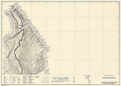 Map C-3
  Map C-4
  Map C-5
  Map C-6
 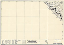 Map C-7
  Map C-8
  Map C-9
  Map C-10
  Map C-11
  Map C-12
  Map C-13
  Map C-14
  Map C-15
  Map C-16
  Map C-17
  Map P-1
 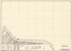 Map P-2
  Map P-3
  Map P-4
  Map P-5
 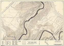 Map P-6
  Map P-7
  Map P-8
  Map P-9
 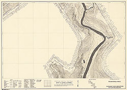 Map P-10
  Map P-11
  Map P-12
  Map P-13
 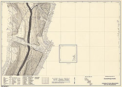 Map P-14
  Map P-15
  Map P-16
  Map P-17
 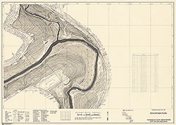 Map P-18
  Map P-10
  Map P-20
  Map P-21
 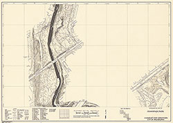 Map P-22
  Map P-23
  Map P-24
  Map P-25
  Map P-26
  Map T-1
  Map T-2
  Map T-3
  Map T-4
 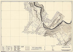 Map T-5
  Map T-6
  Map T-7
  Map T-8
 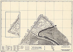 Map W-1
  Map W-2
  Map W-3
  Map W-4
  Map W-5
  Map W-6
  Map W-7
  Map W-8
 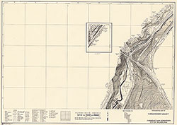 Map W-9
  Map W-10
  Map W-11
  Map W-12
 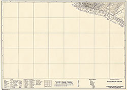 Map W-13
  Map W-14
  Map W-15
  Map W-16
 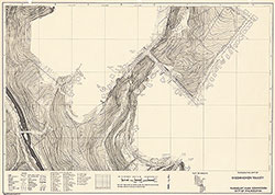 Map W-17
  Map W-18
  Map W-19
  Map W-20
 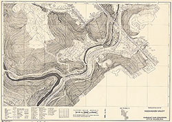 Map W-21
  Map W-22
  Map W-23
  Map W-24
 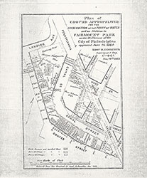 Map
Map
 map
map  Map
Map