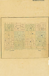
Maps of the City of Philadelphia, 1858-1860, Plate 6
Maps 1860: Hexamer & Locher, Maps of the City of Philadelphia: Volume 1
Item Info
Item No: MHXLBB00009
Title: Maps of the City of Philadelphia, 1858-1860, Plate 6
Additional Title: Maps of the City of Philadelphia, 1858-1860: Volume 1
Publication Year:
1860
Page: 9
Work Type: Property Atlases/Maps
Source: Map Collection
Notes:
Jayne's Hotel: 612-620 Chestnut Street
Sansom Street Hall: 610 Sansom Street
Swain Building: 622-632 Chestnut Street
Washington Square: Locust to Walnut Streets between 6th and 7th Streets
Northside Orientation of Image: Right
Alternate Page Number: Plate 6
City/Town/Township: Geographic Coverage State/Province:Pennsylvania
Geographic Coverage City/Town/Township:Philadelphia
Creator Name: Hexamer & Locher
 Index (v. 1)
 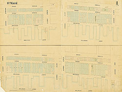 Plate 1
 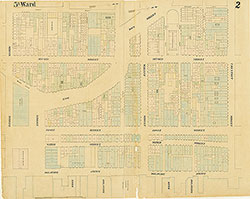 Plate 2
 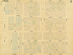 Plate 3
 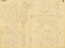 Plate 4
 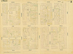 Plate 5
 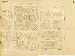 Plate 6
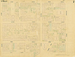 Plate 7
 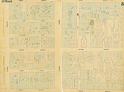 Plate 8
 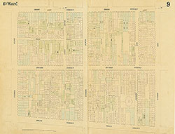 Plate 9
 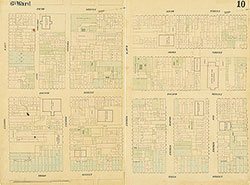 Plate 10
 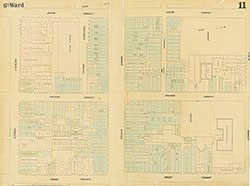 Plate 11
 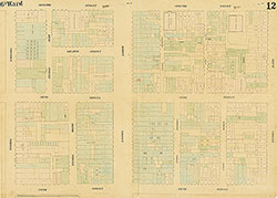 Plate 12
 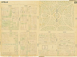 Plate 13
 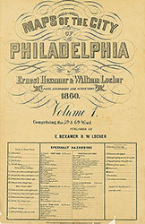 Title
Title 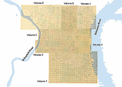 Comprehensive Index