Map of the Whole Incorporated City of Philadelphia, 1867, Plate 1
Maps 1867: Barnes, Map of the Whole Incorporated City of Philadelphia
Item Info
Page: 2
Work Type: General Maps
Source: Map Collection
Notes:
Bustleton Hotel: Welsh Road & Old Newtown Road (Bustleton)
Byberry Hall: Meeting House Lane & townsend's Mill Road (Byberry Square)
Cheltenham Nursery: Montogomery County, Cheltenham Township)
County Line Inn: Old York Road & County Line Road (Montgomery County-Chelten Hills)
Eden Hall Seminary: off Bristol Turnpike east of Torresdale
Fox Chase Hotel: Livezey Road (Fox Chase)
Lower Dublin Academy: Byberry Road & Bristol Turnpike near Collegeville
North American Hotel: Fox Chase Turnpike & Township Line Road south of Fox Chase
Oxford & Dublin Poorhouse: Pennypack Creek above Holmesburg
Pennypack Print Works: Pennypack Creek at Harrisburg
Prince's Mill: Pennypack Creek near Vereeville
Red Lion Hotel: Thomas Lane & Bristol Turnpike at Poquessing Creek (Bucks County)
St. Vincent Orphan Asylum: River Road at Delaware River (Tacony)
Smithfield Hotel: Bustleton-Somerton Turnpike & Horsham Road (Somerton)
Somerton Hotel: Bustleton-Smithfield Turnpike & Horsham Road (Somerton)
United States Naval Shipyard: Delaware River at Washington Avenue
Walnut Mill: Pennypack Creek near Vereeville
Wheat Sheaf Hotel: River Road & Bustleton-Somerton Turnpike near Sandy Hill
Northside Orientation of Image: Top
Alternate Page Number: Plate 1
City/Town/Township: Geographic Coverage State/Province:Pennsylvania
Geographic Coverage City/Town/Township:Philadelphia
Creator Name: Barnes, Rufus L. - Publisher
Hexamer, Ernest - Surveyor
- Philadelphia, Pennsylvania
- Taverns
- Hotels
- Naval yards & naval stations
- Schools
- Orphanages
- Assembly halls
- Convents
- Textile mills
- Inns
- Almshouses (buildings)
- Oxford & Lower Dublin Poor House
- St. Vincent Orphanage (asylum)
- Bustleton Hotel
- United States Naval Shipyard
- Nurseries (horticulture)
- Poorhouse see Almshouses (buildings)
- Walnut Mill
- Fox Chase Hotel
- County Line Inn
- Wheat Sheaf Tavern
- Red Lion Hotel
- Smithfield Hotel
- Somerton Hotel
- Pennypack Print Works
- Lower Dublin Academy
- Eden Hall
- Seminaries (buildings)
- Boarding schools (buildings)
- Byberry Hall
- Prince's Mill
- North American Hotel
- Cheltenham Nursery
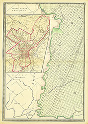 Plate 3
 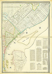 Plate 4
 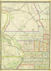 Plate 5
 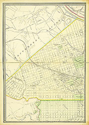 Plate 6
  Cover
Cover 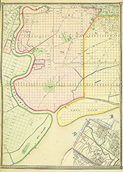 Plate 2
 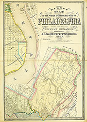 Plate 1