Map of the Whole Incorporated City of Philadelphia, 1867, Plate 3
Maps 1867: Barnes, Map of the Whole Incorporated City of Philadelphia
Item Info
Item No: MRLBAA00004
Title: Map of the Whole Incorporated City of Philadelphia, 1867, Plate 3
Additional Title: Map of the Whole Incorporated City of Philadelphia, 1867
Publication Year:
1867
Page: 4
Work Type: General Maps
Source: Map Collection
Notes:
Woodward's Snuff Factory: Cobbs Creek above Snyder Avenue
Northside Orientation of Image: Top
Alternate Page Number: Plate 3
City/Town/Township: Geographic Coverage State/Province:Pennsylvania
Geographic Coverage City/Town/Township:Philadelphia
Creator Name: Barnes, Rufus L. - Publisher
Hexamer, Ernest - Surveyor
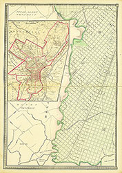 Plate 3
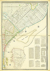 Plate 4
 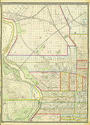 Plate 5
 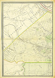 Plate 6
  Cover
Cover 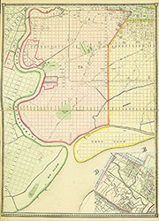 Plate 2
 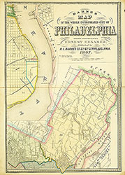 Plate 1