Map of the Whole Incorporated City of Philadelphia, 1867, Plate 6
Maps 1867: Barnes, Map of the Whole Incorporated City of Philadelphia
Item Info
Page: 7
Work Type: General Maps
Source: Map Collection
Notes:
Avenue Drove Yard: Florida Street & Merion Avenue
Blunden's Mill: Mill Creek above Haverford Road
Bull's Head Drove Yard: 65th & Oregon Streets
Burd Orphan Asylum: Cobbs Creek at Westchester Road (Delaware County)
Cardington Mill: Cobbs Creek opposite Catharine Street (Delaware County)
Good Intent Mill: Mill Creek at 47th & Market Streets
Healey's Cherry Hotel: 46th Street & Christian Avenue
Hestonville, Fairmount & Mantua Railroad Station: 52nd Street & Lancaster Avenue
Hillside Mill: Cobbs Creek opposite Catharine Street (Delaware County)
Hunter's Calico Print Works: north side Paschall Avenue above 55th Street
Hunter's Mill: 55th Street & Paschall Avenue
Jefferson Manufacturers: 51st Street and Girard Avenue
Park Hotel: 52nd Street & Lancaster Avenue
Pennsylvania Hospital For the Insane: 49th Street & Haverford Road
St. John's Orphan Asylum: Wyalusing to Westminster between Kingsessing & 50th Streets
Simpson's Wool & Cotton Factory: west side Schuylkill River (Montgomery County)
Yewdell's Factory: northeast corner 55th Street & Girard Avenue
Northside Orientation of Image: Top
Alternate Page Number: Plate 6
City/Town/Township: Geographic Coverage State/Province:Pennsylvania
Geographic Coverage City/Town/Township:Philadelphia
Creator Name: Barnes, Rufus L. - Publisher
Hexamer, Ernest - Surveyor
- Calico
- Philadelphia, Pennsylvania
- Railroad stations
- Street railroads
- Hotels
- Orphanages
- Street railroad stations
- Textile mills
- Stockyards
- St. John's Orphan Asylum
- Horse railroads
- Mental institutions
- Good Intent Mills (Philadelphia, Pa.)
- Park Hotel
- Cotton mills
- Avenue Drove Yard
- Bulls Head Drove Yard
- Hestonville, Fairmount and Mantua Railroad
- Hunter's Calico Print Works
- Pennsylvania Hospital for the Insane
- Yewdell's Factory
- Simpson's Wool & Cotton Factory
- Hillside Mill
- Cardington Mill
- Burd Orphan Asylum
- Blunden's Mill
- Jefferson Manufacturers
- Healey's Cherry Hotel
- Hunter's Mill
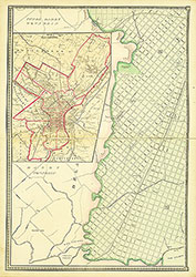 Plate 3
 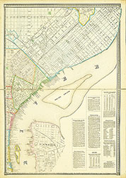 Plate 4
 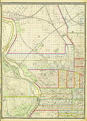 Plate 5
 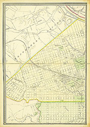 Plate 6
 Cover
Cover 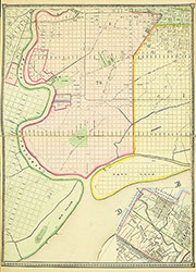 Plate 2
 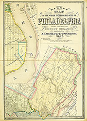 Plate 1