City Atlas of Philadelphia, 24th and 27th Wards, 1872, Plate A
Maps 1872: G. M. Hopkins, City Atlas of Philadelphia, 24th and 27th Wards, Volume 7
Item Info
Item No: MGMHAL00004
Title: City Atlas of Philadelphia, 24th and 27th Wards, 1872, Plate A
Additional Title: City Atlas of Philadelphia, 24th and 27th Wards, 1872: Volume 7
Publication Year:
1872
Page: 4
Work Type: Property Atlases/Maps
Source: Map Collection
Notes:
Allison & Sons Junction Car Works: south side Walnut Street above 31st Street
Detweiler Flouring Mills: south side Market Street above 30th Street
Deveney, White & Hitzeroth Novelty Iron Works: south side Market Street below 32nd Street
Lehigh Coal & Navigation Co.: southwest corner 30th & Chestnut Streets
Mercantile Loan Association: northwest corner Market Street & Lancaster Avenue
Parrish Rolling Mills: northwest corner 30th & Chestnut Street
Pennsylvania Railroad Station & Yard: north side Market Street at 30th Sttreet
Wharton Switch Co.: north side Walnut Street above 31st Street
Notes:
Volume 7 of 7
Northside Orientation of Image: Right
Alternate Page Number: Plate A
City/Town/Township: Geographic Coverage City/Town/Township:Philadelphia
Creator Name: G.M. Hopkins & Co. - Publisher
Subjects
- Philadelphia, Pennsylvania
- Railroad stations
- Wharton Railroad Switch Co.
- Iron industry
- Railroads
- Railroad cars
- Railroad switches
- Banks
- Pennsylvania Railroad Station
- Foundries
- Flour mills
- Steel mills
- Novelty Iron Works (Deveney, White & Hitzeroth)
- Detwiler, Isaac & Abraham Flour Mill
- Parrish, William D. Estate Rolling Mill
- Rolling mills
- Lehigh Coal & Navigation Co.
- Murphy & Allison Junction Car Works
- Mercantile Loan Association
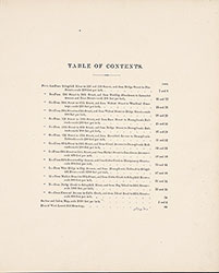 Table of Contents
 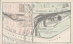 Plate A
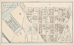 Plate B
 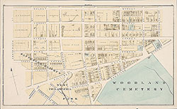 Plate C
 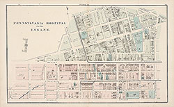 Plate D
  Plate E
  Plate F
  Plate G
 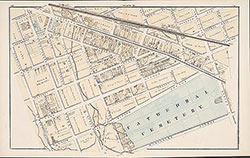 Plate H
 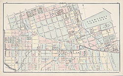 Plate J
 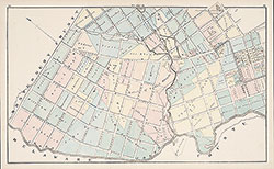 Plate K
 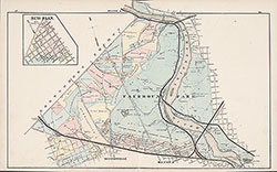 Plate L
 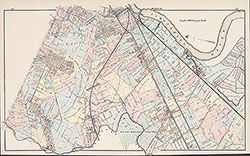 Plate M
  Plate N
  Plate O
  West Laurel Hill Cemetery
  Index Map
 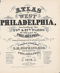 Title Page