Map Collection
Our map collection enables you to see how Philadelphia's neighborhoods and streets have grown and changed. Use our interactive mapping tool to overlay atlases dating back as far as 1843 over today's street layout.
Showing 4141 to 4160 of 5,151
Maps of the City of Philadelphia, 1858-1860, Plate 86
1859: Hexamer & Locher, Maps of the City of Philadelphia: Volume 6
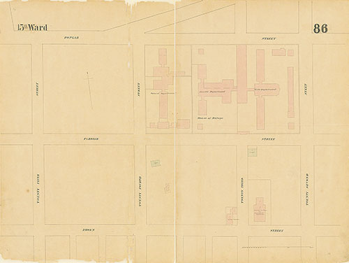
Maps of the City of Philadelphia, 1858-1860, Plate 85
1859: Hexamer & Locher, Maps of the City of Philadelphia: Volume 6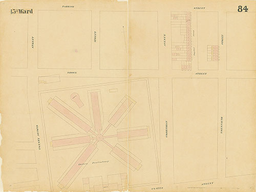
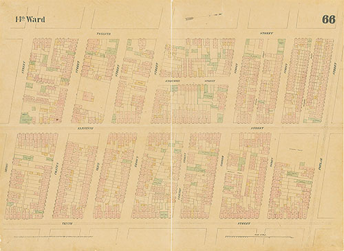
Maps of the City of Philadelphia, 1858-1860, Plate 84
1859: Hexamer & Locher, Maps of the City of Philadelphia: Volume 6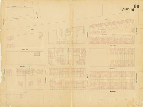
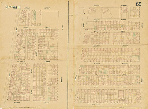
Maps of the City of Philadelphia, 1858-1860, Plate 83
1859: Hexamer & Locher, Maps of the City of Philadelphia: Volume 6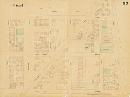
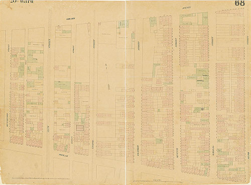
Maps of the City of Philadelphia, 1858-1860, Plate 82
1859: Hexamer & Locher, Maps of the City of Philadelphia: Volume 6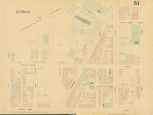
Maps of the City of Philadelphia, 1858-1860, Plate 81
1859: Hexamer & Locher, Maps of the City of Philadelphia: Volume 6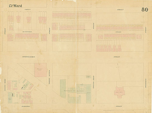
Maps of the City of Philadelphia, 1858-1860, Plate 80
1859: Hexamer & Locher, Maps of the City of Philadelphia: Volume 6
Maps of the City of Philadelphia, 1858-1860, Plate 79
1859: Hexamer & Locher, Maps of the City of Philadelphia: Volume 6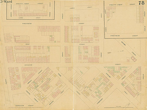
Maps of the City of Philadelphia, 1858-1860, Plate 78
1859: Hexamer & Locher, Maps of the City of Philadelphia: Volume 6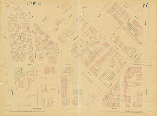
Maps of the City of Philadelphia, 1858-1860, Plate 77
1859: Hexamer & Locher, Maps of the City of Philadelphia: Volume 6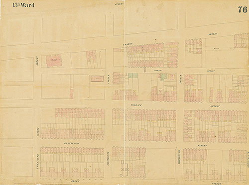
Maps of the City of Philadelphia, 1858-1860, Plate 76
1859: Hexamer & Locher, Maps of the City of Philadelphia: Volume 6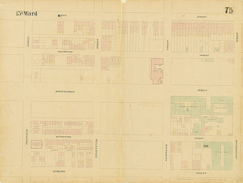
Maps of the City of Philadelphia, 1858-1860, Plate 75
1859: Hexamer & Locher, Maps of the City of Philadelphia: Volume 6
Maps of the City of Philadelphia, 1858-1860, Plate 74
1859: Hexamer & Locher, Maps of the City of Philadelphia: Volume 6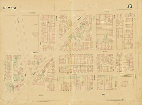
Maps of the City of Philadelphia, 1858-1860, Plate 73
1859: Hexamer & Locher, Maps of the City of Philadelphia: Volume 6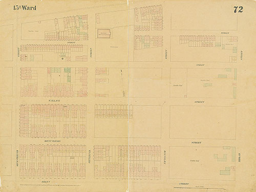
Maps of the City of Philadelphia, 1858-1860, Plate 72
1859: Hexamer & Locher, Maps of the City of Philadelphia: Volume 6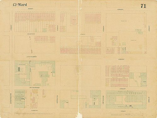
Maps of the City of Philadelphia, 1858-1860, Plate 71
1859: Hexamer & Locher, Maps of the City of Philadelphia: Volume 6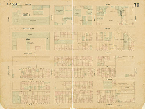
Maps of the City of Philadelphia, 1858-1860, Plate 70
1859: Hexamer & Locher, Maps of the City of Philadelphia: Volume 6