Map Collection
Our map collection enables you to see how Philadelphia's neighborhoods and streets have grown and changed. Use our interactive mapping tool to overlay atlases dating back as far as 1843 over today's street layout.
Showing 4161 to 4180 of 5,151
Maps of the City of Philadelphia, 1858-1860, Plate 65
1859: Hexamer & Locher, Maps of the City of Philadelphia: Volume 5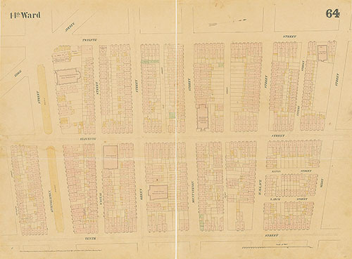
Maps of the City of Philadelphia, 1858-1860, Plate 64
1859: Hexamer & Locher, Maps of the City of Philadelphia: Volume 5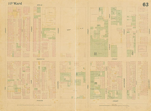
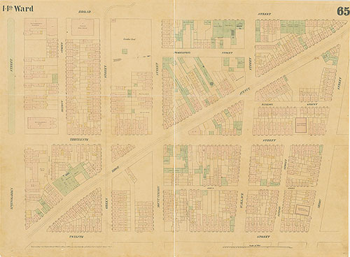
Maps of the City of Philadelphia, 1858-1860, Plate 63
1859: Hexamer & Locher, Maps of the City of Philadelphia: Volume 5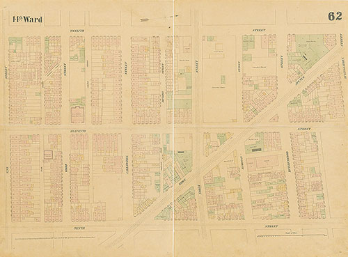
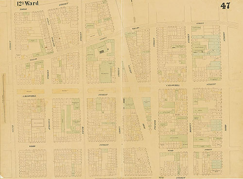
Maps of the City of Philadelphia, 1858-1860, Plate 62
1859: Hexamer & Locher, Maps of the City of Philadelphia: Volume 5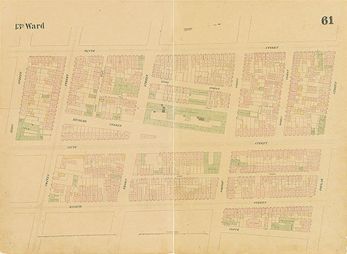
Maps of the City of Philadelphia, 1858-1860, Plate 61
1859: Hexamer & Locher, Maps of the City of Philadelphia: Volume 5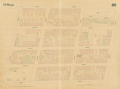
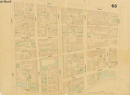
Maps of the City of Philadelphia, 1858-1860, Plate 60
1859: Hexamer & Locher, Maps of the City of Philadelphia: Volume 5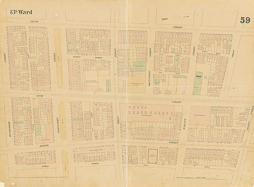
Maps of the City of Philadelphia, 1858-1860, Plate 59
1859: Hexamer & Locher, Maps of the City of Philadelphia: Volume 5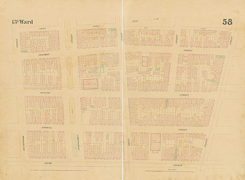
Maps of the City of Philadelphia, 1858-1860, Plate 58
1859: Hexamer & Locher, Maps of the City of Philadelphia: Volume 5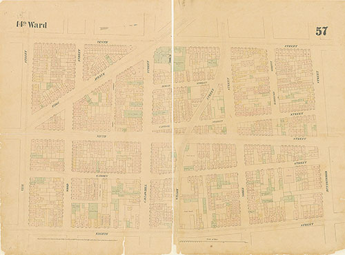
Maps of the City of Philadelphia, 1858-1860, Plate 57
1859: Hexamer & Locher, Maps of the City of Philadelphia: Volume 5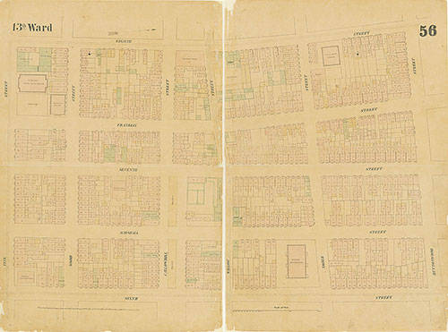
Maps of the City of Philadelphia, 1858-1860, Plate 56
1859: Hexamer & Locher, Maps of the City of Philadelphia: Volume 5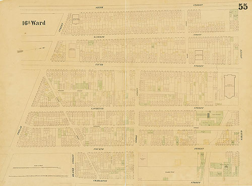
Maps of the City of Philadelphia, 1858-1860, Plate 55
1859: Hexamer & Locher, Maps of the City of Philadelphia: Volume 4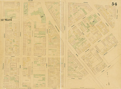
Maps of the City of Philadelphia, 1858-1860, Plate 54
1859: Hexamer & Locher, Maps of the City of Philadelphia: Volume 4
Maps of the City of Philadelphia, 1858-1860, Plate 53
1859: Hexamer & Locher, Maps of the City of Philadelphia: Volume 4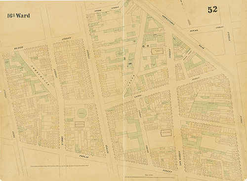
Maps of the City of Philadelphia, 1858-1860, Plate 52
1859: Hexamer & Locher, Maps of the City of Philadelphia: Volume 4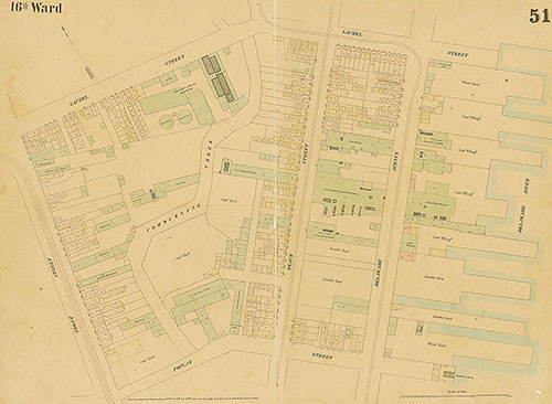
Maps of the City of Philadelphia, 1858-1860, Plate 51
1859: Hexamer & Locher, Maps of the City of Philadelphia: Volume 4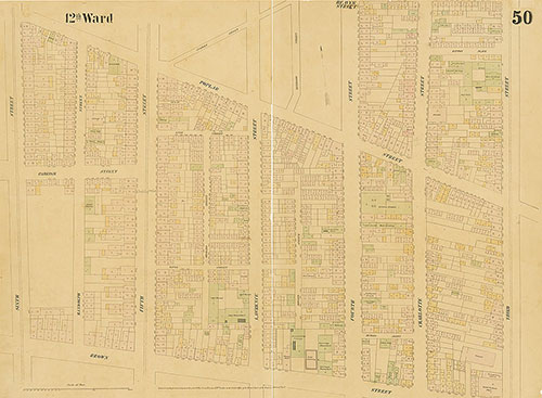
Maps of the City of Philadelphia, 1858-1860, Plate 50
1859: Hexamer & Locher, Maps of the City of Philadelphia: Volume 4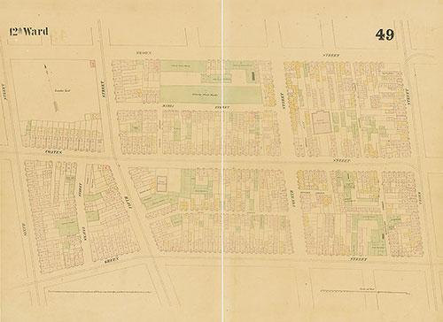
Maps of the City of Philadelphia, 1858-1860, Plate 49
1859: Hexamer & Locher, Maps of the City of Philadelphia: Volume 4