Map Collection
Our map collection enables you to see how Philadelphia's neighborhoods and streets have grown and changed. Use our interactive mapping tool to overlay atlases dating back as far as 1843 over today's street layout.
Showing 4101 to 4120 of 5,151
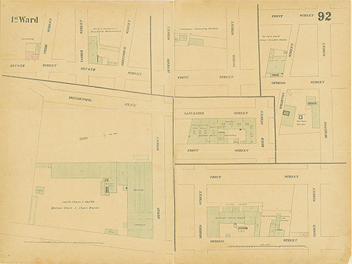
Maps of the City of Philadelphia, 1858-1860, Plate 92
1860: Hexamer & Locher, Maps of the City of Philadelphia: Volume 7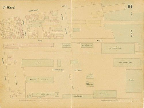
Maps of the City of Philadelphia, 1858-1860, Plate 91
1860: Hexamer & Locher, Maps of the City of Philadelphia: Volume 7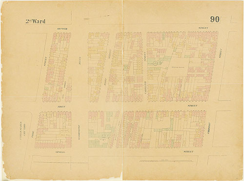
Maps of the City of Philadelphia, 1858-1860, Plate 90
1860: Hexamer & Locher, Maps of the City of Philadelphia: Volume 7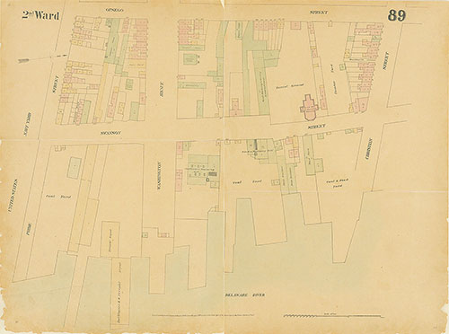
Maps of the City of Philadelphia, 1858-1860, Plate 89
1860: Hexamer & Locher, Maps of the City of Philadelphia: Volume 7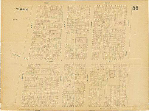
Maps of the City of Philadelphia, 1858-1860, Plate 88
1860: Hexamer & Locher, Maps of the City of Philadelphia: Volume 7
Maps of the City of Philadelphia, 1858-1860, Plate 87
1860: Hexamer & Locher, Maps of the City of Philadelphia: Volume 7
Maps of the City of Philadelphia, 1858-1860, Plate 86
1860: Hexamer & Locher, Maps of the City of Philadelphia: Volume 7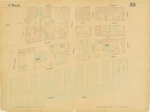
Maps of the City of Philadelphia, 1858-1860, Plate 85
1860: Hexamer & Locher, Maps of the City of Philadelphia: Volume 7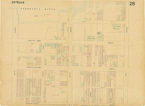
Maps of the City of Philadelphia, 1858-1860, Plate 29
1860: Hexamer & Locher, Maps of the City of Philadelphia: Volume 2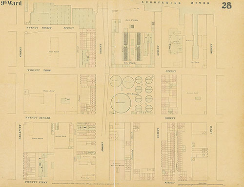
Maps of the City of Philadelphia, 1858-1860, Plate 28
1860: Hexamer & Locher, Maps of the City of Philadelphia: Volume 2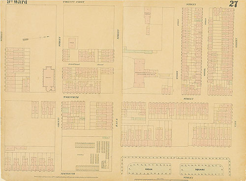
Maps of the City of Philadelphia, 1858-1860, Plate 27
1860: Hexamer & Locher, Maps of the City of Philadelphia: Volume 2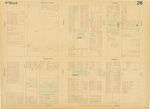
Maps of the City of Philadelphia, 1858-1860, Plate 26
1860: Hexamer & Locher, Maps of the City of Philadelphia: Volume 2
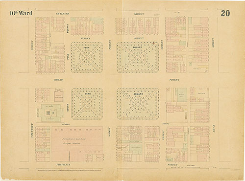
Maps of the City of Philadelphia, 1858-1860, Plate 25
1860: Hexamer & Locher, Maps of the City of Philadelphia: Volume 2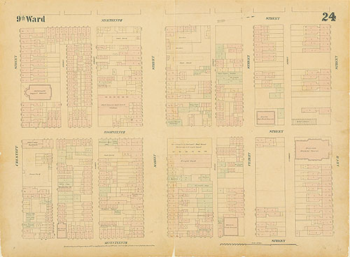
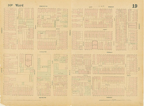
Maps of the City of Philadelphia, 1858-1860, Plate 24
1860: Hexamer & Locher, Maps of the City of Philadelphia: Volume 2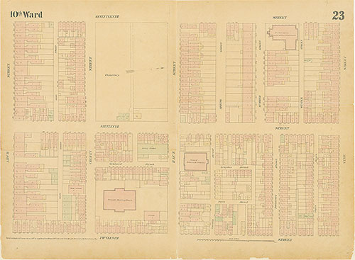
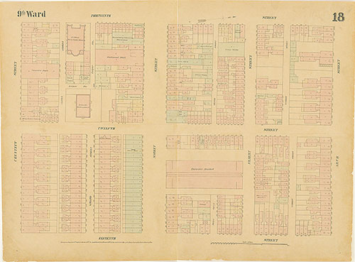
Maps of the City of Philadelphia, 1858-1860, Plate 23
1860: Hexamer & Locher, Maps of the City of Philadelphia: Volume 2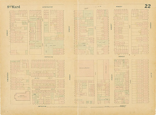
Maps of the City of Philadelphia, 1858-1860, Plate 22
1860: Hexamer & Locher, Maps of the City of Philadelphia: Volume 2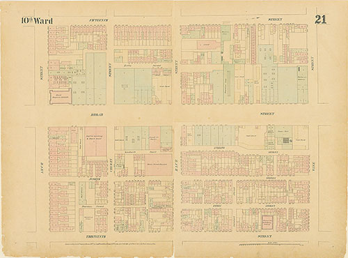
Maps of the City of Philadelphia, 1858-1860, Plate 21
1860: Hexamer & Locher, Maps of the City of Philadelphia: Volume 2