Insurance Maps of the City of Philadelphia, 1897, Plate 7
Maps 1897: Hexamer, Insurance Maps of the City of Philadelphia, Volume 1
Item Info
Page: 16
Work Type: Property Atlases/Maps
Source: Map Collection
Notes:
American Fire Insurance Co.: 308-310 Walnut Street
Commercial Union Association Co.: 420 Walnut Street
Delaware Mutual Insurance Co.: 234 Walnut Street
Franklin Building: 408-414 Walnut Street
Griggs Building: 226 Walnut Street
Insurance Company of North America: 228-232 Walnut Street
Lehigh Valley Railroad Co.: 226-230 South 3rd Street
Manhattan Life Insurance Co.: 332-334 Walnut Street
Miller Confectionery: 25--259 South 3rd Street
New York Biscuit Co.: 247-249 South 3rd Street
Patterson Building: 330 Walnut Street
Penn Building: 426-430 Walnut Street
Philadelphia Commercial Museums: 233 South 4th Street
Quaker City Steam Laundrey: 414 Locust Street
Royal Insurance Co.: 306 Walnut Street
St. Mary Academy: 260 South 4th Street
Teutonia Fire Insurance Co.: 424 Walnut Street
Union Insurance Co.: 300-302 Walnut Street
Westmoreland Building: 222-224 South 3rd Street
Northside Orientation of Image: Right
Alternate Page Number: Plate 7
City/Town/Township: Geographic Coverage State/Province:Pennsylvania
Geographic Coverage City/Town/Township:Philadelphia
Creation Year (Single Year or Range Begin): 1897
Creator Name: Ernest Hexamer & Son - Publisher
- Philadelphia, Pennsylvania
- Bakeries
- Insurance companies
- Schools
- Museums (buildings)
- Laundries (businesses)
- American Fire Insurance Co
- Delaware Mutual Insurance Co.
- St. Mary Academy
- Parochial schools (institutions)
- Quaker City Steam Laundry
- Penn Building
- Franklin Building
- Commercial Union Association Co.
- Teutonia Fire Insurance Co.
- Manhattan Life insurance Co.
- Patterson Building
- Royal Insurance Co.
- Union Insurance Co.
- Westmoreland Building
- Philadelphia Commercial Museums
- Lehigh Valley Railroad Co.
- Miller, George Confectionery
- New York Biscuit Co.
- Insurance Company of North America
- Griggs Building
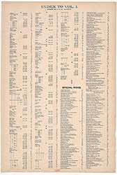 Street Index
 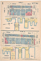 Plate 1
  Plate 1 1/2
  Plate 2
 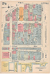 Plate 2 1/2
 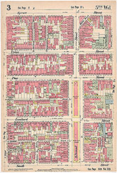 Plate 3
 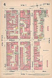 Plate 4
 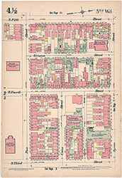 Plate 4 1/2
 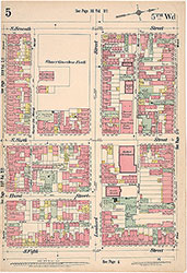 Plate 5
 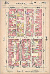 Plate 5 1/2
 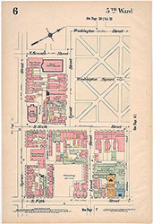 Plate 6
 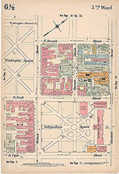 Plate 6 1/2
 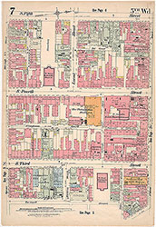 Plate 7
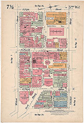 Plate 7 1/2
 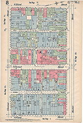 Plate 8
 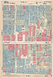 Plate 8 1/2
 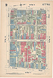 Plate 9
 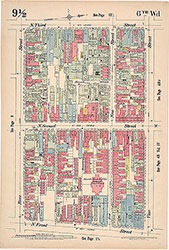 Plate 9 1/2
 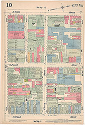 Plate 10
  Plate 10 1/2
 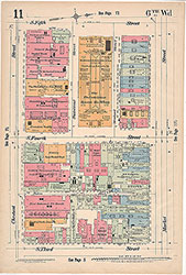 Plate 11
 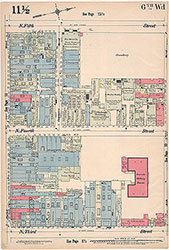 Plate 11 1/2
 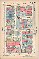 Plate 12
 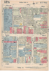 Plate 12 1/2
 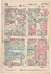 Plate 13
 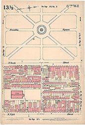 Plate13 1/2
 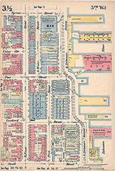 Plate 3 1/2
 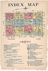 Index Map and Key
  Title Page