Insurance Maps of the City of Philadelphia, 1897, Plate 9
Maps 1897: Hexamer, Insurance Maps of the City of Philadelphia, Volume 1
Item Info
Page: 20
Work Type: Property Atlases/Maps
Source: Map Collection
Notes:
Atlantic Refining Co.: 125 Arch Street
Bilger, Webbing Co.: 113-115 Bread Street
Colburn & Co. Spice Mill: 112-114 North 2nd Street; 125 Bread Street
Darby's Pennsylvania Wire Works: rear 113-115 Bread Street
Borden's Pennsylvania Stoves: 118-120 North 2nd Street
Fallows' Tin Toy Factory: 100-104 Bread Street
Frishmuth's Tobacco Works: 151-153 North 3rd Street
Godley's Keystone Stores: 131-133 Bread Street
Howell's Paint & Color Works: 212-216 Race Street
Mason's Blacking Factory: 138-140 North Front
Oat's Machine Shop, Copper & Brass Foundry: 232-234 Quarry Street
Pfeifer's Pennsylvania Shovel & Coal Hod Works: 222-226 Race Street
Potter's Tinware Factory: 119-123 Bread Street
Union National Bank: 101-105 North 3rd Street
Washington Butcher's Cold Storage & Meat Packing: 146-148 North Front Street
Yocom's City Iron & Brass Foundry: north side Drinker's Alley above Front Street
Northside Orientation of Image: Right
Alternate Page Number: Plate 9
City/Town/Township: Geographic Coverage State/Province:Pennsylvania
Geographic Coverage City/Town/Township:Philadelphia
Creation Year (Single Year or Range Begin): 1897
Creator Name: Ernest Hexamer & Son - Publisher
- Brass industry
- Philadelphia, Pennsylvania
- Shovels
- Spices
- Toys
- Wire
- Stoves
- Petroleum industry
- Meat industry
- Tobacco industry
- Banks
- Warehouses
- F.M. Borden & Bro. Stoves, Heaters and Ranges
- Frishmuth Bro. & Co. Luxury Tobacco Works (Firm)
- Union National Bank
- Coal hods
- Atlantic Refining Co.
- Packing plants
- Machine shops
- Shoe polish
- Cold storage rooms
- Oat, Joseph & Son Machine Shop, Copper & Brass Works
- Copper industry
- Fallows, H. Tin Toys Factory
- Colburn & Co. Spice Mill
- Darby, E. Pennsylvania Wire Works
- Bilger, N. Webbing Factory
- Webbing (material)
- Tinware
- Potter, C.W. Tinware Factory
- Godley's Keystone Stores
- Pfeifer, John Pennsylvania Shovel & Coal Hod Works
- Howell, C.H. Paint & Color Works
- Paint industry
- Yocom's City Iron & Brass Foundry
- Mason's Blacking Factory
- Washington Butcher Co. Cold Storage & Meat Packing
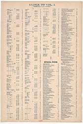 Street Index
 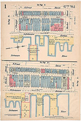 Plate 1
 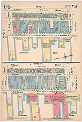 Plate 1 1/2
 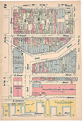 Plate 2
 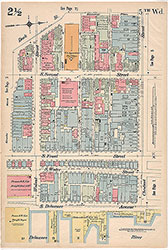 Plate 2 1/2
 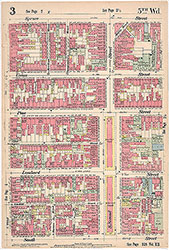 Plate 3
 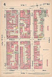 Plate 4
 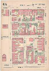 Plate 4 1/2
 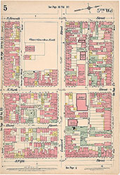 Plate 5
  Plate 5 1/2
  Plate 6
  Plate 6 1/2
 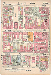 Plate 7
 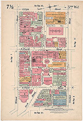 Plate 7 1/2
 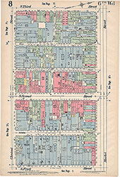 Plate 8
 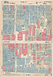 Plate 8 1/2
 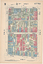 Plate 9
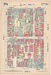 Plate 9 1/2
 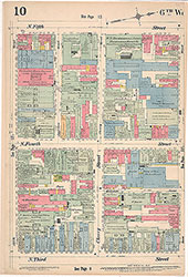 Plate 10
  Plate 10 1/2
 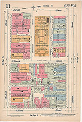 Plate 11
 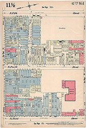 Plate 11 1/2
 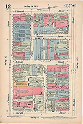 Plate 12
 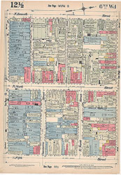 Plate 12 1/2
 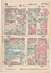 Plate 13
 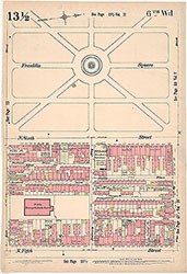 Plate13 1/2
 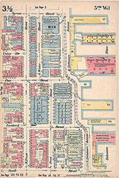 Plate 3 1/2
 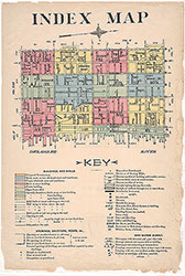 Index Map and Key
  Title Page