Atlas of Philadelphia, 19th Ward, 1874, Plate 2
Maps 1874: G. H. Jones, Atlas of Philadelphia, 19th Ward
Item Info
Item No: MGHJAB00005
Title: Atlas of Philadelphia, 19th Ward, 1874, Plate 2
Additional Title: Atlas of Philadelphia, 19th Ward, 1874
Publication Year:
1874
Page: 5
Work Type: Property Atlases/Maps
Source: Map Collection
Notes:
Volume 2 of 4 (only volumes published)
Index to street railways
National Chain Works: east side East Huntingdon Street below Cedar Street
National Dye Works: eassouthwest corner East Huntingdon & Cedar Streets
Quaker City File Works: east side Rose Street above Commerce Street
Remmey's American Fire Brick & Tile Works: southeast side Commerce & E. Cumberland Sts.
Richmond Whiting Works: northwest corner almond & East Cumberland Streets
Rowley's Hero Glass Works: north & south side Gaul Street at Adams Street
Northside Orientation of Image: Top Right
Alternate Page Number: Plate 2
City/Town/Township: Geographic Coverage Ward:19th Ward
Geographic Coverage City/Town/Township:Philadelphia
Creator Name: G.H. Jones - Publisher
Subjects
- Chains
- Philadelphia, Pennsylvania
- Street railroads
- Files
- Glass industry
- Textile mills
- Horse railroads
- Whiting (chalk)
- Brickworks (factories)
- National Chain Works
- National Dye Works
- Remmey, Richard American Fire Brick & Tile Works
- Quaker City File Works
- Richmond Whiting Works
- Rowley's Hero Glass Works
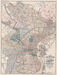 City Map
 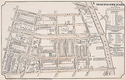 Plate 1
 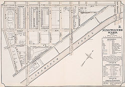 Plate 2
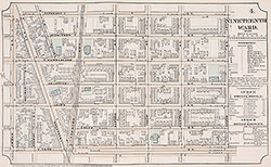 Plate 4
 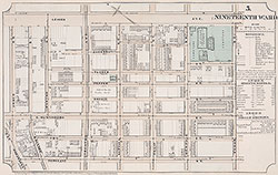 Plate 5
 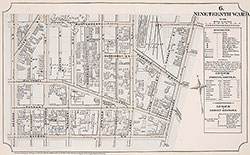 Plate 6
  Plate 7
  Plate 8
 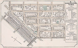 Plate 9
 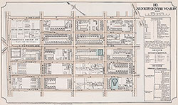 Plate 10
 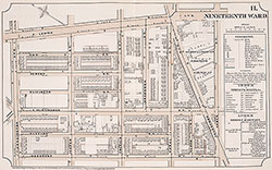 Plate 11
 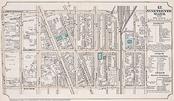 Plate 12
 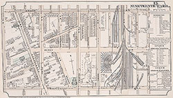 Plate 13
 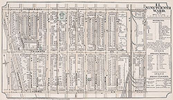 Plate 14
 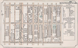 Plate15
 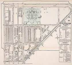 Plate 16
 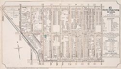 Plate 17
 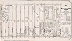 Plate 18
 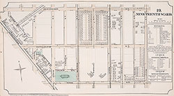 Plate19
 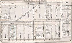 Plate 20
 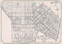 Plate 21
 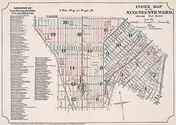 Index Map & Street Listing
 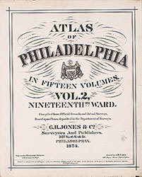 Title Page
 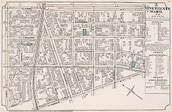 Plate 3