Atlas of Philadelphia, 19th Ward, 1874, Plate 3
Maps 1874: G. H. Jones, Atlas of Philadelphia, 19th Ward
Item Info
Item No: MGHJAB00006
Title: Atlas of Philadelphia, 19th Ward, 1874, Plate 3
Additional Title: Atlas of Philadelphia, 19th Ward, 1874
Publication Year:
1874
Page: 6
Work Type: Property Atlases/Maps
Source: Map Collection
Notes:
Volume 2 of 4 (only volumes published)
Index to street railways
Berges, J. Dye Works: northwest corner Berges & Emma Streets
Doak, James Carpet Mill: northwest corner Blair & East Norris Streets
Pollock, J. Star Carpet Factory: west side Tulip Street below East Dauphin Street
Richardson's Livery Stable: south side Otis Street below Tulip Street
Northside Orientation of Image: Top Left
Alternate Page Number: Plate 3
City/Town/Township: Geographic Coverage Ward:19th Ward
Geographic Coverage City/Town/Township:Philadelphia
Creator Name: G. H. Jones - Publisher
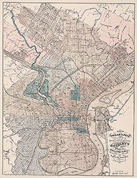 City Map
 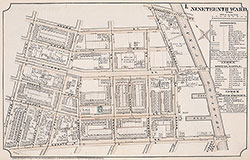 Plate 1
 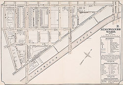 Plate 2
 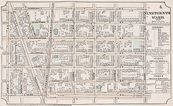 Plate 4
 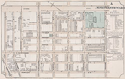 Plate 5
 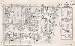 Plate 6
 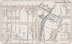 Plate 7
 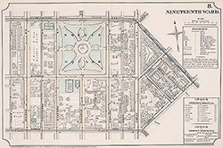 Plate 8
 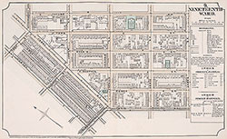 Plate 9
 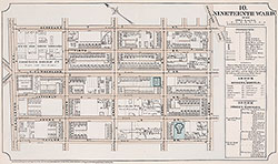 Plate 10
 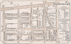 Plate 11
 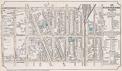 Plate 12
 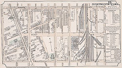 Plate 13
  Plate 14
  Plate15
  Plate 16
 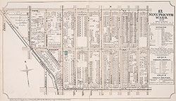 Plate 17
 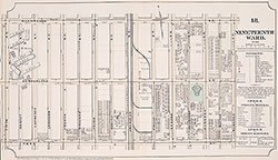 Plate 18
 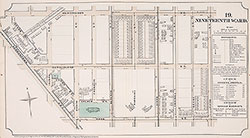 Plate19
 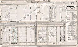 Plate 20
 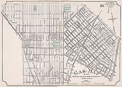 Plate 21
 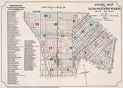 Index Map & Street Listing
 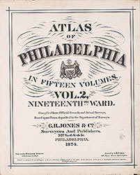 Title Page
 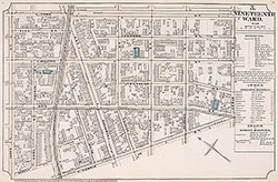 Plate 3