Posts in “maps” (29)
Blog Articles
 Derailment Bulletin 1.jpg)
Last week’s deadly train derailment in the Port Richmond section of Philadelphia was eerily similar to a crash that happened at the same junction on Labor Day in 1943. The 1943 accident… continue reading 1943 Philadelphia Train Derailment Tragedy
By written by David N. May 21, 2015
Google recently announced updates to their Maps API script, with more updates planned this summer for their overall Maps platform. The Free Library uses this API to display Google Maps in various… continue reading Free Library Google Maps Upgrade and New Features
By written by Peter SM May 21, 2013

Another resource and ally in the Open Data movement (as I've written about in previous blog posts ) has popped up online as of last week: CultureBlocks.com . CultureBlocks is a free web-based… continue reading Arts, Culture, and Creativity Mapped Out on CultureBlocks
By written by Peter SM May 8, 2013
Back in November 2012, Google updated its Maps service for browsers, as well as Android powered mobile phones and tablets, with indoor maps and floor plans of over 10,000 locations inlcuding… continue reading Find Your Way Around Parkway Central via Google Indoor Maps
By written by Peter SM March 12, 2013
Picking up from where we left off last week: What does Open Data mean for patrons and customers of the Free Library and what are some of the potential benefits and possibilities? If ever there was… continue reading Benefits and Possibilities of Open Data and the Free Library
By written by Peter SM December 4, 2012
This is the first part in a multi-part series looking at tech news and issues relevant to the Free Library of Philadelphia’s customers and patrons. One of the more recent buzzwords gaining… continue reading The Open Data Initiative and GIS Technology
By written by Peter SM November 27, 2012
This morning the Techmobile hosted third graders from Reynolds School onboard for an overview of the Library’s electronic resources for children, and then did a hands-on activity using… continue reading Philadelphia: People, Places Things with Third Graders from Reynolds School
By written by Joel N. May 1, 2012 1
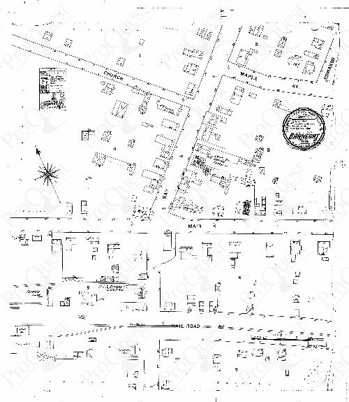
Although often called just "Sanborns" or "Sanborn Maps", the formal name of this series of maps is Sanborn Insurance Maps, and they're a combination of… continue reading What exactly is a Sanborn, anyway?
By written by Rich B. May 2, 2011
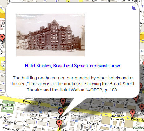
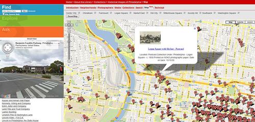
Step back in time and explore the Philadelphia of yesterday using the Free Library of Philadelphia's Historical Images of Philadelphia digital collection with Google Maps. A portion of our records… continue reading Explore Historical Images of Philadelphia on a Map
By written by Jim L. June 15, 2009 12