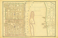
Atlas of the City of Philadelphia, 1862, Section 4
Maps 1862: Smedley, Atlas of the City of Philadelphia
Item Info
Page: 9
Work Type: Property Atlases/Maps
Source: Map Collection
Notes:
Academy of Natural Sciences: northwest corner Broad & George Streets
Adams Express: southeast corner Broad & Locust Streets
African Grand Lodge: east side 11th Street below Barley Street
American Academy of Music: southwest corner Broad & Locust Streets
American Sunday School Union: south side Chestnut Street between 11th & 12th Streets
Broad Street Market: east side Broad Street below Race Street
Chestnut & Walnut Railway Depot: south side Chestnut Street above 31st Street
Continental Hotel: southeast corner 9th & Chestnut Streets
Cornelius & Baker Lighting Manufactory: north Side Cherry Street between 8th & 9th Streets
Cresswell Iron Foundry: south side Race Street between 8th & 9th Streets
Deaf & Dumb Asylum (Broad Street): west side Broad Street between Broad and 15th Streets
Farmers Western Market: northwest corner 21st & Market Streets
Franklin Market: south side Marble Street between 10th & 11th Streets
Girard House: northeast corner 9th & Chestnut Streets
Girard Tube Works: northwest corner 23rd & Filbert Streets
Girls High School: south side Castle Street between 9th & 10th Streets
Herkness' Horse & Carriage Bazaar: southeast corner 9th & Sansom Streets
House of the Good Shepherd: northwest corner George & Albion Streets
Jefferson Medical College: west side 10th Street below Sansom Street
La Pierre House: west side Broad Street below Chestnut Street
Magdalen Society: east side 23rd Street above Race Street
Masonic Hall: north side Market Street between 7th & 8th Streets
Music Fund Hall: southwest corner Locust & Duponceau Streets
National Theatre & Circus: north side Walnut Street between 8th & 9th Streets
Pennsylvania Institute For the Instruction of the Blind: northwest corner 20th & Race Streets
Pennsylvania Medical School: west side 9th Street below Locust Street
Pennsylvania State Arsenal: east side 16th Street below Filbert Street
Philadelphia & Reading Railroad Freight Depot: southwest corner Juniper & Cherry Streets
Philadelphia College of Pharmacy: south side Filbert Street between 7th & 8th Streets
Philadelphia Gas Works: Market to Filbert Streets, 22nd Street to Schuylkill River
Race Street Market: southwest corner Juniper & Race Streets
St. Charles Borromeo Seminary: northeast corner 18th & Race Streets
St. Joseph's Orphan Asylum: southwest corner 7th & Spruce Streets
Union Market: southeast corner 17th & Jones Streets
United States Mint: northwest corner Chestnut & Juniper Streets
University of Pennsylvania: west side 9th Street above Chestnut Street
Washington House: north side Chestnut Street between 7th & *th Street
West Chester Railroad Station: northeast corner 18th & Market Streets
Western Exchange Hotel: north side Market Street between 15th & 16th Streets
Western House of Employment: northeast corner 17th & Barker Streets
Western Market: east side 16th Street above Market Street
Northside Orientation of Image: Top
Alternate Page Number: Section 4
City/Town/Township: Geographic Coverage State/Province:Pennsylvania
Geographic Coverage City/Town/Township:Philadelphia
Creator Name: J. B. Lippincott & Co. (1862) - Publisher
Samuel L. Smedley
- Pennsylvania Railroad
- Philadelphia, Pennsylvania
- Old United States Mint
- Jefferson Medical College
- Iron industry
- Gas-lighting
- Gas industry
- Hotels
- Markets
- Charities
- Academy of Natural Sciences of Philadelphia
- La Pierre House
- Adams Express Company (Firm)
- Academy of Music
- Music halls
- Mints
- Universities & colleges
- Philadelphia & Reading Railroad Co.
- Western Market
- Circuses & shows
- Hospitals
- Pennsylvania State Arsenal
- Orphanages
- University Of Pennsylvania
- Blind (people)
- High schools
- Magdalen Society
- Pennsylvania Institute for the Instruction of the Blind
- Philadelphia Gas Works
- Universities
- Masonic buildings
- Wills Hospital
- Lighting industry
- Franklin Market
- Arsenals
- West Chester Railroad Station
- Railroad terminals
- Science museums (buildings)
- Deaf and Dumb Asylum (Broad Street)
- Asylums (welfare buildings)
- Union Market
- Medical schools (buildings)
- House of the Good Shepherd
- Theological seminaries (buildings)
- American Sunday School Union
- Philadelphia College of Pharmacy
- Freight
- Pennsylvania Medical College
- National Theatre and Circus
- Musical Fund Hall
- St Joseph's Orphan Asylum
- Girard House
- Masonic Hall
- Washington House
- Broad Street Market
- Race Street Market
- Western House of Employment
- Girard Tube Works
- Farmers Western Market
- Girls High School
- Cresswell Iron Foundry
- Continental Hotel
- Western Exchange Hotel
- African Grand Lodge
- Fraternal lodges
- Chestnut and Walnut Railway Depot
- Herkness' Horse and Carriage Bazaar
- Cornelius and Baker Lighting Manufactory
- American Academy of Music see Academy of Music
- St. Charles Borromeo Seminary
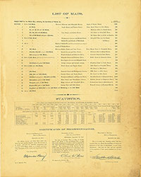 List of Maps
 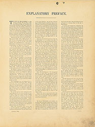 Preface
 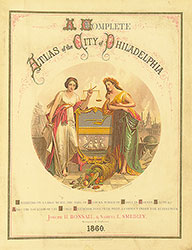 Title Page 1
 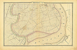 Section 1
 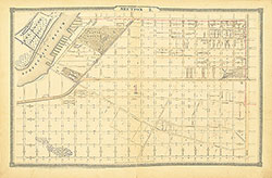 Section 2
 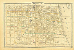 Section 3
 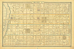 Section 4
 Section 5
 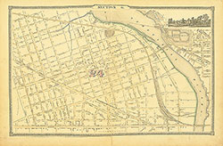 Section 6
 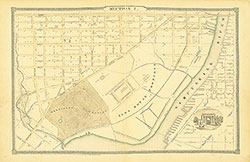 Section 7
 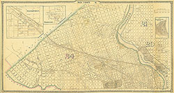 Section 8
 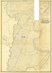 Section 9
 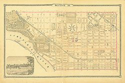 Section 10
 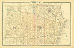 Section 11
 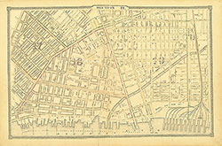 Section 12
 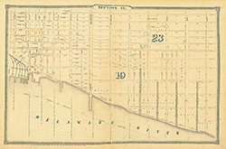 Section 13
 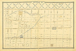 Section 14
  Section 15
  Section 16
  Section 17
  Section 18
  Section 19
 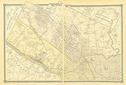 Section 20
 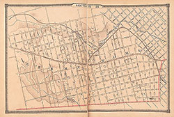 Section 21
 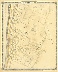 Section 22
 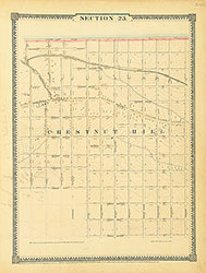 Section 23
 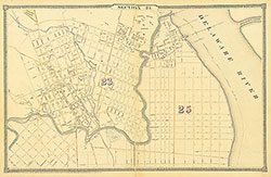 Section 24
 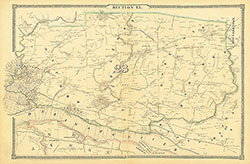 Section 25
 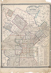 Map Index
  Title Page 2