Atlas of the City of Philadelphia, 1862, Section 20
Maps 1862: Smedley, Atlas of the City of Philadelphia
Item Info
Page: 25
Work Type: Property Atlases/Maps
Source: Map Collection
Notes:
Abbey Hotel: east side 23rd Street above Tioga Street (Kenderton)
American Mechanics Hall: Ridge Road below County Line Road (Roxborough)
Branchtown Hotel: Old York Road (Branchtown)
Crease's Chemical Works: Eliza's Lane above Ridege Avenue (Roxborough)
Crescentville Seminary: Tacony Creek below city line (Crescentville)
Cresheim Cotton Factory: Cresheim Creek at Paper Mill Lane (Chestnut Hill)
Cricketeers Hotel: New 2nd Street Road (McCartersville)
Egbert's Cotton Factory: west side Schuylkill River above Manayunk (Lower Merion Township)
Franklin KNitting Mills: Chew Avenue & Church Street (Germantown)
Godfrey's Hotel: Germantown Avenue & Carpenter Street (Germantown)
Hill's Carpet Factory: Cresheim Creek below Paper Mill Lane (Chestnut Hill)
Leverington Hotel: Ridge Road & Leverington Avenue (Roxborough)
Logan Nursery: south side Rockland Street east of Old York Road north of Hunting Park
Magargee Mill: Wissahickon Creek at township Line (Chestnut Hill)
Manatawna School: Ridge Road below County Line Road (Roxborough)
Maupay's Nursery: 12th Street to 13th Street, Clearfield Street to Allegheny Avenue
McCallum's Carpet Factory: Carpenter Street & Jefferson Avenue (Germantown)
McCarty's Fulling Mill: Saw Milll Creek below County Line Road above Milestown
Mermaid Hotel: Germantown Avenue & Mermaid Lane (Chestnut Hill)
Penn Coat of Arms Inn: Fishers Lane (Feltonville)
Powers & Weightman: Norristown Railroad below School House Lane (Falls of Schuylkill)
Rittenhouse Mill: Shur's Land and Wissahickon Creek above Falls of Schuylkill
Roberts Iron Works: west side Schuylkill River below Manayunk (Lower Merion Township)
Rowland Saw Works: Tacony Creek southeast of Feltonville
Roxborough Lyceum: Ridge Road at Lyceum Avenue (Roxborough)
Roxborough Poorhouse: Livezey's Mill Lane below Wissahickon Creek (Roxborough)
Simpson's Wool & Cotton Factory: west side Schuylkill River opposite Manayunk (L. Merion)
Sorrel Horse Inn: Ridge Road above Ship Lane (Roxborough)
Teedyuscung Wool & Cotton Mill: Wissahickon Creek & Paul's Mill Lane (Chestnut Hill)
Wakefield Hosiery: Wingohocking Creek at Lindley Street south of Branchtown)
Whitaker's Factory: Tacony Creek at Olney Road northeast of Feltonville
Wissahickon Paper Mill: Wissahickon Creek at township line (Chestnut Hill)
Northside Orientation of Image: Top
Alternate Page Number: Section 20
City/Town/Township: Geographic Coverage State/Province:Pennsylvania
Geographic Coverage City/Town/Township:Philadelphia
Creator Name: J. B. Lippincott & Co. (1862) - Publisher
Samuel L. Smedley
- Carpets
- Philadelphia, Pennsylvania
- Powers & Weightman
- Chemical industry
- Iron industry
- Hosiery industry
- Taverns
- Hotels
- Schools
- Megargee Paper and Rags (Firm)
- Assembly halls
- Textile mills
- Paper mills
- Inns
- Almshouses (buildings)
- Theological seminaries (buildings)
- Sawmills
- Lyceums (buildings)
- Whitaker, William-Cedar Grove Mill
- Cotton mills
- Nurseries (horticulture)
- Rowland, William & Harvey Saw Works
- Abbey Hotel
- Wissahickon Paper Mill
- Crease's Chemical Works
- Crescentville Seminary
- Mermaid Hotel
- McCallum's Carpet Factory
- Leverington Hotel
- Roxborough Poorhouse
- Rittenhouse Paper Mill
- Sorell Horse Tavern
- Branchtown Hotel
- Cresheim Cotton Mills:
- Roxborough Lyceum
- American Mechanics Hall
- Maupay's Nursery
- Penn Coat of Arms Inn
- Cricketers Hotel
- Logan's Nursery
- Fulling mills
- McCarty's Fulling Mill
- Wakefield Hosiery
- Franklin Knitting Mills
- Godfrey's Hotel
- Hills Carpet Factory
- Manatawna School
- Roberts, A.&P. Iron Works
- Simpson's Wool & Cotton Factory
- Egbert's Mill
- Teedyuscung Wool & Cotton Mill
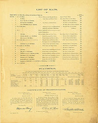 List of Maps
 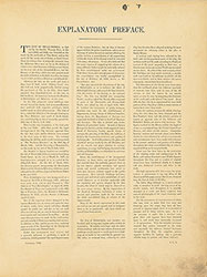 Preface
 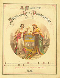 Title Page 1
 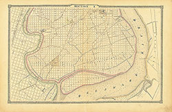 Section 1
 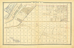 Section 2
 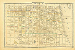 Section 3
 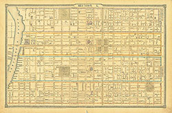 Section 4
 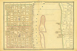 Section 5
 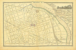 Section 6
 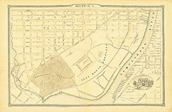 Section 7
 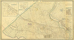 Section 8
 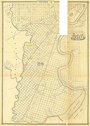 Section 9
 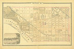 Section 10
 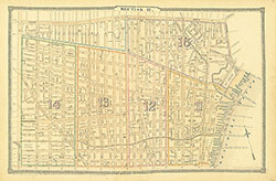 Section 11
  Section 12
 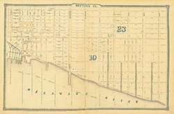 Section 13
 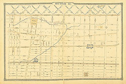 Section 14
 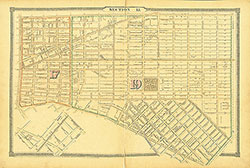 Section 15
 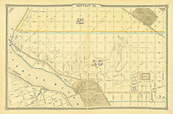 Section 16
 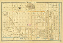 Section 17
 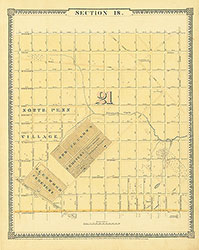 Section 18
 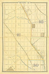 Section 19
  Section 20
 Section 21
 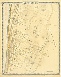 Section 22
 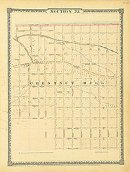 Section 23
 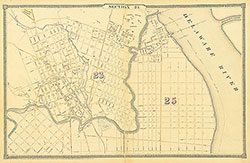 Section 24
 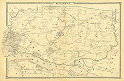 Section 25
 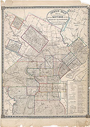 Map Index
  Title Page 2