Castner Scrapbook v.12, Streets 1, page 1
Historical Images of Philadelphia Castner Scrapbook Collection
Item Info
Historic Street Address: Broad & Jefferson, Northwest corner
Media Type: Scrapbooks
Source: Print and Picture Collection
Notes:
Item pdcc01220, top right [image dimensions 8.5 cm x 12.5 cm]:
Depicts uniformly plain rowhouses looking over a garden in the middle of a street. Shows pedestrians on the sidewalks and a horse and buggy being brought to a halt on the cobblestone street. St. Alban's Place, located between Catharine and Fitzwater Streets and 23rd and 24th Streets, was laid out as a garden street in the 1870s. The garden, surrounded by an iron fence, featured three ornate fountains and numerous flower urns.
Notes:
Item pdcc01221, middle [image dimensions 12.8 cm x 18.7 cm]:
Depicts a busy promenade scene on Broad Street typical of a Sunday afternoon in the 1870s. Shows well-dressed people strolling in front of the mansion built by Jospeh Singerly, a wealthy businessman who developed Philadelphia's street rail system. Also shows a man and woman on horseback and two ladies driving a surry with a fringed canopy-top.
Building demolished: YES ca. 1908
Notes:
Item pdcc01222, bottom [image dimensions 10.0 cm x 11.4 cm]:
Shows a busy scene on Broad Street looking towards South Penn Square from Chestnut Street. Sunlight describes the architectural splendour of the City Hall facade. On the left Kuglers restaurant is identified by its sign.
Geocode Latitude: Geocode Longitude:-75.164436
Geocode Latitude:39.950526
Call Number: A917.481 P536 v.12
Creator Name: Castner, Samuel, Jr., 1843-1929 - Compiler
Snyder, Henry M. - Engraver
Schell, Frederic B. - Artist
 11
11 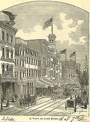 1B
1B 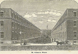 1
1 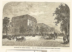 1
1 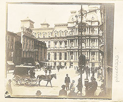 1
1 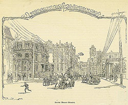 2
2 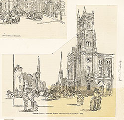 2
2  1B
1B 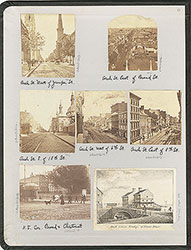 inside front cover
  1B
1B  1B
1B  1C
1C 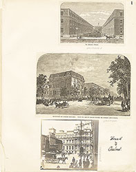 1
1
 2
2  2
2  3
3 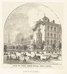 3
3  6
6  7
7  7
7 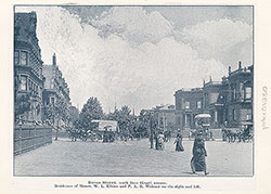 7
7 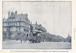 8
8  8
8  4
4 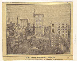 4
4  9
9  9
9  9
9 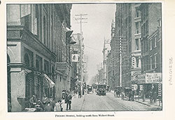 10
10  10
10  13
13  14
14 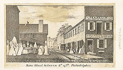 15
15 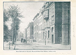 15
15 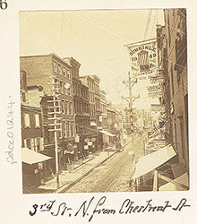 16
16 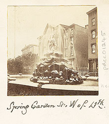 16
16 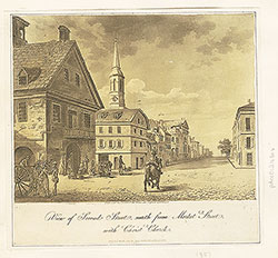 16
16  17
17  13
13 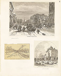 3
3 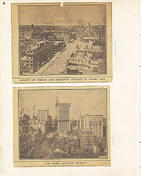 4
4 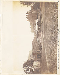 5
5  6
6  7
7 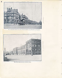 8
8 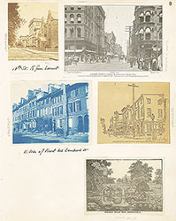 9
9 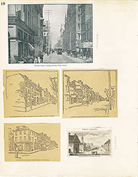 10
10  11
11  12
12  13
13  14
14 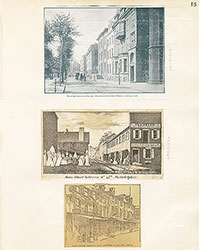 15
15 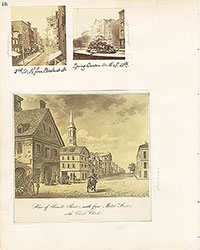 16
16 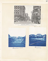 17
17  5
5  17
17  17
17  18
18 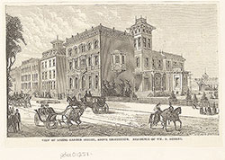 18
18  18
18  20
20 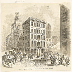 22
22 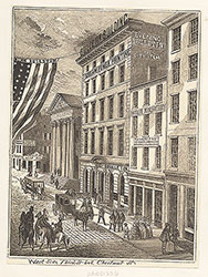 23
23  24
24  24
24 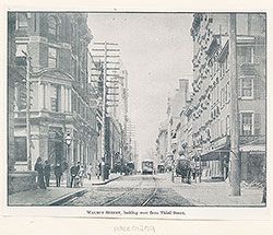 24
24 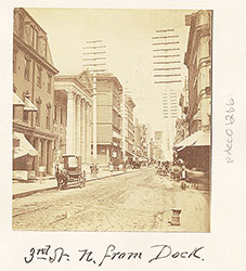 20
20 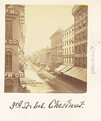 20
20  19
19 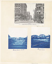 17
17  17
17  17
17  18
18  19
19 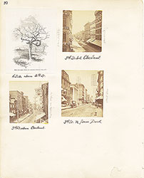 20
20  21
21  22
22 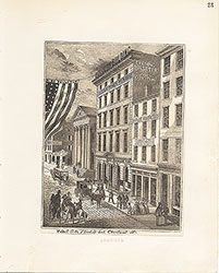 23
23 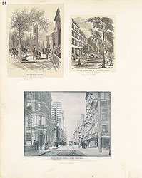 24
24  28
28  28
28 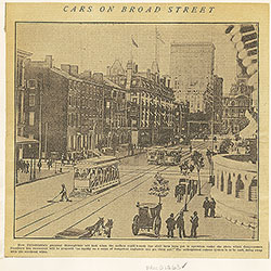 30
30  32
32  32
32 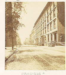 26
26  26
26  26
26  37
37  28
28 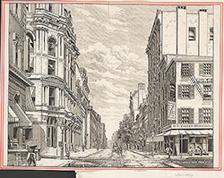 33
33 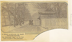 36
36  27
27  29
29  31
31  32
32  32
32  36
36 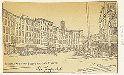 36
36  25
25  26
26  27
27 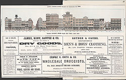 27
27 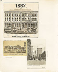 28
28 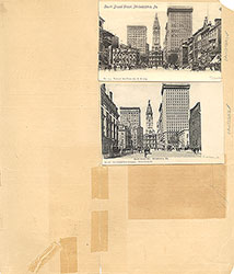 29
29 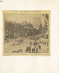 30
30  31
31  32
32  33
33  34
34 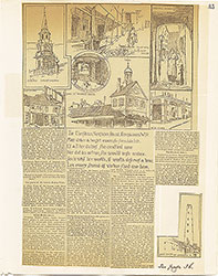 35
35  36
36  37
37  26
26 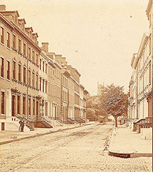 26
26 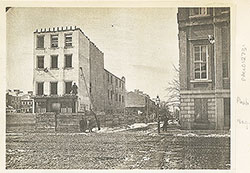 42
42 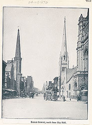 43
43  45
45  48
48  48
48  47
47  48
48 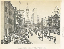 46
46 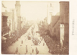 49
49 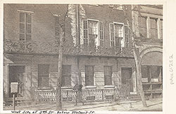 49
49  52
52 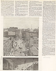 53
53  37
37 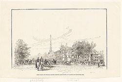 44
44  44
44 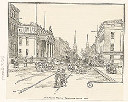 45
45 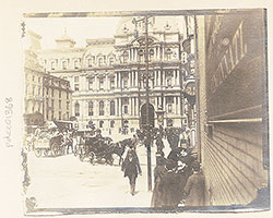 43
43  47
47  50
50 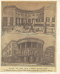 51
51  38
38  39
39  40
40  41
41  42
42 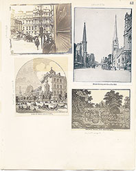 43
43  44
44  45
45  45
45  46
46  47
47 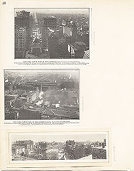 48
48  49
49  50
50  51
51  52
52  53
53  54
54  59
59 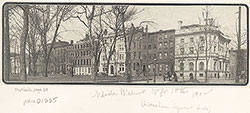 57
57 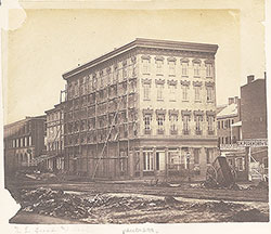 54
54  64
64 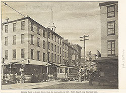 62
62 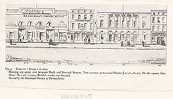 59
59  57
57  57
57  56
56 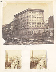 54
54  55
55  56
56  57
57 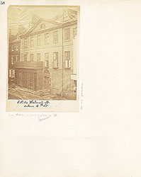 58
58  59
59 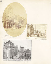 60
60  61
61 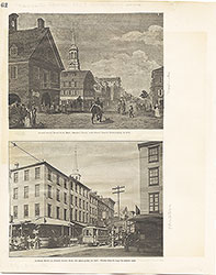 62
62  63
63  64
64  Freeman's Auction House, Walnut Street at 3rd
  69
69  66
66  69
69  69
69  72
72  71
71  71
71  65
65 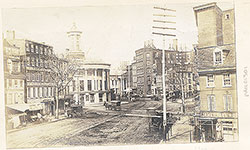 68
68 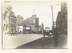 68
68  74
74  67
67 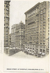 67
67 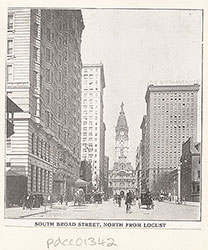 65
65 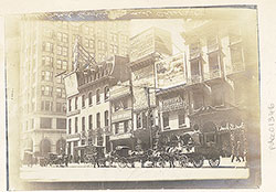 71
71 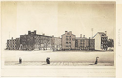 73
73 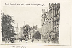 73
73 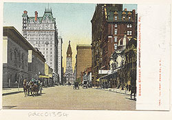 73
73 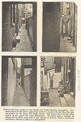 73
73  71
71 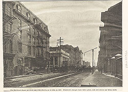 70
70 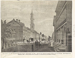 70
70 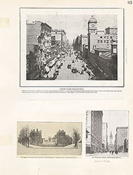 65
65 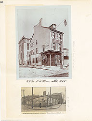 66
66 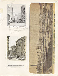 67
67  68
68  69
69  70
70 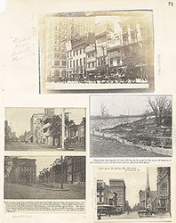 71
71  72
72  73
73  73
73 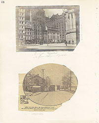 74
74 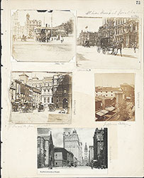 75
75  76
76  66
66 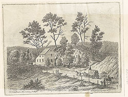 80
80 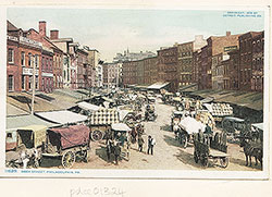 83
83 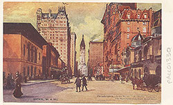 77
77  78
78  78
78  78
78  79
79  79
79  79
79  83
83  84
84  83
83 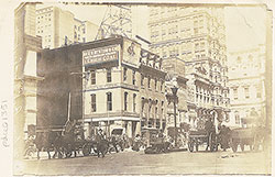 77
77 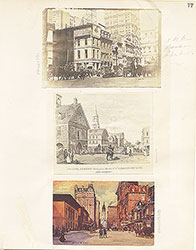 76
76  78
78  79
79 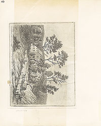 80
80  81
81  82
82  83
83  84
84  93
93  91
91  91
91  88
88  86
86  85
85  97
97 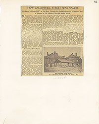 85
85  86
86 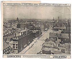 86
86 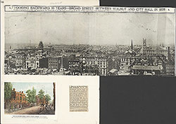 86
86 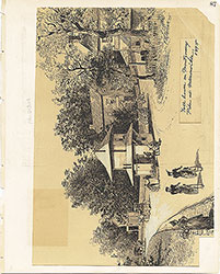 87
87 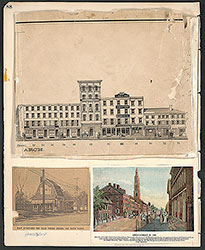 88
88 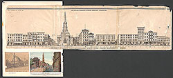 88
88  9
9 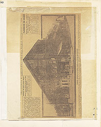 90
90  90
90 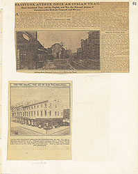 91
91  92
92 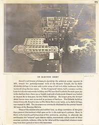 93
93  94
94  95
95 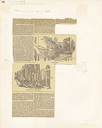 96
96  97
97  98
98