Castner Scrapbook v.12, Streets 1, page 26
Historical Images of Philadelphia Castner Scrapbook Collection
Item Info
Historic Street Address: 3rd & Walnut Streets
Historic Street Address: 9th & Walnut Streets
Historic Street Address: Fourth and Walnut Streets
Historic Street Address: Seventeenth and Walnut Streets
Media Type: Scrapbooks
Source: Print and Picture Collection
Notes:
Item pdcc01268, middle row on the right [image dimensions 8.8 cm x 8.0 cm]:
Shows a block of fine residences on Walnut Street looking west from 19th Street. A partial view of Holy Trinity Church is visible on the extreme left at the Northwest corner of West Rittenhouse Square.
Unmounted half stereoview.
Notes:
Item pdcc01269, middle row on the left:
Shows businesses on the ground floors of these private residences.
Unmounted half stereoview.
Building demolished: YES
Notes:
Item pdcc01270, top left [image dimension 9.0 cm x 7.8 cm]:
Shows a mix of building types on the north side of the 300 block of Walnut Street. Tha tall commercial facade is at 307. Adjacent buldings, which were once private residences, have businesses at street level. One sign indicates the presence of the Germantown Fire Insurance Co.
Unmounted half stereoview.
Building demolished: YES
Notes:
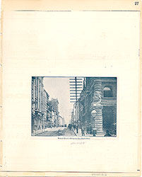
Item pdcl00142, top right [image dimensions 9.3 cm x 7.1 cm]:
"Covered wagons, a frequent sight in Philadelphia in the 1850s and 1860s, lend a rural atmosphere to this city scene. The trees of Independence Square are visible in the background. The gas lamp on the corner is fitted with an unusual accoutrement, a transparent street sign which was illuminated when the lamp was lighted."--OPEP, p. 147.
The street with commercial buildings on either side. People on the sidewalks; horse-drawn carts and carriages; streetcar on tracks on Walnut. Street lamp and utility poles on sidewalk; trees in background. Businesses include: "Spofford & Clark, shippers of coal," "Phoenix Mutual Life Insurance Company," "North Pennsylvania R.R. Co.," and "Lumberman's."
Notes:
Item pdcl00146, bottom left [image dimensions 9.1 cm x 8.0 cm]:
"Beyond this block of fine residences can be seen Rittenhouse Square and the tower of Holy Trinity Church. The house at the corner of 18th Street, center, is the Weightman Mansion (see next picture)."--OPEP, p. 150.
The street with rowhouses on both sides; man in top hat with umbrella; street lamps and trees on sidewalk. Streetcar on tracks. Trees in background; church can be seen above the trees.
Bibliography:
Item pdcl00142:
Reprinted in: Old Philadelphia in early photographs, 1839-1914/edited by Robert F. Looney. New York: Dover Publications, c1976.
Item pdcl00146:
Reprinted in: Old Philadelphia in early photographs, 1839-1914/edited by Robert F. Looney. New York: Dover Publications, c1976.
Geocode Latitude: Geocode Longitude:-75.169016
Geocode Latitude:39.949722
Call Number: A917.481 P536 v.12
Creator Name: Castner, Samuel, Jr., 1843-1929 - Compiler
- Animals
- Buildings
- Horses
- Men
- Street lights
- Street railroads
- Row houses
- People
- Signs and signboards
- Street railroad tracks
- Society Hill
- Commercial buildings
- Covered wagons
- Spofford & Clark
- Utility poles
- Parks
- Stores
- Insurance companies
- Awnings
- Phoenix Mutual Life Insurance Company
- North Pennsylvania Railroad Company
- Rittenhouse Square
- Holy Trinity Catholic Church
- Catholic churches
- Mansions
- Horse-drawn vehicles
- Cobblestone streets
- Street scenes
- Fourth Street
- Independence Square
- Walnut Street
- Seventeenth Street
 11
11 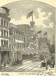 1B
1B  1
1 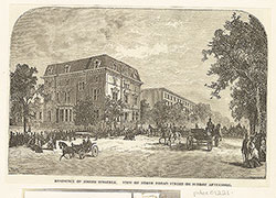 1
1 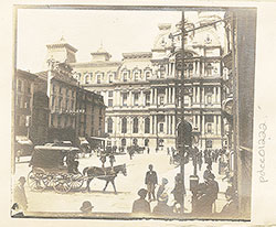 1
1  2
2  2
2  1B
1B 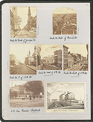 inside front cover
  1B
1B  1B
1B  1C
1C 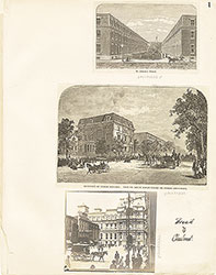 1
1  2
2 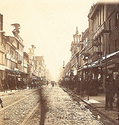 2
2 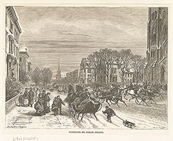 3
3 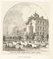 3
3  6
6  7
7  7
7 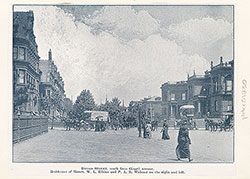 7
7 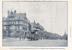 8
8 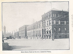 8
8 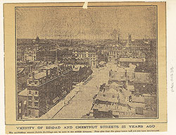 4
4  4
4 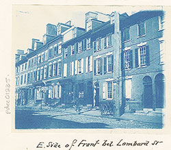 9
9 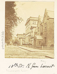 9
9 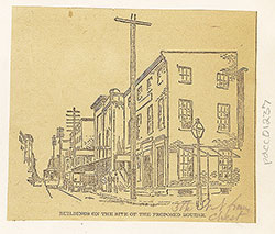 9
9 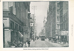 10
10  10
10  13
13 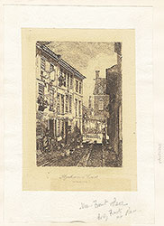 14
14 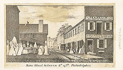 15
15 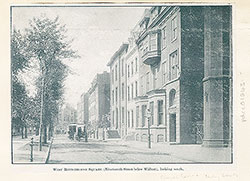 15
15  16
16  16
16 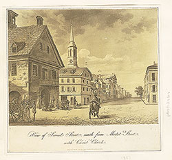 16
16 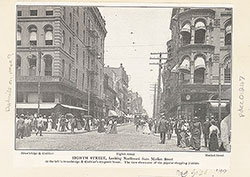 17
17  13
13 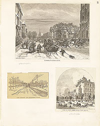 3
3  4
4  5
5  6
6 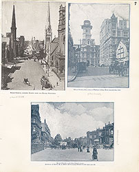 7
7  8
8 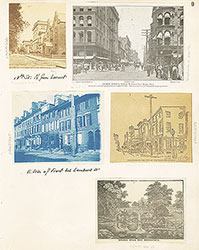 9
9 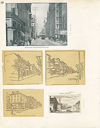 10
10  11
11  12
12  13
13  14
14 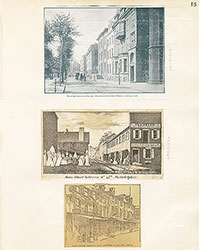 15
15 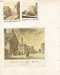 16
16 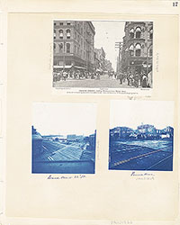 17
17 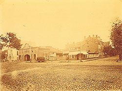 5
5  17
17  17
17 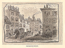 18
18 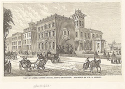 18
18  18
18  20
20 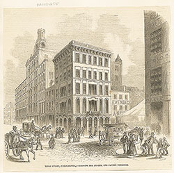 22
22 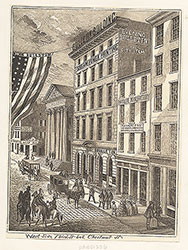 23
23 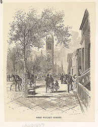 24
24 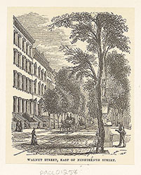 24
24 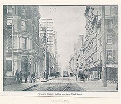 24
24 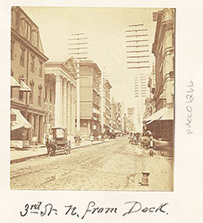 20
20 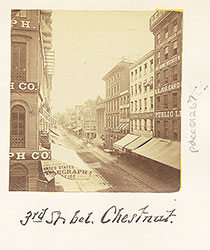 20
20  19
19 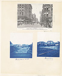 17
17  17
17  17
17  18
18 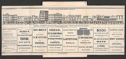 19
19  20
20 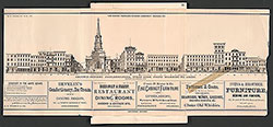 21
21 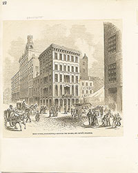 22
22 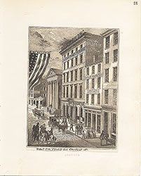 23
23 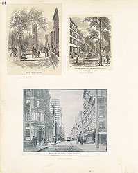 24
24  28
28  28
28 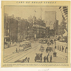 30
30  32
32  32
32 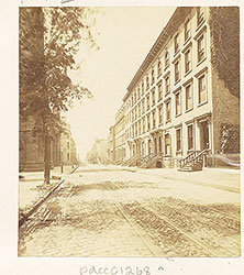 26
26 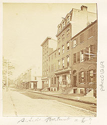 26
26 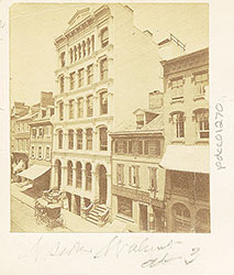 26
26  37
37  28
28 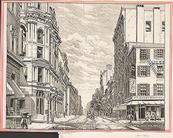 33
33  36
36  27
27  29
29  31
31  32
32  32
32  36
36 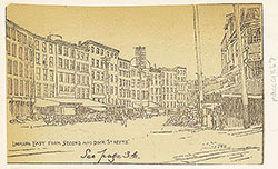 36
36 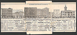 25
25 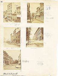 26
26
 27
27  27
27  28
28 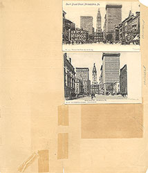 29
29 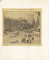 30
30  31
31  32
32 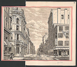 33
33 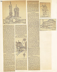 34
34 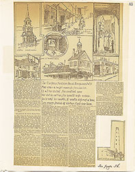 35
35  36
36  37
37 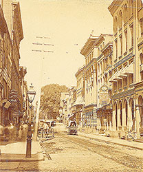 26
26 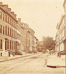 26
26 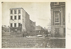 42
42 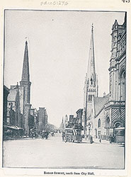 43
43  45
45  48
48  48
48  47
47  48
48 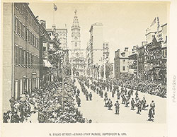 46
46 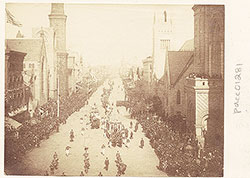 49
49 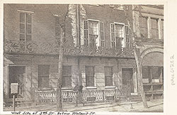 49
49  52
52 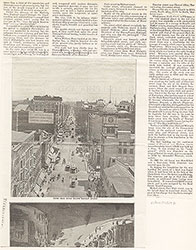 53
53  37
37 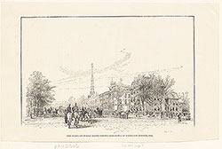 44
44 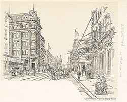 44
44 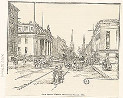 45
45 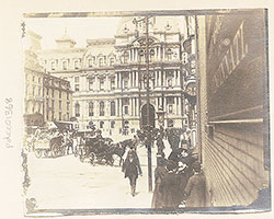 43
43  47
47  50
50 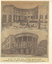 51
51  38
38  39
39  40
40 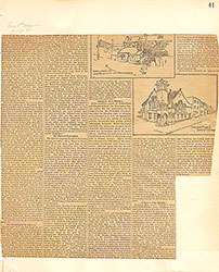 41
41 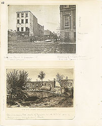 42
42 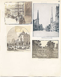 43
43  44
44 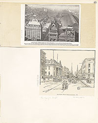 45
45 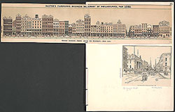 45
45 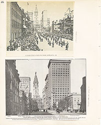 46
46  47
47 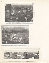 48
48 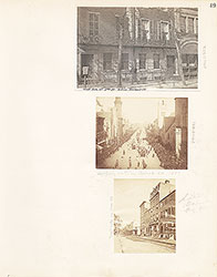 49
49  50
50  51
51  52
52  53
53  54
54  59
59 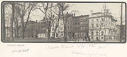 57
57 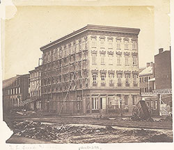 54
54  64
64 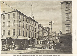 62
62 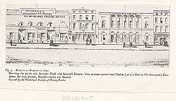 59
59 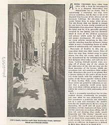 57
57  57
57  56
56 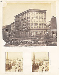 54
54 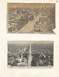 55
55 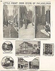 56
56 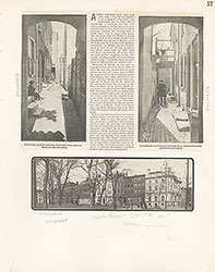 57
57 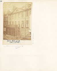 58
58  59
59  60
60 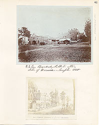 61
61 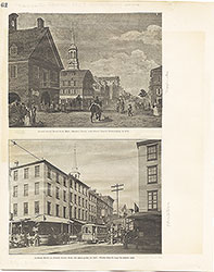 62
62  63
63  64
64 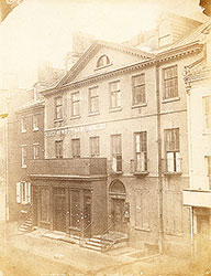 Freeman's Auction House, Walnut Street at 3rd
 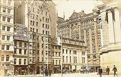 69
69  66
66  69
69  69
69 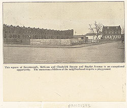 72
72  71
71 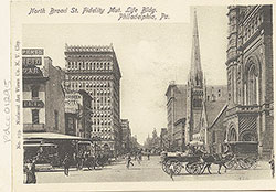 71
71 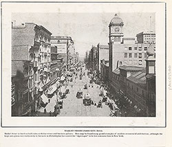 65
65 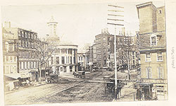 68
68  68
68  74
74  67
67  67
67  65
65 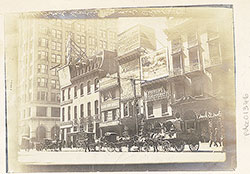 71
71  73
73  73
73  73
73 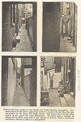 73
73 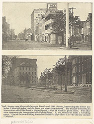 71
71 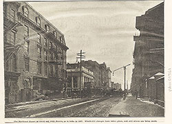 70
70 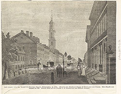 70
70  65
65  66
66 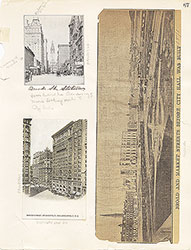 67
67 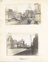 68
68  69
69 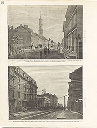 70
70 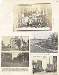 71
71  72
72 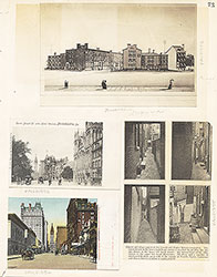 73
73  73
73 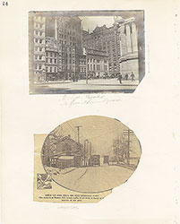 74
74 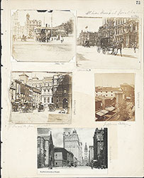 75
75  76
76 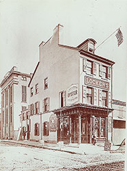 66
66  80
80  83
83 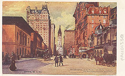 77
77 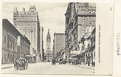 78
78  78
78  78
78  79
79  79
79  79
79  83
83  84
84  83
83 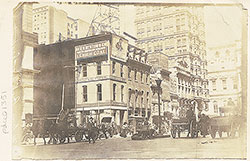 77
77  76
76  78
78  79
79  80
80  81
81  82
82  83
83  84
84  93
93  91
91  91
91  88
88  86
86  85
85  97
97  85
85 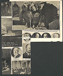 86
86  86
86  86
86 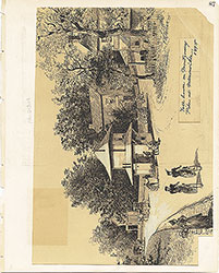 87
87 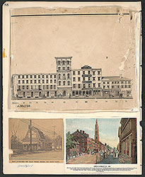 88
88 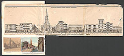 88
88 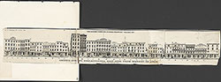 9
9  90
90  90
90  91
91  92
92  93
93  94
94  95
95 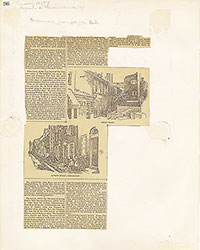 96
96 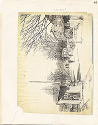 97
97  98
98