Castner Scrapbook v.20, Delaware River 1, page 12
Historical Images of Philadelphia Castner Scrapbook Collection
Item Info
Media Type: Scrapbooks
Source: Print and Picture Collection
Notes:
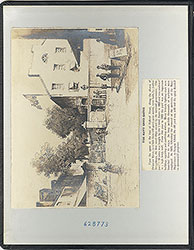
Three depictions of activity at the Port Richmond Coal Terminal of the Philadelphia & Reading Railroad, on the Delaware River, which operated from 1841 until c.1960.
Item 1, top: Image is a view of the Port Richmond Coal Terminal from the river. It features a schooner in full sail and two rowboats, as well as many schooners lined up along the wharves in the background. (At the lefthand side of the engraving is a "Geo Payne" sign at wharf 21, which may refer to the construction company of George Payne.) Engraving by David Scattergood for an unidentified publication, 15.5 x 9 cm, c. 1880.
Item 2, center: Detailed newspaper article about the formative years of the Port Richmond Coal Terminal. Between the years of 1841 and the writing of this c. 1860 article, the number of coal wharves grew from an initial 9 wharves to 18 (which are labeled right to left in the image). By 1876, the coal terminal had 21 wharves. The image views the terminal from the river, with paddle steamers--in particular, the Logan in the center foreground--and schooners in service to the coal trade. The substantial engine house can be seen in the center background, behind the array of wharves on the shore. Engraving and text for an unidentified newspaper, 18 x 12 cm, c.1860.
Item 3, bottom: This image of the Port Richmond Coal Terminal is similar to Item 2, above. They share the same caption, a similar view from the river, and both feature the Logan paddle steamer in the foreground and the railroad engine house and numbered wharves in the background. The engravers are not identified, but they appear to be different. Since neither image is dated, it is not known which one was created first, however they appear to be created around the same time period. Engraving for an unidentified publication, 25 x 10 cm, c.1860.
Creation Year: 1845
Geocode Latitude: Geocode Longitude:-75.098710
Geocode Latitude:39.978704
Call Number: A917.481 P536 v.20
Creator Name: Castner, Samuel, Jr., 1843-1929 - Compiler
David Scattergood - Engraver
 inside front cover
  0
0  1c
1c 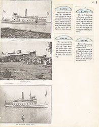 1
1 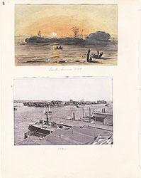 2
2 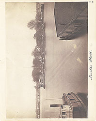 3
3  4
4  5
5 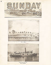 6
6  7
7  8
8  9
9  10
10  11
11 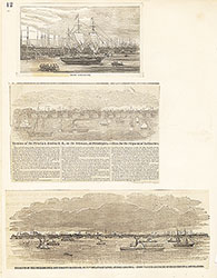 12
12
 13
13 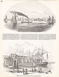 14
14 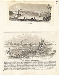 15
15  16
16  17
17 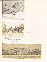 18
18  19
19  20
20  21
21 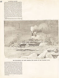 22
22  23
23 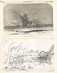 24
24  25
25 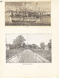 26
26  27
27 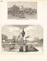 28
28 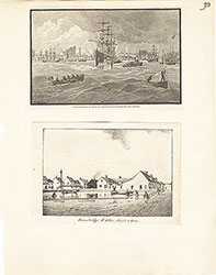 29
29  30
30 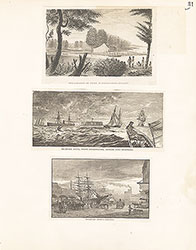 31
31  32
32  33
33  34
34 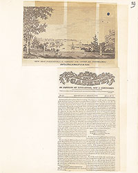 35
35  36
36 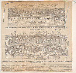 37
37 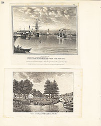 38
38  39
39  39
39 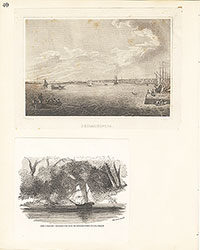 40
40 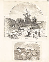 41
41  42
42 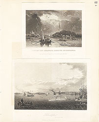 43
43  44
44 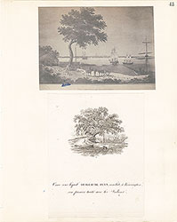 45
45 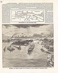 46
46 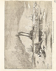 47
47  48
48 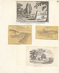 49
49  50
50  51
51  51
51 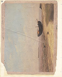 52
52  53
53  53
53 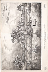 53
53  54
54  55
55 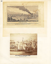 56
56 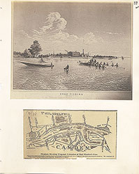 57
57 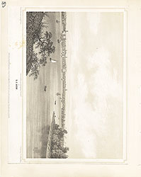 58
58  59
59 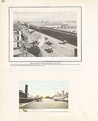 60
60 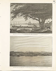 61
61 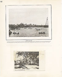 62
62  63
63 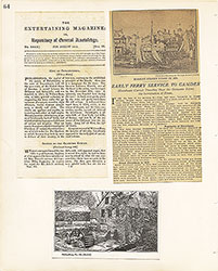 64
64 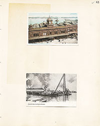 65
65 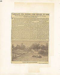 66
66  67
67 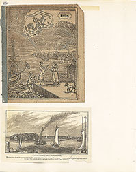 68
68  69
69  69
69 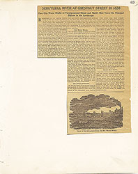 69
69  70
70 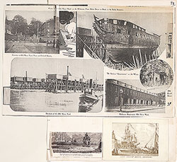 71
71 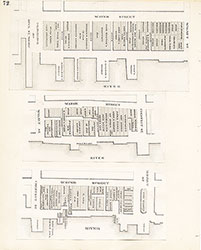 72
72 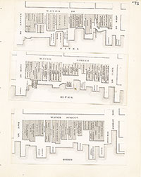 73
73 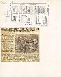 74
74 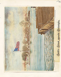 75
75 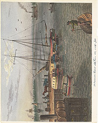 76
76 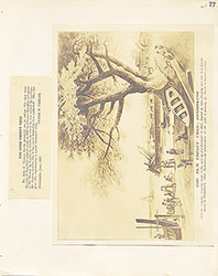 77
77  78
78  79
79 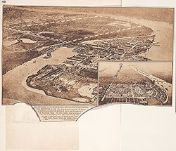 80
80 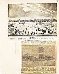 81
81 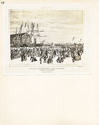 82
82 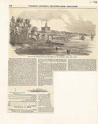 83
83 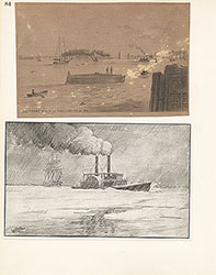 84
84  85
85 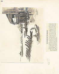 86
86  87
87 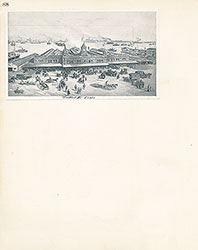 88
88 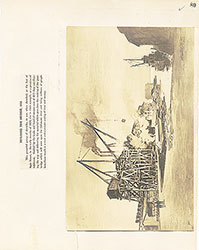 89
89 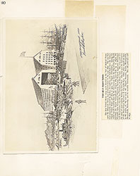 90
90  91
91 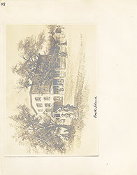 92
92 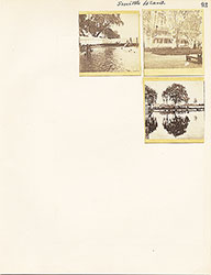 93
93  64a
64a