Castner Scrapbook v.20, Delaware River 1, page 18
Historical Images of Philadelphia Castner Scrapbook Collection
Item Info
Historic Street Address: today, 16 S Christopher Columbus Blvd
Historic Street Address: today, Penn's Landing Road (at Market Street)
Media Type: Scrapbooks
Source: Print and Picture Collection
Notes:
Item 1, top: Image of the docks at Greenwich Point on the Delaware River, in the early 1870s. Ferry service had originally operated here from 1688-1865. Goods and passengers were transported between Greenwich Point (South Philadelphia) and Gloucester Point (Gloucester, NJ). In 1865, the Pennsylvania Railroad purchased land along the Delaware River, which included Greenwich Point, thereby eliminating ferry service at that location. The railroad access transformed Greenwich Point into a major hub for the booming coal industry, for both domestic and export purposes. On the river are pictured a steamer docked at the port, and a schooner in full sail. Smoke rising from numerous smokestacks make apparent the early industrialization of the area. Multiple railroad lines are visible to the left and right of the docks, with train activity in evidence. Lithograph by an unidentifed artist, 12 x 10 cm, undated, but most likely c. 1870s.
Item 2, center: Image of a bustling 1890s Delaware Avenue, looking north from Market Street. This was a major location of ferry services between Philadelphia and Camden, NJ. Ferry sheds and baggage facilities line the east side of the street. On the west side of the street are businesses catering to ferry-related activities, some selling sails or rope ("Chas. Lawrence, Sail Maker, flags made" and "[...] Rope [...]."), as well as services for the Camden Ferry (streetlamp: "Camden Ferry, Pennsylvania, West Jersey, R.R."). In the street are many horse-drawn carts and carriages, and pedestrians are seen on the sidewalks or in the street. Albumen print, 12 x 19.5 cm, c. 1890.
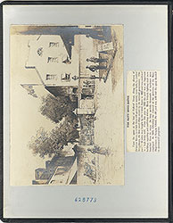
Item 3, bottom: Reproduction of an 1891 Frederick Gutekunst photograph, for a 1922 article in the Evening Public Ledger. The view is the Delaware River, seen from the ferry docks at Market Street (today, Penn's Landing Road at Market Street). The photograph shows paddle steamers on the left, providing ferry service from Market Street to Camden, NJ, and a ferry building on the right. Smith's Island and Windmill Island are seen in the center. The text below the photograph mentions the beginning of work on a bridge which would provide access for vehicular traffic, to complement the ferry service between Philadelphia and Camden. The Delaware River Bridge (renamed in 1955 for Benjamin Franklin), opened in 1926. Reproduction of a photograph, with accompanying text, for the Evening Public Ledger, 21.5 x 8 cm, 1922; photograph without text, 21 x 6 cm, 1891.
Creation Year: 1845
Geocode Latitude: Geocode Longitude:-75.140262
Geocode Latitude:39.948878
Call Number: A917.481 P536 v.20
Creator Name: Castner, Samuel, Jr., 1843-1929 - Compiler
Frederick Gutekunst (1831-1917) - Photographer
 inside front cover
 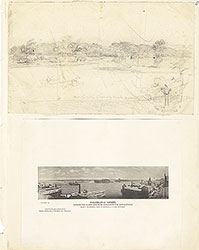 0
0  1c
1c 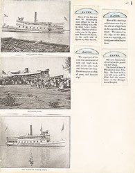 1
1 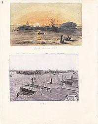 2
2 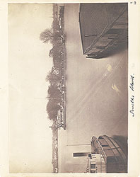 3
3  4
4  5
5 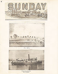 6
6 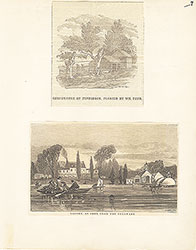 7
7 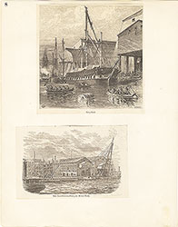 8
8  9
9 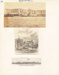 10
10  11
11  12
12  13
13 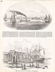 14
14 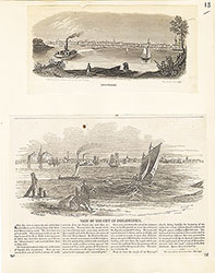 15
15  16
16  17
17 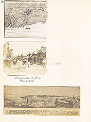 18
18
 19
19  20
20  21
21 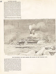 22
22 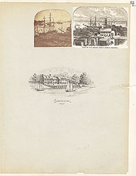 23
23 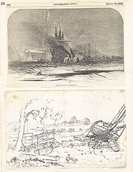 24
24  25
25 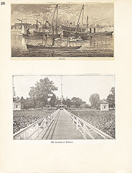 26
26  27
27  28
28 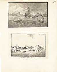 29
29 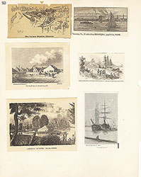 30
30  31
31  32
32  33
33 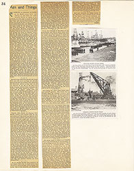 34
34  35
35  36
36  37
37 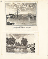 38
38  39
39  39
39 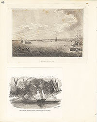 40
40 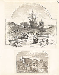 41
41  42
42  43
43 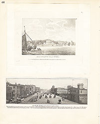 44
44 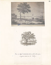 45
45 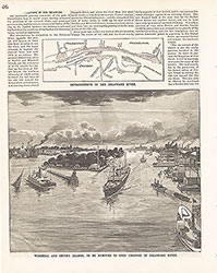 46
46 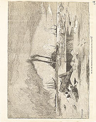 47
47  48
48 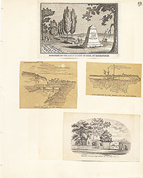 49
49  50
50  51
51  51
51 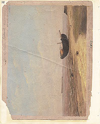 52
52  53
53  53
53  53
53  54
54 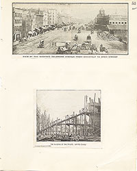 55
55 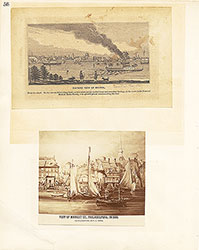 56
56 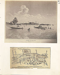 57
57 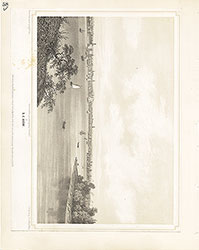 58
58  59
59 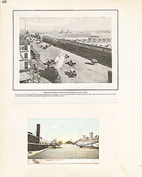 60
60 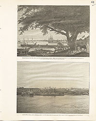 61
61 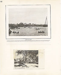 62
62  63
63  64
64 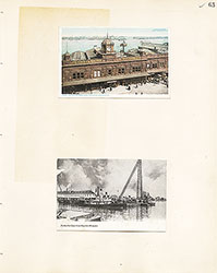 65
65  66
66  67
67 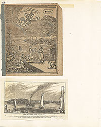 68
68  69
69  69
69  69
69  70
70 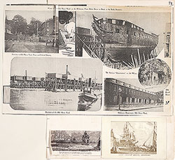 71
71 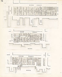 72
72 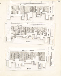 73
73 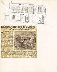 74
74  75
75 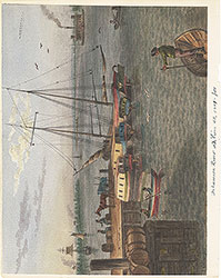 76
76  77
77 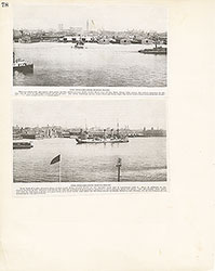 78
78  79
79 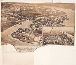 80
80 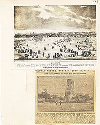 81
81 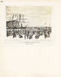 82
82  83
83 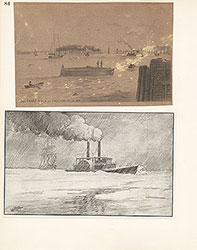 84
84  85
85  86
86  87
87 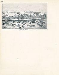 88
88 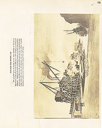 89
89 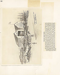 90
90  91
91 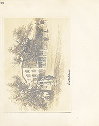 92
92 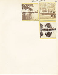 93
93  64a
64a