Castner Scrapbook v.20, Delaware River 1, page 23
Historical Images of Philadelphia Castner Scrapbook Collection
Item Info
Historic Street Address: RCA Pier (Water St., at Market St., Camden, NJ
Media Type: Scrapbooks
Source: Print and Picture Collection
Notes:
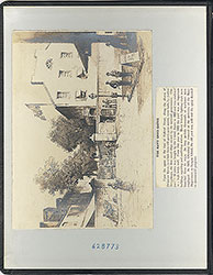
Item 1, top left: Albumen print of a schooner docked at a ferry stop on the Delaware River, probably in Camden, NJ. Several more typical ferries (e.g., paddle steamers) can be seen in the background. Apparently, each ferry line that operated between Philadelphia and Camden in the mid-1800s was associated with a "pleasure garden," popular recreational establishments that proliferated throughout Camden during that period. Zimmerman's Garden and Diamond Cottage was one such place, as advertised in this image. It was located then between Broadway and 7th Streets, between Penn and Linden Streets, Camden (where the Ben Franklin Bridge Plaza is today). Albumen photographic print (probably one half of a stereograph), 7 x 7 cm, undated.
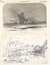
Item 2, top right: Image captioned, "View of the Poplar Street Lumber Wharves." Many lumberyards lined the Delaware River along the Northern Liberties piers in the 1800s. This image shows a full lumberyard behind the Poplar Street Lumber Wharf, located at then Pier 39. The bustling activity of the many ships on the Delaware River illustrates the significance of Philadelphia for the lumber industry. Engraving (see *Note below) for an unidentified publication, 11 x 8 cm, undated (but c. 1875).
*Note: An 1870 albumen print by Frederick Gutekunst was the source for the above engraving. The original print was used for an advertisement for the Patterson & Lippincott lumberyard. See https://digital.librarycompany.org/islandora/object/digitool%3A127316
Item 3, bottom: Image of buildings on the Delaware River shore, in Gloucester, NJ, in 1830. Two sailboats cruise on the river, in front of three buildings which may comprise a fishing resort, since shad fishing in this area was extremely popular. A fence encloses the property at the shoreline, and trees surround it from behind. Engraving measuring 14 x 8 cm, printed in the center of a large sheet measuring 25 x 33 cm, 1830.
Creation Year: 1845
Geocode Latitude: Geocode Longitude:-75.129898
Geocode Latitude:39.894002
Call Number: A917.481 P536 v.20
Creator Name: Castner, Samuel, Jr., 1843-1929 - Compiler
 inside front cover
 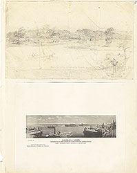 0
0  1c
1c 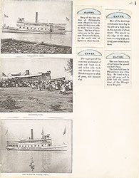 1
1 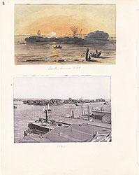 2
2  3
3  4
4  5
5 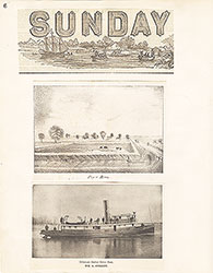 6
6 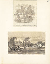 7
7 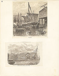 8
8  9
9 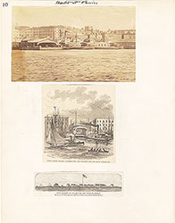 10
10  11
11  12
12  13
13  14
14 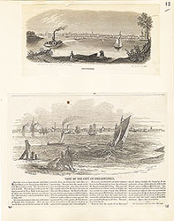 15
15 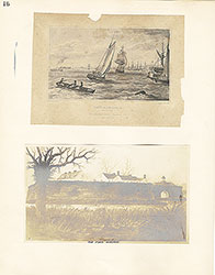 16
16  17
17 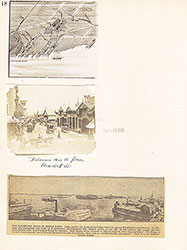 18
18  19
19  20
20  21
21  22
22 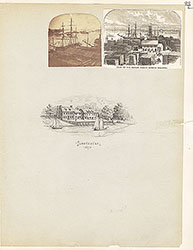 23
23
 24
24  25
25 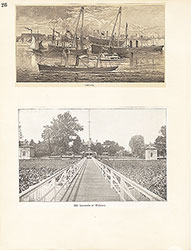 26
26  27
27 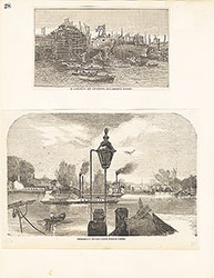 28
28 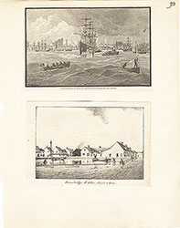 29
29 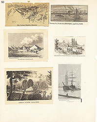 30
30  31
31  32
32  33
33  34
34 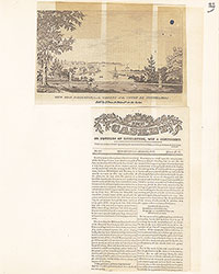 35
35 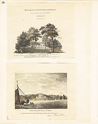 36
36 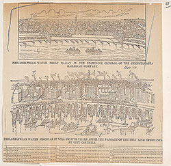 37
37 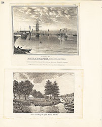 38
38  39
39  39
39 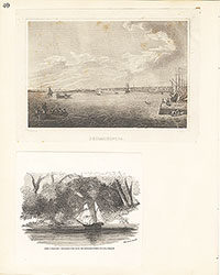 40
40 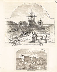 41
41  42
42  43
43  44
44 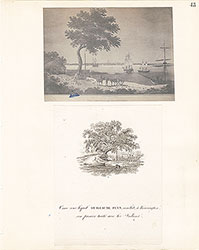 45
45 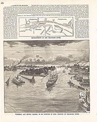 46
46  47
47  48
48 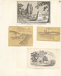 49
49  50
50  51
51  51
51 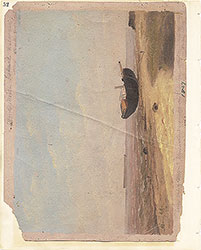 52
52  53
53  53
53 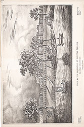 53
53  54
54 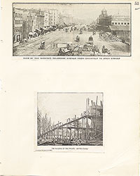 55
55 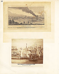 56
56 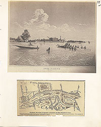 57
57 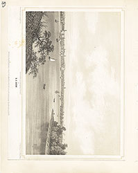 58
58 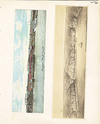 59
59  60
60  61
61 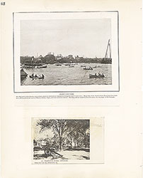 62
62 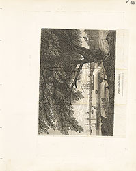 63
63  64
64 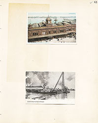 65
65  66
66  67
67 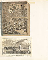 68
68  69
69  69
69  69
69  70
70 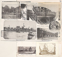 71
71  72
72  73
73  74
74 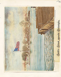 75
75 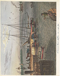 76
76  77
77  78
78  79
79  80
80  81
81 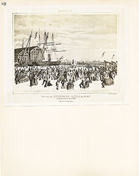 82
82 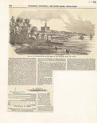 83
83 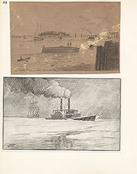 84
84 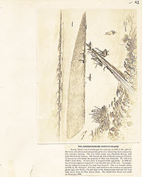 85
85  86
86 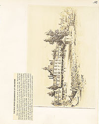 87
87 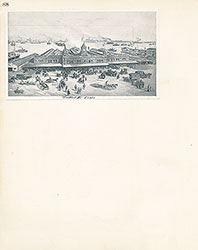 88
88 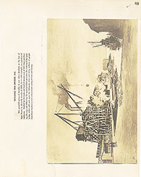 89
89 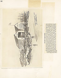 90
90  91
91 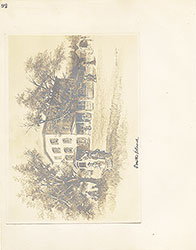 92
92 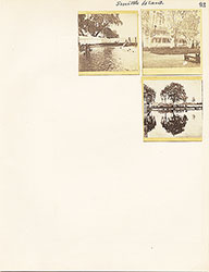 93
93  64a
64a