Castner Scrapbook v.20, Delaware River 1, page 16
Historical Images of Philadelphia Castner Scrapbook Collection
Item Info
Historic Street Address: Kensington (today, Penn Treaty Park, Fishtown)
Media Type: Scrapbooks
Source: Print and Picture Collection
Notes:
Item 1, top: Image titled "Philadelphia From Kensington." The 191-acre colonial town of Old Kensington was founded in the 1730s, on the Delaware River, opposite Petty Island. Activities generally centered around fishing and shipbuilding. This engraving demonstrates the busy river activity in 1828. In the foreground are featured a rowboat, a sailboat, and an early schooner. On the right are loading docks for river trade. In the distance is an early paddle steamer (left) and many more boats. By the late 1800s, the area had grown substantially due to increased industrialization, and the boundaries of the original town became known as Fishtown. Print of an 1828 engraving by Joseph Cone, drawn by Thomas Birch, for an unidentified publication, 18.5 x 13.5 cm, c. 1830s.
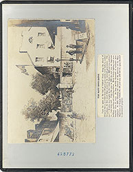
Item 2, bottom: Albumen photograph of a painting by watercolorist Thomas H. Wilkinson. The subject is Fort Mifflin, on Hog (or "Mud") Island, on the Delaware River. Built by the British in 1771, it became an American fort in the Revolutionary War. It was destroyed in battle in 1777. After the war, it was rebuilt c. 1800, and served as an active military post until it was decommissioned in 1954. It is unclear what period in the fort's history was being portrayed by Wilkinson, but it was probably painted around 1900. The view is from the Philadelphia shoreline, looking at the fort across the no-longer existent Back Channel, which separated Hog Island from the mainland. In this image, several buildings of the reconstructed fort can be seen, as well as an entrance through one of its substantial outer walls. Sepia-tone albumen photographic print of a painting, 20 x 12 cm, c. 1900.
Creation Year: 1845
Geocode Latitude: Geocode Longitude:-75.128726
Geocode Latitude:39.965629
Call Number: A917.481 P536 v.20
Creator Name: Castner, Samuel, Jr., 1843-1929 - Compiler
Thomas Birch - Artist
Joseph Cone - Engraver
Thomas H. Wilkinson (1847-1929) - Artist
 inside front cover
 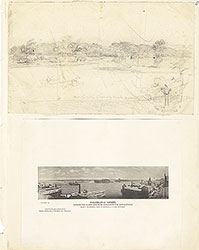 0
0  1c
1c  1
1 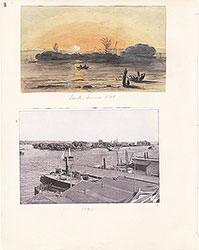 2
2  3
3  4
4  5
5  6
6 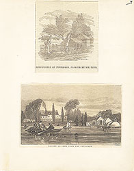 7
7  8
8  9
9 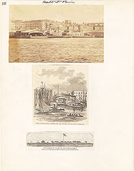 10
10  11
11  12
12  13
13  14
14 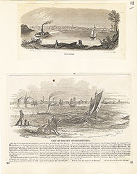 15
15 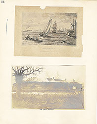 16
16
 17
17 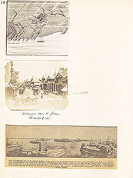 18
18 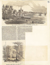 19
19  20
20  21
21  22
22  23
23  24
24  25
25 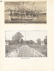 26
26  27
27  28
28  29
29 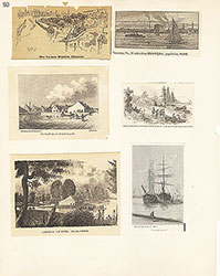 30
30  31
31  32
32  33
33  34
34 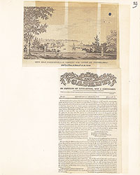 35
35 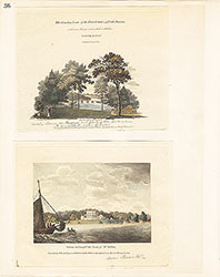 36
36  37
37 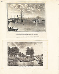 38
38  39
39  39
39  40
40 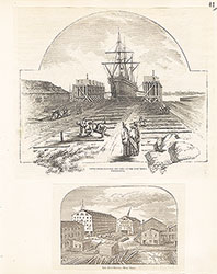 41
41  42
42  43
43  44
44 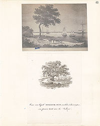 45
45  46
46  47
47  48
48 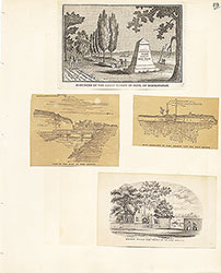 49
49  50
50  51
51  51
51 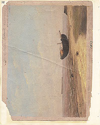 52
52  53
53  53
53 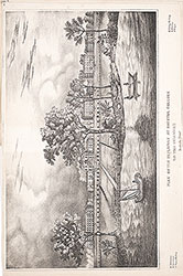 53
53  54
54  55
55 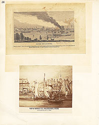 56
56 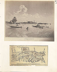 57
57 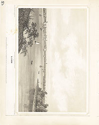 58
58 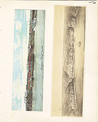 59
59  60
60  61
61 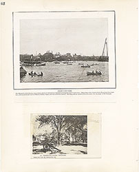 62
62  63
63  64
64  65
65  66
66  67
67 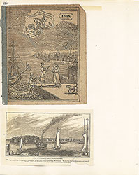 68
68  69
69  69
69  69
69  70
70 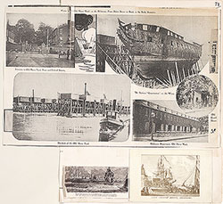 71
71  72
72  73
73  74
74 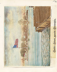 75
75 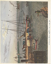 76
76  77
77 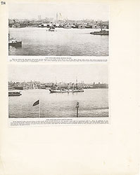 78
78  79
79 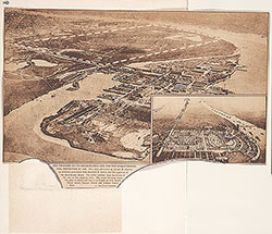 80
80  81
81  82
82 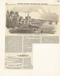 83
83 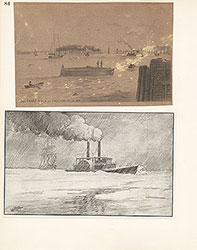 84
84  85
85  86
86  87
87 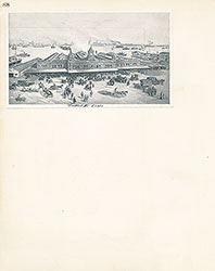 88
88 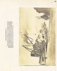 89
89  90
90  91
91 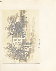 92
92 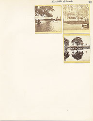 93
93  64a
64a