Castner Scrapbook v.20, Delaware River 1, page 20
Historical Images of Philadelphia Castner Scrapbook Collection
Item Info
Historic Street Address: 717 S. Christopher Colombus Blvd.
Historic Street Address: Philadelphia Navy Yard, League Island
Historic Street Address: Shackamaxon Street & Delaware Avenue
Media Type: Scrapbooks
Source: Print and Picture Collection
Notes:
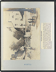
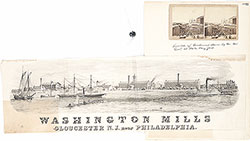
Item 1, top: Image captioned, "View of the River Delaware at Gloucester." The Washington Cotton Mills began operation in 1845, and resulted in a steady period of growth and prosperity for Gloucester, NJ, as described in the attached text (below the image, to the left). The engraving depicts the mills, as viewed from the river. It features varied crafts at the busy port-- a paddle steamer on the extreme left, a few schooners, and longboats in the right foreground. The extensive mill facilities are pictured along the shore, in the background. Engraving by artist Watts, image measures 16 x 11 cm, c. 1855.
Item 2, center right: As captioned, this is an image of a [Philadelphia] City Ice Boat, c. 1875. This particular boat is clearing the ice on the Delaware River, for the Philadelphia Naval Shipyard at League Island. The two naval ship-houses can be seen in the background, left, and large ships are seen following behind the ice boat. The Navy Yard was moved to League Island in 1871, therefore this is most likely an image of either City Ice Boat No. 2 or No. 3. Engraving by Schell & Hogan (presumably for Harper's Weekly), 15.5 x 10.5 cm, c. 1875.
Item 3, bottom left: Image of a "Delaware Indian Fort" (ie, the Native American Lenape tribe). The New Sweden colony (1638-1655) was located along both sides of the Delaware River, on land occupied by the Lenni-Lenape, approximately between what are today Smyrna, DE, and Trenton, NJ. This engraving was created and published in 1702 by Swedish artist Thomas Campanius Holm, in his book, Description of the Province of New Sweden. The book was based on the first-hand accounts of his grandfather Thomas Campanius, of life in the colony in the 1640s. The image shows a Lenape village, surrounded by a protective pallisade. Engraving for Description of the Province of New Sweden, by Thomas Campanius Holm, 7 x 5.5 cm, 1702.
Item 4, bottom right: Captioned, "At Knight's Sugar Wharves." This refers to the importing, refining, and exporting activities of the E. C. Knight Sugar Refining Company, located in South Philadelphia, at Bainbridge Street & (then) Delaware Avenue. The image depicts large schooners docked at the series of wharfs, with a concentration of refinery buildings and warehouses close behind. An 1875 atlas of Philadelphia clearly shows the presence of Knight's sugar wharfs at that location. (https://www.philageohistory.org/tiles/viewer/?SelectedLayers=Overlay,GMH1875v6) Engraving for an unidentified publication, 16 x 10.5 cm, undated (c. 1875)
Creation Year: 1845
Geocode Latitude: Geocode Longitude:-75.141154
Geocode Latitude:39.939252
Call Number: A917.481 P536 v.20
Creator Name: Castner, Samuel, Jr., 1843-1929 - Compiler
Ponitz - Artist
Watts - Engraver
Thomas Hogan (1843-1890) - Artist
Francis Schell (1834-1909) - Artist
Thomas Companius Holm (1670-1702) - Artist
- Cotton industry
- Philadelphia Naval Shipyard
- Naval yards & naval stations
- Warehouses
- Native Americans
- Schooners
- Sugar industry
- Sugar refineries
- Gloucester City, New Jersey
- Ice
- Cotton mills
- Knight, Edward C. (Edward Collings), 1813-1892
- Sugar wharves
- Delaware River
- Defensive walls
- Palisades (outworks)
- flat-bottomed watercraft
 inside front cover
 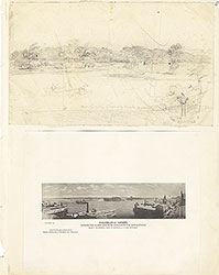 0
0  1c
1c  1
1 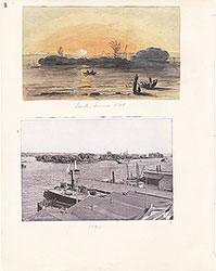 2
2  3
3  4
4  5
5 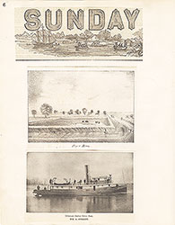 6
6 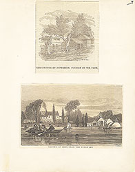 7
7 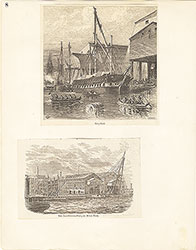 8
8  9
9 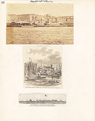 10
10  11
11  12
12  13
13 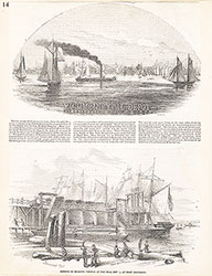 14
14 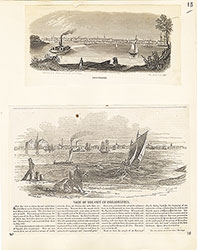 15
15 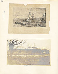 16
16 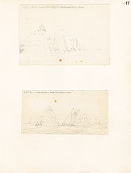 17
17 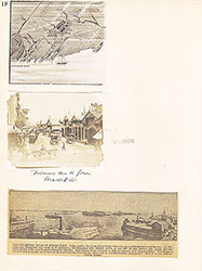 18
18  19
19 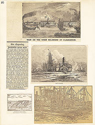 20
20
 21
21 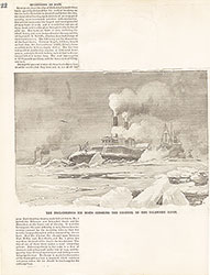 22
22 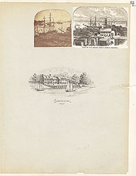 23
23 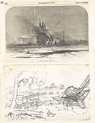 24
24 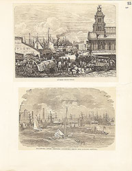 25
25  26
26 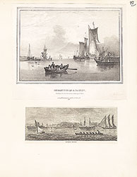 27
27 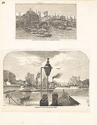 28
28 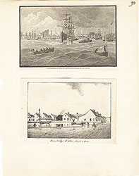 29
29 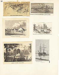 30
30  31
31  32
32  33
33 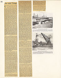 34
34 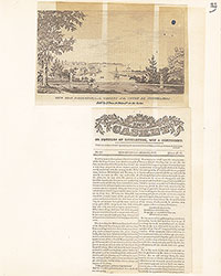 35
35  36
36  37
37 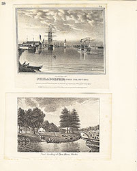 38
38  39
39  39
39  40
40 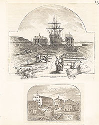 41
41  42
42 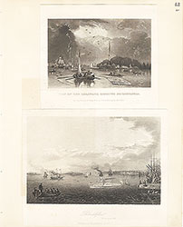 43
43 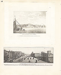 44
44 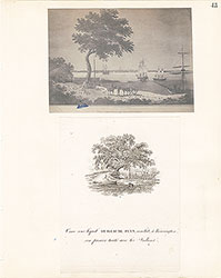 45
45 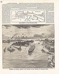 46
46 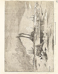 47
47 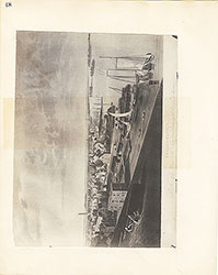 48
48 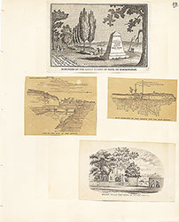 49
49  50
50  51
51  51
51 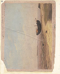 52
52  53
53  53
53 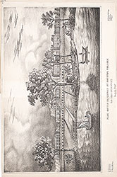 53
53 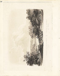 54
54  55
55 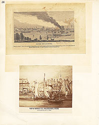 56
56 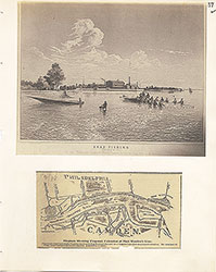 57
57 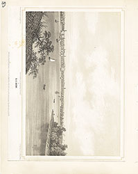 58
58 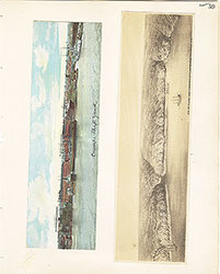 59
59 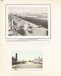 60
60 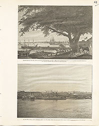 61
61 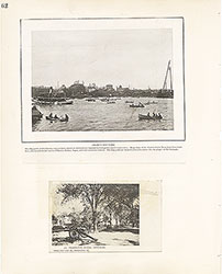 62
62 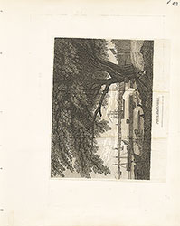 63
63 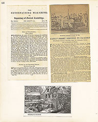 64
64 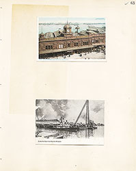 65
65  66
66  67
67 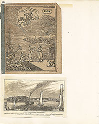 68
68  69
69  69
69 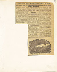 69
69  70
70 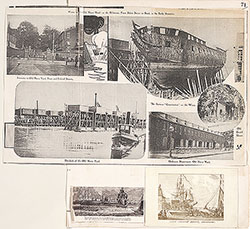 71
71  72
72  73
73  74
74 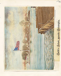 75
75 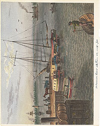 76
76  77
77  78
78  79
79 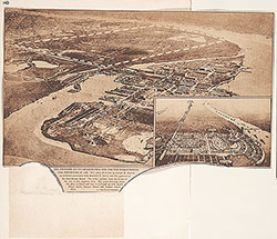 80
80 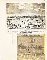 81
81 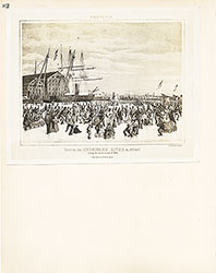 82
82 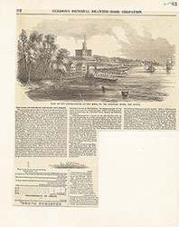 83
83 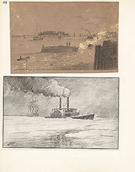 84
84 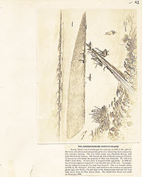 85
85 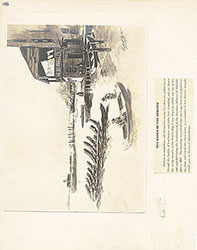 86
86  87
87 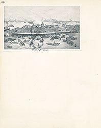 88
88 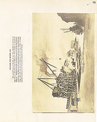 89
89 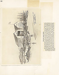 90
90  91
91 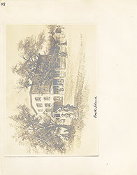 92
92 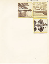 93
93  64a
64a