Map of Pennsylvania and West New Jersey.
Historical Images of Philadelphia Castner Scrapbook Collection
Item Info
Item No: pdcc00689
Title: Map of Pennsylvania and West New Jersey.
Media Type:
Scrapbooks
Source: Print and Picture Collection
Notes:
This 1698 map gives the names of various counties and towns surrounding Philadelphia as well as parts of Maryland. The New Jersey colony was divided into east and west from 1676 until 1702, hence the textual reference on the map to West New Jersey.
The original map was made by Philip Lea, London, and published in Gabriel Thomas's "History of Pennsylvania", 1698. The map shown was published in c1880.
Creation Year: 1698
Call Number: A917.481 P536 v.7
Creator Name: Lea, Philip, active 1683-1700 - Engraver
Castner, Samuel, Jr., 1843-1929 - Compiler
Subjects
 53
53  1B
1B  1B
1B  1C
1C  1C
1C  1C
1C  0
0  1B
1B 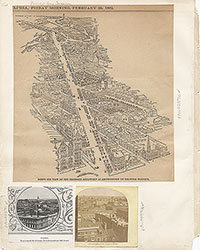 1C
1C  2
2  2
2  2
2  2
2  2
2  3
3  11
11  11
11  14
14  14
14  15
15  15
15 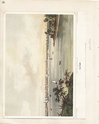 16
16  17
17  17
17  18
18 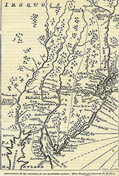 19
19  19
19  20
20  21
21  22
22  22
22  38
38 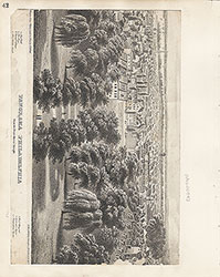 42
42  31
31  43
43  34
34  43
43  43
43  18
18
 1
1  2
2 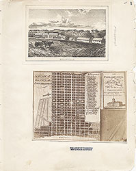 3
3  4
4  5
5  6
6  7
7 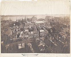 8
8 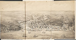 9
9  10
10  11
11  13
13  14
14  15
15  18
18  19
19  20
20  21
21  22
22  23
23  24
24  25
25  26
26  28
28 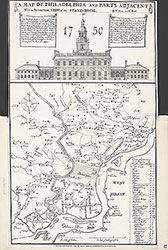 31
31  32
32 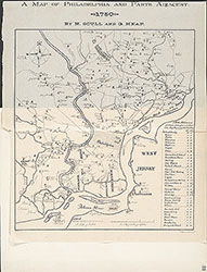 33
33  34
34  35
35  36
36  37
37  38
38  39
39 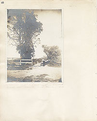 40
40  43
43 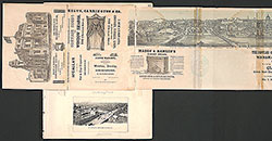 43
43  44
44  45
45  46
46 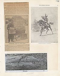 47
47  17
17  7
7  8
8  6
6  4
4  2
2  47
47  53
53  53
53 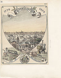 54
54  53
53  55
55  56
56  57
57  49
49  50
50  51
51  52
52  57
57  58
58 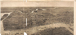 59
59  53
53  63
63  64
64  64
64  65
65  67
67  67
67  68
68  70
70  69
69  69
69 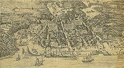 71
71  72
72  74
74  57
57  57
57  57
57  57
57  57
57  57
57  57
57  57
57 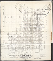 60
60  61
61  62
62  63
63  64
64  65
65 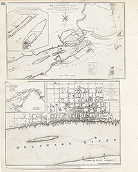 66
66  67
67  68
68  69
69 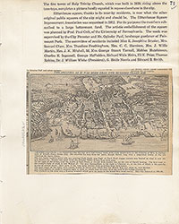 71
71  73
73 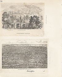 74
74  75
75  76
76  77
77  78
78  79
79  79
79  80
80  80
80  80
80  84
84  85
85  85
85  86
86  86
86  91
91  93
93  97
97  76
76  78
78  79
79  80
80  81
81  82
82  83
83  84
84  85
85  86
86 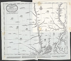 87
87  88
88  89
89  90
90  91
91  92
92  93
93  94
94  00
00  97
97  97
97  97
97  97
97  97
97  97
97  97
97  97
97  97
97 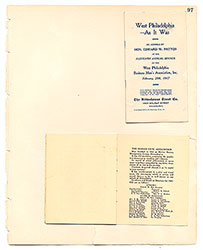 97
97  12
12  27
27  29
29  30
30  41
41  77
77  95
95  96
96  53
53  43
43 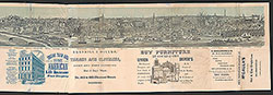 43
43  57
57