Castner Scrapbook v.7, Walks, Views, Maps, page 80
Historical Images of Philadelphia Castner Scrapbook Collection
Item Info
Media Type: Scrapbooks
Source: Print and Picture Collection
Notes:
Item pdcc00630, top right [image dimensions 16.8 cm x 8.9 cm]:
Halftone reproduction of photograph taken from atop City Hall tower showing the newly finished Fairmount Parkway (now Benjamin Franklin Parkway). In the middle distance the Cathedral of Saints Peter and Paul is visible on Logan Square, and in the far distance the Schuylkill River is seen bending above the dam at Fairmount.
Notes:
Item pdcc00631, top left [image dimensions 16.8 cm x 8.9 cm]:
Halftone reproduction of photograph showing the line of the projected Fairmount Parkway (now Benjamin Franklin Parkway). Most of the buildings shown were removed to make way for the highway, including the substantial residences at the bottom of the picture. Logan Square, visible in the middle, was opened up and changed into a circle.
Notes:
Item pdcc00632, bottom [image dimensions 11.5 cm x 16.2 cm]:
Halftone reproduction of photograph taken from Broad and Walnut Streets looking north. Shows the framework of the top of the archway, which stood at Broad and Sansom Street during the celebrations of the Constitutional Convention. Several cabs are at the cab stand. Note the cobblestones of Broad Street.
Geocode Latitude: Geocode Longitude:-75.163565
Geocode Latitude:39.949180
Call Number: A917.481 P536 v.7
Creator Name: Castner, Samuel, Jr., 1843-1929 - Compiler
 53
53  1B
1B 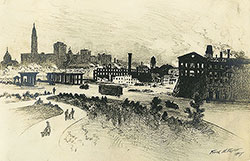 1B
1B  1C
1C 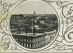 1C
1C  1C
1C 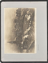 0
0  1B
1B 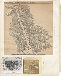 1C
1C  2
2  2
2 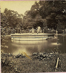 2
2  2
2  2
2  3
3  11
11  11
11  14
14  14
14  15
15  15
15  16
16  17
17  17
17  18
18  19
19  19
19  20
20  21
21  22
22  22
22  38
38  42
42  31
31  43
43  34
34  43
43  43
43  18
18  1
1  2
2  3
3 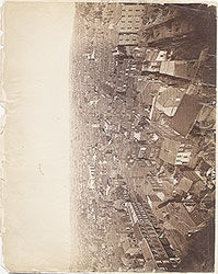 4
4 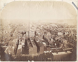 5
5  6
6 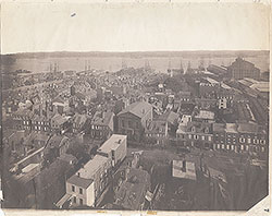 7
7 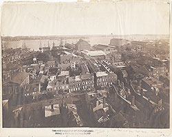 8
8  9
9  10
10  11
11 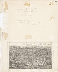 13
13  14
14  15
15  18
18  19
19  20
20  21
21  22
22  23
23 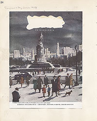 24
24 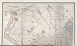 25
25  26
26  28
28  31
31  32
32  33
33  34
34  35
35  36
36  37
37  38
38  39
39  40
40  43
43  43
43  44
44  45
45  46
46 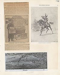 47
47  17
17 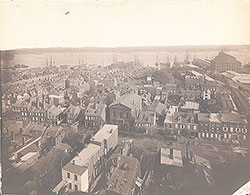 7
7  8
8 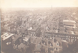 6
6 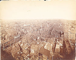 4
4 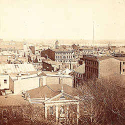 2
2  47
47 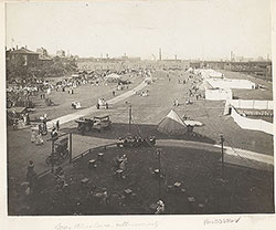 53
53  53
53 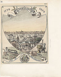 54
54 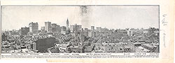 53
53 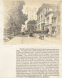 55
55  56
56  57
57  49
49  50
50  51
51  52
52  57
57  58
58 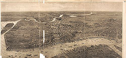 59
59 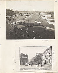 53
53 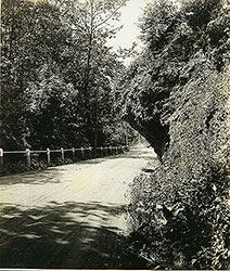 63
63  64
64  64
64 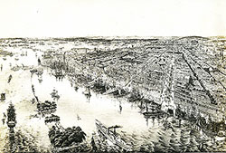 65
65  67
67 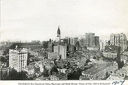 67
67 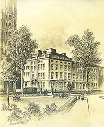 68
68  70
70  69
69  69
69  71
71  72
72  74
74  57
57  57
57  57
57  57
57  57
57  57
57 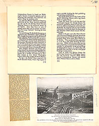 57
57  57
57 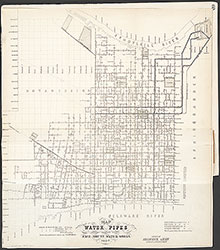 60
60 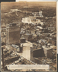 61
61  62
62  63
63  64
64 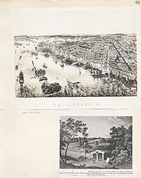 65
65 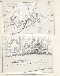 66
66 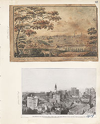 67
67  68
68  69
69  71
71  73
73  74
74  75
75  76
76  77
77  78
78 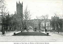 79
79  79
79 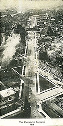 80
80  80
80 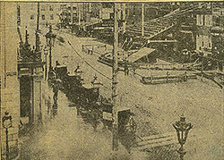 80
80  84
84  85
85  85
85  86
86  86
86  91
91  93
93  97
97  76
76  78
78  79
79  80
80
 81
81  82
82  83
83  84
84  85
85  86
86 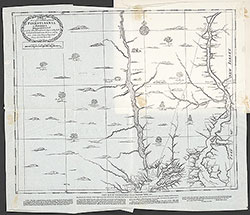 87
87  88
88  89
89  90
90  91
91 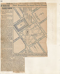 92
92 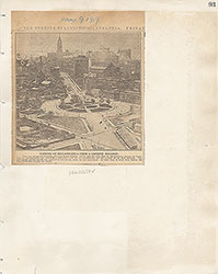 93
93  94
94  00
00  97
97  97
97  97
97  97
97  97
97  97
97  97
97  97
97  97
97  97
97  12
12  27
27  29
29  30
30  41
41  77
77  95
95  96
96 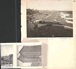 53
53  43
43  43
43  57
57