Castner Scrapbook v.7, Walks, Views, Maps, page 11
Historical Images of Philadelphia Castner Scrapbook Collection
Item Info
Item No: pdcc02273
Title: Castner Scrapbook v.7, Walks, Views, Maps, page 11
Historic Street Address:
16th & Spring Garden Streets
Media Type: Scrapbooks
Source: Print and Picture Collection
Notes:
Item pdcc00579, bottom [image dimensions 9.0 cm x 15.4 cm]:
Oval woodcut depicts a rural vista with country estates separated by wooden fences. A man on horseback rides along a dirt road in the foreground. Inscription in pencil below the print identifies this view as looking northwest from what today would be the location of 16th and Spring Garden Streets.
Published in the New York Magazine, 1787.
Notes:
Item pdcc00580, top [image dimensions 14.4 cm x 22.0 cm]:
Depicts a panoramic view of the City of Philadelphia in colonial times with a numbered key identifying landmarks and houses associated with prominent citizens. Shows the seals of William Penn and Pennsylvania. Also shows ships and boats on the Delaware River.
Geocode Latitude: Geocode Longitude:-75.164684
Geocode Latitude:39.962773
Call Number: A917.481 P536 v.7
Creator Name: Castner, Samuel, Jr., 1843-1929 - Compiler
Hoffman, Jacob - Artist
Scoles, John, 1772?-1853 - Engraver
Goist, P. F. - Artist
 53
53 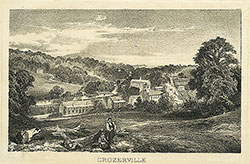 1B
1B  1B
1B  1C
1C  1C
1C  1C
1C 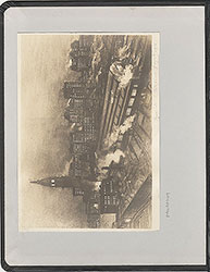 0
0  1B
1B 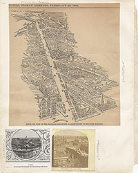 1C
1C  2
2  2
2  2
2  2
2  2
2  3
3 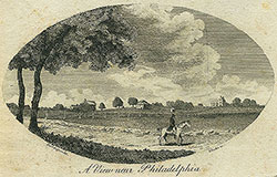 11
11 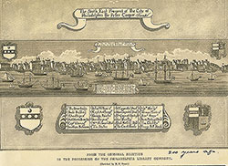 11
11  14
14 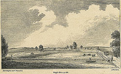 14
14 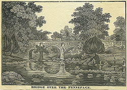 15
15  15
15  16
16  17
17  17
17 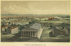 18
18  19
19  19
19  20
20  21
21 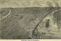 22
22 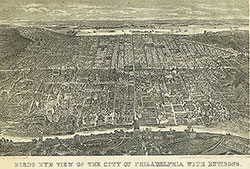 22
22  38
38  42
42  31
31  43
43 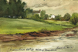 34
34  43
43 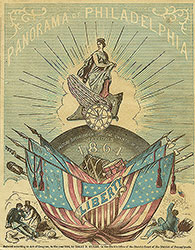 43
43  18
18  1
1  2
2 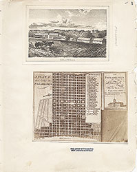 3
3  4
4  5
5  6
6  7
7 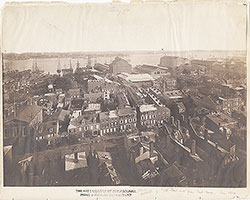 8
8 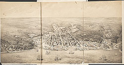 9
9  10
10  11
11
 13
13  14
14  15
15  18
18  19
19  20
20  21
21  22
22  23
23 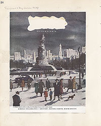 24
24  25
25  26
26 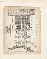 28
28 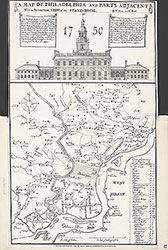 31
31  32
32 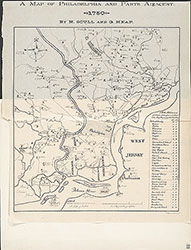 33
33  34
34  35
35  36
36  37
37 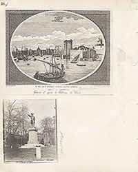 38
38  39
39 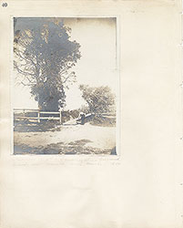 40
40  43
43  43
43  44
44  45
45  46
46 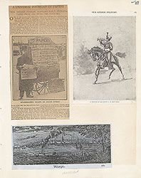 47
47  17
17  7
7  8
8  6
6 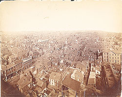 4
4  2
2  47
47  53
53  53
53 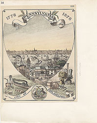 54
54  53
53  55
55  56
56  57
57  49
49  50
50  51
51  52
52  57
57  58
58 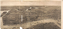 59
59  53
53 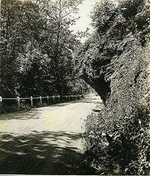 63
63 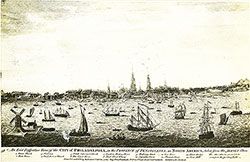 64
64  64
64  65
65  67
67 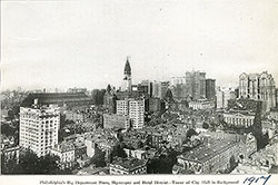 67
67  68
68  70
70  69
69  69
69 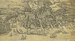 71
71  72
72  74
74  57
57  57
57  57
57  57
57  57
57  57
57  57
57  57
57  60
60  61
61  62
62  63
63  64
64 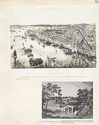 65
65 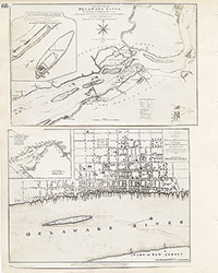 66
66  67
67  68
68  69
69 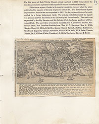 71
71  73
73 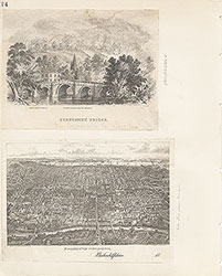 74
74  75
75  76
76  77
77  78
78  79
79  79
79 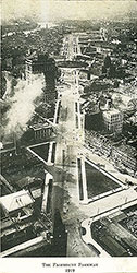 80
80  80
80  80
80  84
84 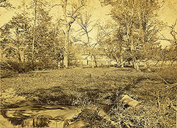 85
85  85
85  86
86  86
86  91
91  93
93 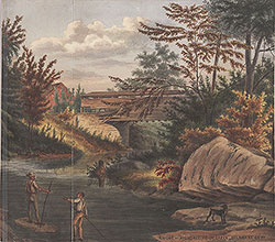 97
97  76
76 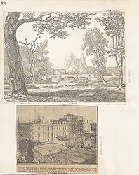 78
78  79
79  80
80  81
81  82
82  83
83  84
84  85
85  86
86 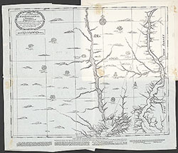 87
87  88
88  89
89  90
90  91
91  92
92  93
93  94
94  00
00  97
97  97
97  97
97  97
97  97
97  97
97  97
97  97
97  97
97  97
97  12
12  27
27  29
29  30
30  41
41  77
77  95
95  96
96 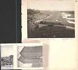 53
53  43
43  43
43  57
57