Castner Scrapbook v.7, Walks, Views, Maps, page 18
Historical Images of Philadelphia Castner Scrapbook Collection
Item Info
Source: Print and Picture Collection
Notes:
Item pdcc00588, top [image dimensions 11.6 cm x 19.5 cm]:
The buildings of Girard College dominate this bird's eye view of the city, which is seen in the distance. Eastern State Penitentiary is shown in the middle ground. Note the people standing on the roof of the college.
This colored engraving was published by Charles Magnus, a German born New York based printer and publisher working in the second half of the nineteenth century. He was a prolific publisher of a wide variety of products, including views of cities in the United States and Canada.
Notes:
Item pdcc00689, bottom [image dimensions 12.5 cm x 14.0 cm]:
This 1698 map gives the names of various counties and towns surrounding Philadelphia as well as parts of Maryland. The New Jersey colony was divided into east and west from 1676 until 1702, hence the textual reference on the map to West New Jersey.
The original map was made by Philip Lea, London, and published in Gabriel Thomas's "History of Pennsylvania", 1698. The map shown was published in c1880.
Call Number: A917.481 P536 v.7
Creator Name: Castner, Samuel, Jr., 1843-1929 - Compiler
G. G. Lange, Darmstadt - Engraver
Magnus, Charles, 1826-1900 - Lithographer
Lea, Philip, active 1683-1700 - Engraver
 53
53  1B
1B  1B
1B  1C
1C 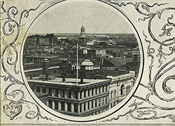 1C
1C  1C
1C  0
0  1B
1B 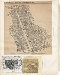 1C
1C  2
2  2
2  2
2  2
2  2
2  3
3  11
11  11
11 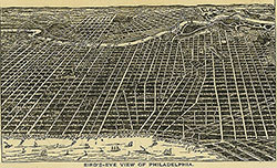 14
14  14
14  15
15  15
15 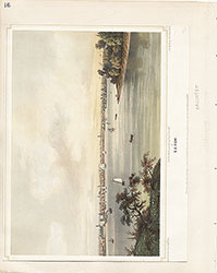 16
16  17
17  17
17 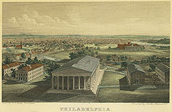 18
18 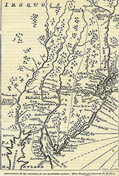 19
19  19
19  20
20  21
21 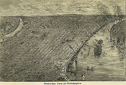 22
22 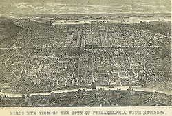 22
22  38
38  42
42  31
31  43
43  34
34  43
43 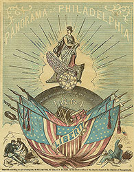 43
43  18
18  1
1  2
2 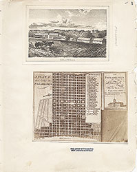 3
3  4
4  5
5  6
6  7
7 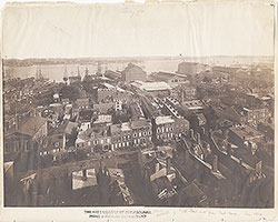 8
8 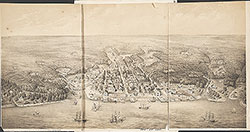 9
9  10
10  11
11  13
13  14
14  15
15  18
18
 19
19  20
20  21
21  22
22  23
23 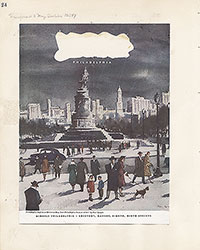 24
24  25
25  26
26  28
28 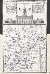 31
31  32
32 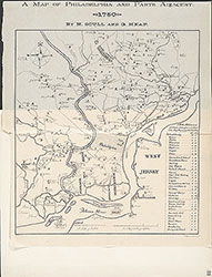 33
33  34
34  35
35  36
36  37
37 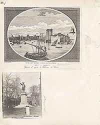 38
38  39
39  40
40  43
43  43
43  44
44  45
45  46
46 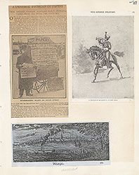 47
47 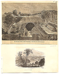 17
17  7
7  8
8  6
6 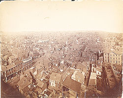 4
4  2
2  47
47  53
53  53
53 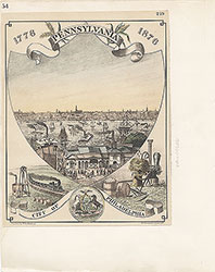 54
54  53
53  55
55  56
56  57
57  49
49  50
50  51
51  52
52  57
57  58
58 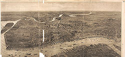 59
59  53
53  63
63 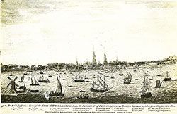 64
64  64
64 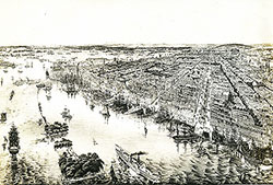 65
65  67
67  67
67  68
68  70
70  69
69  69
69  71
71  72
72  74
74  57
57  57
57  57
57  57
57  57
57  57
57  57
57  57
57  60
60  61
61  62
62  63
63  64
64 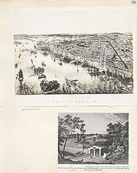 65
65 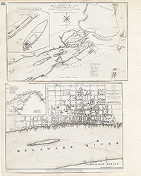 66
66  67
67  68
68  69
69 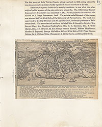 71
71  73
73  74
74  75
75  76
76  77
77  78
78  79
79  79
79  80
80  80
80  80
80  84
84  85
85  85
85  86
86  86
86  91
91  93
93 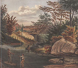 97
97  76
76  78
78  79
79  80
80  81
81  82
82  83
83  84
84  85
85  86
86 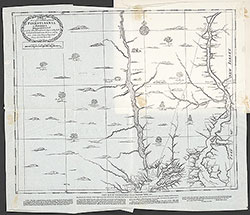 87
87  88
88  89
89  90
90  91
91  92
92  93
93  94
94  00
00  97
97  97
97  97
97  97
97  97
97  97
97  97
97  97
97  97
97  97
97  12
12  27
27  29
29  30
30  41
41  77
77  95
95  96
96 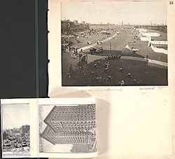 53
53  43
43  43
43  57
57