Castner Scrapbook v.7, Walks, Views, Maps, page 19
Historical Images of Philadelphia Castner Scrapbook Collection
Item Info
Item No: pdcc02278
Title: Castner Scrapbook v.7, Walks, Views, Maps, page 19
Media Type:
Scrapbooks
Source: Print and Picture Collection
Notes:
Item pdcc00590, top [image dimensions 21.0 cm x 14.5 cm]:
This is a portion of a map of New England, New York, New Jersey and Pennsylvania produced by H. Moll in 1708. It was reproduced in David Humphrey's account of the missions in the British colonies to the year 1728, published in London in 1730.
Despite the date of the original map, Moll still shows a divided New Jersey, which had been reunified in 1702.
Notes:
Item pdcc00591, bottom [image dimensions 7.7 cm x 7.7 cm]:
This cityscape is looking southeast from Independence Hall. The tower and steeple belongs to St. Peter's Church at 3rd & Pine Streets. The shot tower is visible in the far distance. Ship masts can just be made out on the Delaware River.
Call Number: A917.481 P536 v.7
Creator Name: Castner, Samuel, Jr., 1843-1929 - Compiler
Moll, Herman, -1732 - Engraver
 53
53  1B
1B  1B
1B  1C
1C 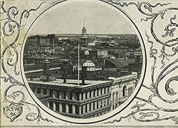 1C
1C  1C
1C 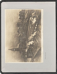 0
0  1B
1B 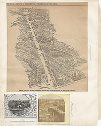 1C
1C  2
2  2
2  2
2  2
2  2
2  3
3  11
11  11
11  14
14  14
14 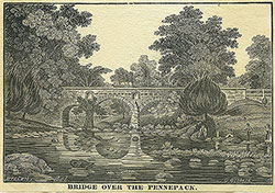 15
15  15
15  16
16  17
17  17
17 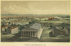 18
18 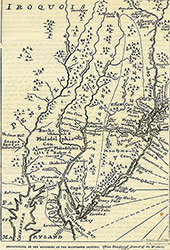 19
19  19
19  20
20  21
21 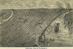 22
22 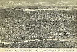 22
22  38
38  42
42  31
31  43
43  34
34  43
43  43
43  18
18  1
1  2
2 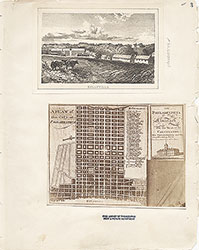 3
3 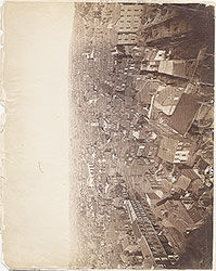 4
4  5
5  6
6  7
7  8
8 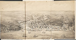 9
9  10
10  11
11  13
13  14
14  15
15  18
18  19
19
 20
20  21
21  22
22  23
23  24
24  25
25  26
26  28
28  31
31  32
32  33
33  34
34  35
35  36
36  37
37 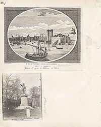 38
38  39
39  40
40  43
43  43
43  44
44  45
45  46
46  47
47 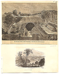 17
17  7
7  8
8  6
6  4
4 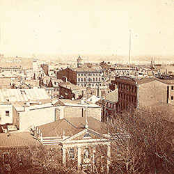 2
2  47
47  53
53  53
53  54
54 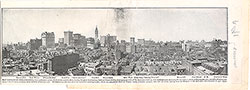 53
53  55
55  56
56  57
57  49
49  50
50  51
51  52
52 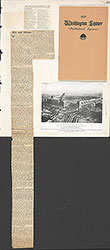 57
57  58
58 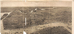 59
59 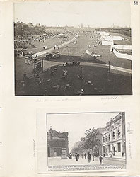 53
53  63
63 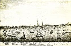 64
64 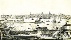 64
64  65
65  67
67  67
67  68
68  70
70  69
69  69
69 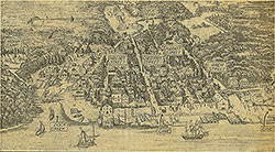 71
71  72
72  74
74  57
57  57
57  57
57  57
57  57
57  57
57  57
57  57
57  60
60  61
61  62
62  63
63  64
64 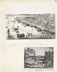 65
65  66
66 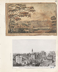 67
67  68
68  69
69 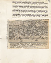 71
71  73
73 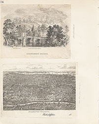 74
74  75
75  76
76  77
77  78
78  79
79  79
79  80
80  80
80  80
80  84
84  85
85  85
85  86
86  86
86  91
91  93
93  97
97  76
76  78
78  79
79  80
80  81
81  82
82  83
83  84
84  85
85  86
86 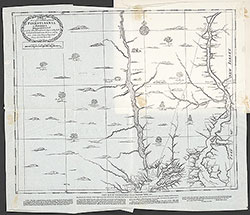 87
87  88
88  89
89  90
90  91
91  92
92  93
93  94
94  00
00  97
97  97
97  97
97  97
97  97
97  97
97  97
97  97
97  97
97  97
97  12
12  27
27  29
29  30
30  41
41  77
77  95
95  96
96  53
53 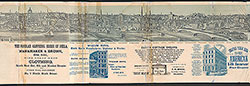 43
43 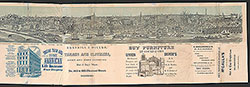 43
43  57
57